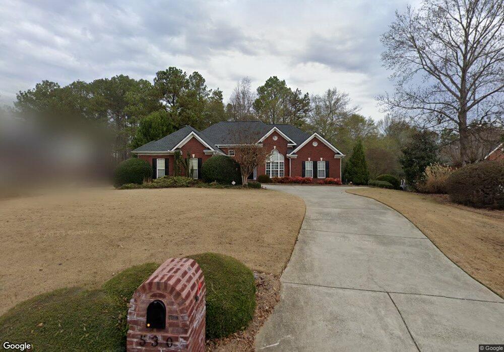
530 Chesterfield Rd Bogart, GA 30622
Estimated Value: $439,533 - $466,000
4
Beds
3
Baths
2,289
Sq Ft
$197/Sq Ft
Est. Value
About This Home
This home is located at 530 Chesterfield Rd, Bogart, GA 30622 and is currently estimated at $451,383, approximately $197 per square foot. 530 Chesterfield Rd is a home located in Clarke County with nearby schools including Cleveland Road Elementary School, Burney-Harris-Lyons Middle School, and Clarke Central High School.
Ownership History
Date
Name
Owned For
Owner Type
Purchase Details
Closed on
Sep 17, 2009
Sold by
Tudman Patty S
Bought by
Patty S Tudman Inter Vivos Tru
Current Estimated Value
Purchase Details
Closed on
Mar 17, 2009
Sold by
Hansen Elizabeth M
Bought by
Tudman Patty S
Purchase Details
Closed on
Oct 8, 2002
Sold by
H & B Homes Llc
Bought by
Hansen Elizabeth M
Purchase Details
Closed on
Mar 1, 2000
Sold by
Willwork L L C
Bought by
H & B Homes Llc
Create a Home Valuation Report for This Property
The Home Valuation Report is an in-depth analysis detailing your home's value as well as a comparison with similar homes in the area
Home Values in the Area
Average Home Value in this Area
Purchase History
| Date | Buyer | Sale Price | Title Company |
|---|---|---|---|
| Patty S Tudman Inter Vivos Tru | -- | -- | |
| Tudman Patty S | $258,000 | -- | |
| Hansen Elizabeth M | $219,900 | -- | |
| H & B Homes Llc | $18,800 | -- |
Source: Public Records
Tax History Compared to Growth
Tax History
| Year | Tax Paid | Tax Assessment Tax Assessment Total Assessment is a certain percentage of the fair market value that is determined by local assessors to be the total taxable value of land and additions on the property. | Land | Improvement |
|---|---|---|---|---|
| 2025 | $3,531 | $182,831 | $18,000 | $164,831 |
| 2024 | $3,531 | $174,948 | $18,000 | $156,948 |
| 2023 | $3,561 | $163,685 | $18,000 | $145,685 |
| 2022 | $3,422 | $141,856 | $18,000 | $123,856 |
| 2021 | $3,273 | $117,355 | $16,000 | $101,355 |
| 2020 | $3,229 | $114,103 | $16,000 | $98,103 |
| 2019 | $3,124 | $104,747 | $16,000 | $88,747 |
| 2018 | $3,060 | $100,125 | $16,000 | $84,125 |
| 2017 | $2,781 | $91,918 | $16,000 | $75,918 |
| 2016 | $2,705 | $89,667 | $16,000 | $73,667 |
| 2015 | $2,612 | $86,822 | $16,000 | $70,822 |
| 2014 | $2,734 | $90,262 | $16,000 | $74,262 |
Source: Public Records
Map
Nearby Homes
- 682 Chesterfield Rd
- 190 W Huntington Rd
- 240 W Huntington Rd
- 212 Huntington Shoals Dr
- 100 Hanover Dr
- 241 Meeler Cir
- 141 Huntington Shoals Dr
- 637 Huntington Rd Unit B1
- 240 Deerfield Rd
- 112 Deerhollow Rd
- 575 Vaughn Rd
- 532 Huntington Rd Unit 7
- 470 Huntington Rd Unit 5
- 256 Cherokee Ridge
- 150 Callaway Dr
- 215 Claystone Trace
- 178 Ben Burton Cir
- 450 River Bottom Rd
- 536 Chesterfield Rd
- 524 Chesterfield Rd
- 542 Chesterfield Rd
- 518 Chesterfield Rd
- 531 Chesterfield Rd
- 541 Chesterfield Rd
- 551 Chesterfield Rd
- 548 Chesterfield Rd
- 512 Chesterfield Rd
- 521 Chesterfield Rd
- 187 Brittany Rd
- 561 Chesterfield Rd
- 554 Chesterfield Rd
- 165 Chelsea Ct
- 184 Brittany Rd
- 511 Chesterfield Rd
- 145 Chelsea Ct
- 571 Chesterfield Rd
- 167 Brittany Rd
- 560 Chesterfield Rd