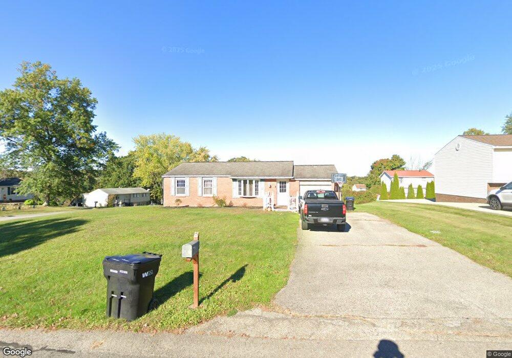
530 Cornell Dr Aliquippa, PA 15001
Estimated Value: $200,759 - $261,000
3
Beds
2
Baths
1,260
Sq Ft
$176/Sq Ft
Est. Value
About This Home
This home is located at 530 Cornell Dr, Aliquippa, PA 15001 and is currently estimated at $222,190, approximately $176 per square foot. 530 Cornell Dr is a home located in Beaver County with nearby schools including Center Grange Primary School, Todd Lane Elementary School, and Central Valley Middle School.
Ownership History
Date
Name
Owned For
Owner Type
Purchase Details
Closed on
Dec 18, 2009
Sold by
Secretary Of Veterans Affairs
Bought by
Aikens Richard A and Aikens Mark J
Current Estimated Value
Home Financials for this Owner
Home Financials are based on the most recent Mortgage that was taken out on this home.
Original Mortgage
$69,600
Interest Rate
4.95%
Mortgage Type
New Conventional
Purchase Details
Closed on
Aug 18, 2009
Sold by
Lowery Timothy S and Lowery Deanna R
Bought by
The Secretary Veterans Affairs
Purchase Details
Closed on
Sep 12, 2007
Sold by
Parisi Anthony
Bought by
Lowery Timothy S
Home Financials for this Owner
Home Financials are based on the most recent Mortgage that was taken out on this home.
Original Mortgage
$112,250
Interest Rate
6.7%
Mortgage Type
VA
Create a Home Valuation Report for This Property
The Home Valuation Report is an in-depth analysis detailing your home's value as well as a comparison with similar homes in the area
Home Values in the Area
Average Home Value in this Area
Purchase History
| Date | Buyer | Sale Price | Title Company |
|---|---|---|---|
| Aikens Richard A | $87,000 | Pennsylvania Land Titles | |
| The Secretary Veterans Affairs | $2,317 | None Available | |
| Lowery Timothy S | $109,900 | -- |
Source: Public Records
Mortgage History
| Date | Status | Borrower | Loan Amount |
|---|---|---|---|
| Closed | Aikens Richard A | $69,600 | |
| Previous Owner | Lowery Timothy S | $112,250 |
Source: Public Records
Tax History Compared to Growth
Tax History
| Year | Tax Paid | Tax Assessment Tax Assessment Total Assessment is a certain percentage of the fair market value that is determined by local assessors to be the total taxable value of land and additions on the property. | Land | Improvement |
|---|---|---|---|---|
| 2025 | $1,856 | $90,400 | $21,050 | $69,350 |
| 2024 | $2,899 | $90,400 | $21,050 | $69,350 |
| 2023 | $2,902 | $27,400 | $5,400 | $22,000 |
| 2022 | $2,698 | $27,400 | $5,400 | $22,000 |
| 2021 | $2,698 | $27,400 | $5,400 | $22,000 |
| 2020 | $2,582 | $27,400 | $5,400 | $22,000 |
| 2019 | $2,582 | $27,400 | $5,400 | $22,000 |
| 2018 | $2,468 | $27,400 | $5,400 | $22,000 |
| 2017 | $2,468 | $27,400 | $5,400 | $22,000 |
| 2016 | $2,298 | $27,400 | $5,400 | $22,000 |
| 2015 | $608 | $27,400 | $5,400 | $22,000 |
| 2014 | $608 | $27,400 | $5,400 | $22,000 |
Source: Public Records
Map
Nearby Homes
- 109 Sunset Ln
- 129 Bainbridge Dr
- 223 Columbia Dr
- 215 Columbia Dr
- 130 Columbia Dr
- 107 Pinehurst Dr
- 584 Chapel Rd
- 0 Farland St Unit 1716872
- 303 Elkhorn Rd
- 110 Marcur Ln
- 103 Brookhaven Dr
- 155 W Woodland Dr
- 145 Oakhill Rd
- 205 Shadyside Dr
- 182 Center Grange Rd
- 133 Bennett Blvd
- 122 Gross Dr
- 1544 Eldorado Dr
- 148 Zimmerle Dr
- 137 Sunset Blvd
- 201 Princeton Dr
- 529 Cornell Dr
- 527 Cornell Dr
- 526 Cornell Dr
- 199 Princeton Dr
- 200 Princeton Dr
- 202 Princeton Dr
- 525 Cornell Dr
- 198 Princeton Dr
- 524 Cornell Dr
- 197 Princeton Dr
- 204 Princeton Dr
- 207 Princeton Dr
- 523 Cornell Dr
- 196 Princeton Dr
- 209 Princeton Dr
- 522 Cornell Dr
- 194 Princeton Dr
- 211 Princeton Dr
- 192 Princeton Dr