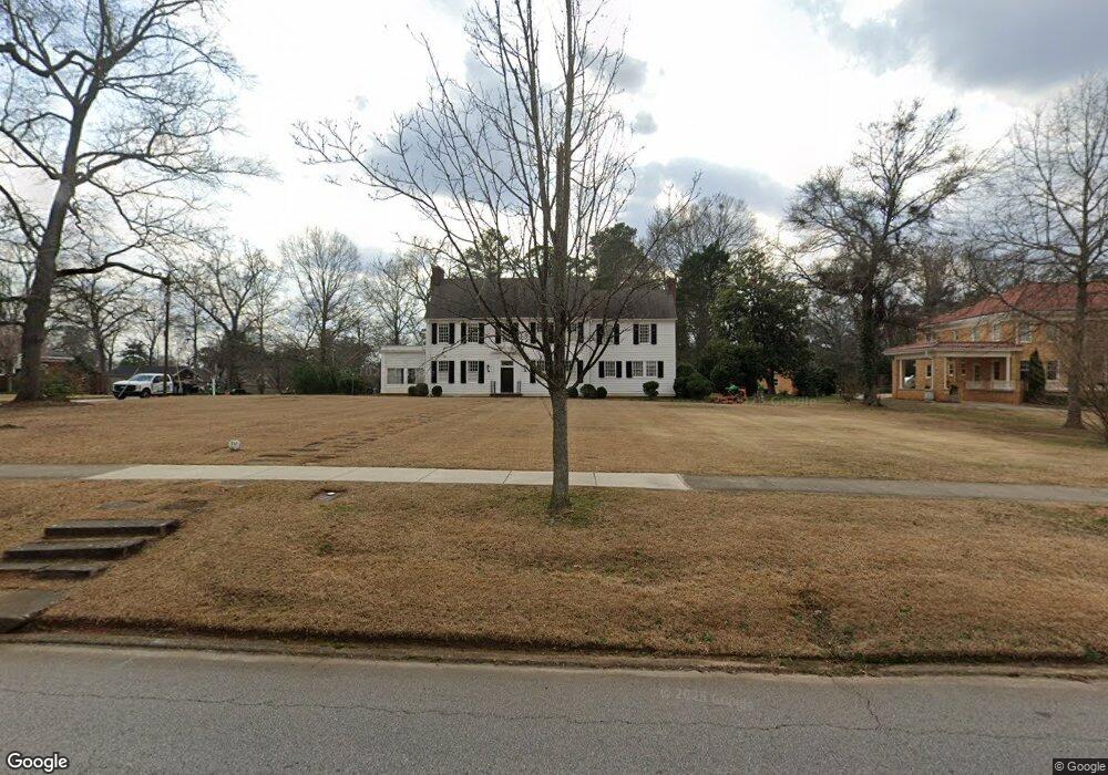
530 E College St Griffin, GA 30224
Spalding County NeighborhoodEstimated Value: $427,000 - $547,000
5
Beds
5
Baths
4,398
Sq Ft
$114/Sq Ft
Est. Value
About This Home
This home is located at 530 E College St, Griffin, GA 30224 and is currently estimated at $499,379, approximately $113 per square foot. 530 E College St is a home located in Spalding County with nearby schools including Futral Road Elementary School, Rehoboth Road Middle School, and Spalding High School.
Ownership History
Date
Name
Owned For
Owner Type
Purchase Details
Closed on
Dec 29, 2017
Sold by
Knight
Bought by
Hendricks Kathryn B
Current Estimated Value
Purchase Details
Closed on
Feb 29, 1984
Sold by
Goddard John H and Goddard Loula W
Bought by
Barnes S Grantland
Purchase Details
Closed on
Nov 4, 1968
Sold by
Graefe Mrs W L
Bought by
Goddard John H and Goddard Loula W
Purchase Details
Closed on
Feb 23, 1940
Bought by
Graefe Mrs W L
Create a Home Valuation Report for This Property
The Home Valuation Report is an in-depth analysis detailing your home's value as well as a comparison with similar homes in the area
Home Values in the Area
Average Home Value in this Area
Purchase History
| Date | Buyer | Sale Price | Title Company |
|---|---|---|---|
| Hendricks Kathryn B | $165,000 | -- | |
| Knight Alton W Executor | -- | -- | |
| Barnes S Grantland | $165,000 | -- | |
| Goddard John H | $50,000 | -- | |
| Graefe Mrs W L | -- | -- |
Source: Public Records
Tax History Compared to Growth
Tax History
| Year | Tax Paid | Tax Assessment Tax Assessment Total Assessment is a certain percentage of the fair market value that is determined by local assessors to be the total taxable value of land and additions on the property. | Land | Improvement |
|---|---|---|---|---|
| 2024 | $7,334 | $192,056 | $25,200 | $166,856 |
| 2023 | $7,334 | $192,056 | $25,200 | $166,856 |
| 2022 | $5,924 | $148,246 | $25,200 | $123,046 |
| 2021 | $5,569 | $139,362 | $25,200 | $114,162 |
| 2020 | $5,569 | $139,362 | $25,200 | $114,162 |
| 2019 | $4,070 | $125,848 | $25,200 | $100,648 |
| 2018 | $0 | $119,759 | $25,200 | $94,559 |
| 2017 | $4,950 | $119,759 | $25,200 | $94,559 |
| 2016 | $5,030 | $119,759 | $25,200 | $94,559 |
| 2015 | $5,113 | $119,759 | $25,200 | $94,559 |
| 2014 | $5,267 | $119,759 | $25,200 | $94,559 |
Source: Public Records
Map
Nearby Homes
- 304 Tilney Ave
- 40 Terrace St
- 18 Terracedale Ct
- 541 S 6th St
- 523 S 6th St
- 706 Maple Dr
- 714 Maple Dr
- 818 Hillcrest Ave
- 134 Townsend Ct
- 505 Kincaid Ave
- 524 Kincaid Ave
- 650 S Hill St
- 406 E Solomon St
- 115 Kennelsman Dr Unit LOT FC 1
- 821 Bel Air Cir
- 831 Bel Air Cir
- 303 E Broadway St
- 203 N 1st St
- 102 N Hill St Unit 304
- 102 N Hill St Unit 303
- 518 E College St
- 604 E College St
- 0 Mimosa Dr Unit 7084644
- 0 Mimosa Dr Unit 8765741
- 0 Mimosa Dr Unit 8006478
- 0 Mimosa Dr Unit 7058491
- 0 Mimosa Dr Unit 7534465
- 0 Mimosa Dr Unit 3203337
- 0 Mimosa Dr
- 612 E College St
- 426 Mimosa Dr
- 502 E College St
- 432 Mimosa Dr
- 521 E College St
- 525 E College St
- 515 E College St
- 618 E College St Unit /3
- 618 E College St
- 434 Mimosa Dr
- 437 Mimosa Dr