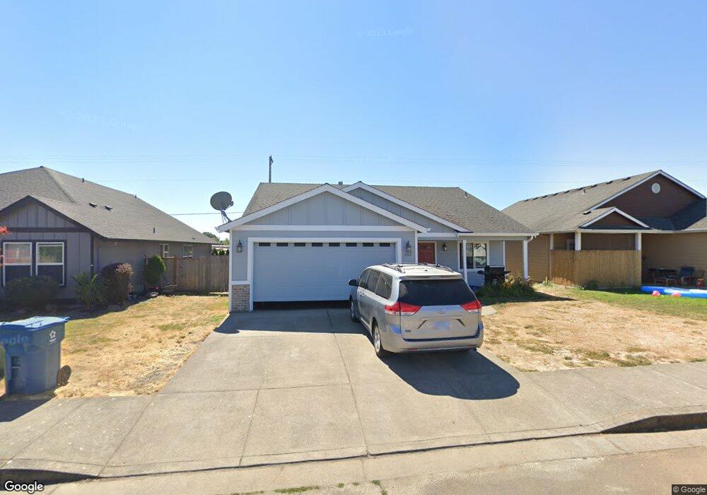
530 E Elm Loop Gervais, OR 97026
Estimated Value: $450,441 - $489,000
3
Beds
2
Baths
1,692
Sq Ft
$275/Sq Ft
Est. Value
About This Home
This home is located at 530 E Elm Loop, Gervais, OR 97026 and is currently estimated at $466,110, approximately $275 per square foot. 530 E Elm Loop is a home located in Marion County with nearby schools including Gervais Middle School, Gervais High School, and Sacred Heart Catholic School.
Ownership History
Date
Name
Owned For
Owner Type
Purchase Details
Closed on
Dec 17, 2007
Sold by
Cherepanov Bill and Cherepanov Anna
Bought by
Cruz Pablo and Cruz Clotildet Ramirez
Current Estimated Value
Home Financials for this Owner
Home Financials are based on the most recent Mortgage that was taken out on this home.
Original Mortgage
$172,000
Outstanding Balance
$107,811
Interest Rate
6.2%
Mortgage Type
Purchase Money Mortgage
Estimated Equity
$358,299
Purchase Details
Closed on
Apr 13, 2007
Sold by
Brown Farm Development Llc
Bought by
Cherepanov Bill and Cherepanov Anna
Create a Home Valuation Report for This Property
The Home Valuation Report is an in-depth analysis detailing your home's value as well as a comparison with similar homes in the area
Home Values in the Area
Average Home Value in this Area
Purchase History
| Date | Buyer | Sale Price | Title Company |
|---|---|---|---|
| Cruz Pablo | $215,000 | Lawyers Title Ins Corp | |
| Cherepanov Bill | $71,500 | Fidelity Natl Title Co Of Or |
Source: Public Records
Mortgage History
| Date | Status | Borrower | Loan Amount |
|---|---|---|---|
| Open | Cruz Pablo | $172,000 |
Source: Public Records
Tax History
| Year | Tax Paid | Tax Assessment Tax Assessment Total Assessment is a certain percentage of the fair market value that is determined by local assessors to be the total taxable value of land and additions on the property. | Land | Improvement |
|---|---|---|---|---|
| 2025 | $4,237 | $207,520 | -- | -- |
| 2024 | $4,237 | $201,480 | -- | -- |
| 2023 | $3,752 | $195,620 | $0 | $0 |
| 2022 | $3,542 | $189,930 | $0 | $0 |
| 2021 | $3,442 | $184,400 | $0 | $0 |
| 2020 | $3,343 | $179,030 | $0 | $0 |
| 2019 | $3,245 | $173,820 | $0 | $0 |
| 2018 | $3,190 | $0 | $0 | $0 |
| 2017 | $3,094 | $0 | $0 | $0 |
| 2016 | $3,010 | $0 | $0 | $0 |
| 2015 | $2,901 | $0 | $0 | $0 |
| 2014 | $2,598 | $0 | $0 | $0 |
Source: Public Records
Map
Nearby Homes
- 224 E Hemlock Dr
- 220 Juniper Ave
- 222 Juniper Ave
- 220 222 Juniper St
- 600 4th St
- 120 3rd St
- Lot 301 & 303 Checkerboard Rd NE
- 620 Studer Place
- 0 Checkerboard Rd NE Unit 585951546
- 1065 S Pacific Hwy Unit 4
- 1065 S Pacific Hwy
- 1004 Drake Ln
- 1197 Stubb Rd
- 1632 Brown St
- 3249 Quail Ave
- 3225 Quail Ave
- Azalea Plan at Brighton Pointe - The Evergreen Collection
- Ashland Plan at Brighton Pointe - The Willow Collection
- Thatcher Plan at Brighton Pointe - The Willow Collection
- Burton Plan at Brighton Pointe - The Evergreen Collection
Your Personal Tour Guide
Ask me questions while you tour the home.