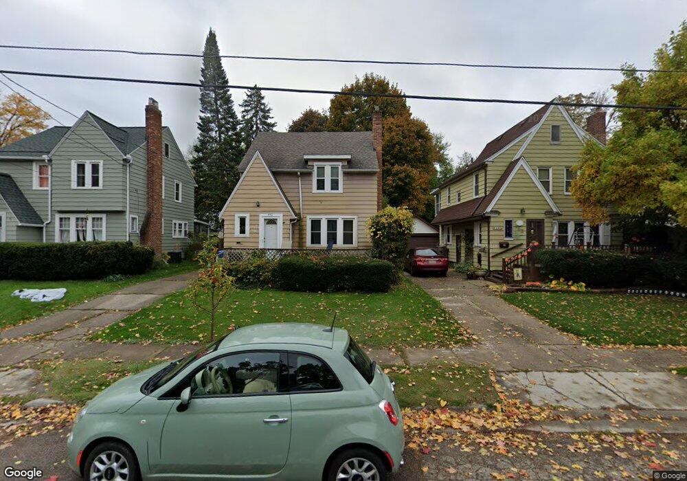
530 Edison Ave Lansing, MI 48910
Clifford Park NeighborhoodEstimated Value: $162,000 - $183,000
Studio
1
Bath
1,238
Sq Ft
$138/Sq Ft
Est. Value
About This Home
This home is located at 530 Edison Ave, Lansing, MI 48910 and is currently estimated at $170,995, approximately $138 per square foot. 530 Edison Ave is a home located in Ingham County with nearby schools including Lyons Elementary School, Attwood School, and Eastern High School.
Ownership History
Date
Name
Owned For
Owner Type
Purchase Details
Closed on
Jul 23, 2010
Sold by
Wilson Suzanne K
Bought by
Wilson Michael Edward
Current Estimated Value
Purchase Details
Closed on
Aug 6, 2001
Sold by
Birdsong Gayle
Bought by
Wilson Michael Edward and Wilson Suzanne K
Purchase Details
Closed on
Jul 1, 1981
Sold by
Birdsong David K and Birdsong Gayle K
Bought by
Wilson Michael E and Wilson Suzanne K
Create a Home Valuation Report for This Property
The Home Valuation Report is an in-depth analysis detailing your home's value as well as a comparison with similar homes in the area
Home Values in the Area
Average Home Value in this Area
Purchase History
| Date | Buyer | Sale Price | Title Company |
|---|---|---|---|
| Wilson Michael Edward | -- | None Available | |
| Wilson Michael Edward | $25,000 | -- | |
| Wilson Michael E | $25,000 | -- |
Source: Public Records
Tax History
| Year | Tax Paid | Tax Assessment Tax Assessment Total Assessment is a certain percentage of the fair market value that is determined by local assessors to be the total taxable value of land and additions on the property. | Land | Improvement |
|---|---|---|---|---|
| 2025 | $2,975 | $77,700 | $5,900 | $71,800 |
| 2024 | $24 | $69,900 | $5,900 | $64,000 |
| 2023 | $2,789 | $61,200 | $5,900 | $55,300 |
| 2022 | $2,515 | $54,100 | $5,400 | $48,700 |
| 2021 | $2,462 | $51,100 | $3,600 | $47,500 |
| 2020 | $2,447 | $49,100 | $3,600 | $45,500 |
| 2019 | $2,346 | $42,400 | $3,600 | $38,800 |
| 2018 | $2,199 | $38,800 | $3,600 | $35,200 |
| 2017 | $2,105 | $38,800 | $3,600 | $35,200 |
| 2016 | $2,043 | $38,100 | $3,600 | $34,500 |
| 2015 | $2,043 | $36,200 | $7,253 | $28,947 |
| 2014 | $2,043 | $36,200 | $5,685 | $30,515 |
Source: Public Records
Map
Nearby Homes
- 555 Tisdale Ave
- 2118 Roberts Ln
- 2600 Maplewood Ave
- 704 Mckim Ave
- 1917 Teel Ave
- 315 E Mount Hope Ave
- 311 E Mount Hope Ave
- 307 E Mount Hope Ave
- 560 Paris Ave
- 1731 Herbert St
- 1807 Teel Ave
- 413 E Hodge Ave
- 534 Isbell St
- 2311 S Pennsylvania Ave
- 2309 S Pennsylvania Ave
- 2201 S Pennsylvania Ave
- 1731 Lyons Ave
- 320 E Hodge Ave
- 147 Isbell St
- 145 Isbell St
- 534 Edison Ave
- 526 Edison Ave
- 538 Edison Ave
- 533 Tisdale Ave
- 529 Tisdale Ave
- 516 Edison Ave
- 12 Edison Ave
- 523 Tisdale Ave
- 539 Tisdale Ave
- 521 Tisdale Ave
- 531 Edison Ave
- 527 Edison Ave
- 535 Edison Ave
- 525 Edison Ave
- 519 Tisdale Ave
- 20 Edison Ave
- 545 Tisdale Ave
- 521 Edison Ave
- 543 Edison Ave
- 517 Edison Ave
Your Personal Tour Guide
Ask me questions while you tour the home.