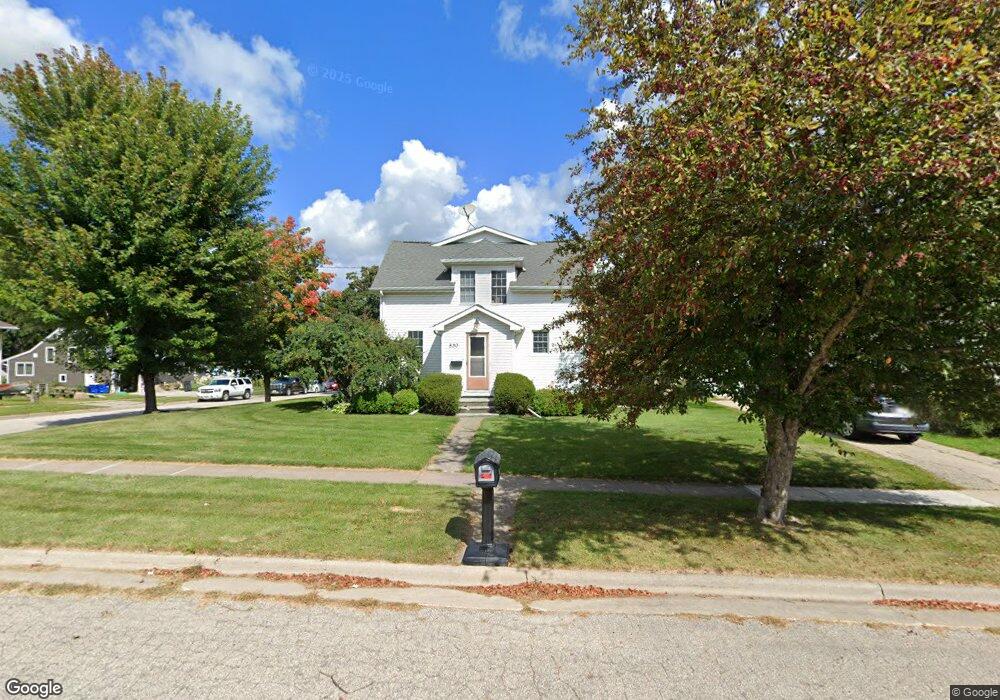
530 Independence St Viroqua, WI 54665
Estimated Value: $354,000 - $387,000
--
Bed
--
Bath
--
Sq Ft
0.25
Acres
About This Home
This home is located at 530 Independence St, Viroqua, WI 54665 and is currently estimated at $369,270. 530 Independence St is a home located in Vernon County with nearby schools including Viroqua Elementary School, Viroqua Middle School, and Viroqua High School.
Ownership History
Date
Name
Owned For
Owner Type
Purchase Details
Closed on
Sep 26, 2017
Sold by
Lampman Anthony J and Lampman Tracy A
Bought by
Skrede Craig A and Skrede Keeley M
Current Estimated Value
Home Financials for this Owner
Home Financials are based on the most recent Mortgage that was taken out on this home.
Original Mortgage
$178,485
Outstanding Balance
$149,364
Interest Rate
3.89%
Mortgage Type
Credit Line Revolving
Estimated Equity
$219,906
Create a Home Valuation Report for This Property
The Home Valuation Report is an in-depth analysis detailing your home's value as well as a comparison with similar homes in the area
Home Values in the Area
Average Home Value in this Area
Purchase History
| Date | Buyer | Sale Price | Title Company |
|---|---|---|---|
| Skrede Craig A | $177,500 | None Available |
Source: Public Records
Mortgage History
| Date | Status | Borrower | Loan Amount |
|---|---|---|---|
| Open | Skrede Craig A | $178,485 |
Source: Public Records
Tax History Compared to Growth
Tax History
| Year | Tax Paid | Tax Assessment Tax Assessment Total Assessment is a certain percentage of the fair market value that is determined by local assessors to be the total taxable value of land and additions on the property. | Land | Improvement |
|---|---|---|---|---|
| 2024 | $4,528 | $191,200 | $18,900 | $172,300 |
| 2023 | $3,948 | $191,200 | $18,900 | $172,300 |
| 2022 | $4,452 | $191,200 | $18,900 | $172,300 |
| 2021 | $4,259 | $191,200 | $18,900 | $172,300 |
| 2020 | $4,135 | $191,200 | $18,900 | $172,300 |
| 2019 | $4,092 | $191,200 | $18,900 | $172,300 |
| 2018 | $3,501 | $144,400 | $14,500 | $129,900 |
| 2017 | $3,379 | $144,400 | $14,500 | $129,900 |
| 2016 | $3,401 | $144,400 | $14,500 | $129,900 |
| 2015 | $3,754 | $144,400 | $14,500 | $129,900 |
| 2014 | $3,361 | $144,400 | $14,500 | $129,900 |
| 2013 | $3,442 | $144,400 | $14,500 | $129,900 |
Source: Public Records
Map
Nearby Homes
- 220 W Broadway St
- 222 W Decker St
- 313 N Main St
- 000 Abbey Ln
- 729 N Main St
- 756 N Main St
- 231 S Rusk Ave
- 401 Fairview Dr
- 130 W Maple St
- 651 E Decker St
- 727 Garfield Ave
- 720 S Main St
- 125 N Lincoln Ave
- 208 Circle Dr S
- 115 Crestline St
- 912 Silverthorne Dr
- 914 Silverthorne Dr
- 1230 N Main St
- S5117 County Road Nn
- 1 Sandy Oak Dr
- 524 Independence St
- 520 Independence St
- 421 Western Ave
- 604 Independence St
- 404 Western Ave
- 333 Western Ave
- 418 Western Ave
- 427 Western Ave
- 518 Independence St
- 334 Western Ave
- 422 Western Ave
- 618 Independence St
- 325 Western Ave
- 505 Independence St
- 503 Independence St
- 422 Chicago Ave
- 504 Independence St
- 420 Chicago Ave
- 501 W Broadway St
- 522 Chicago Ave