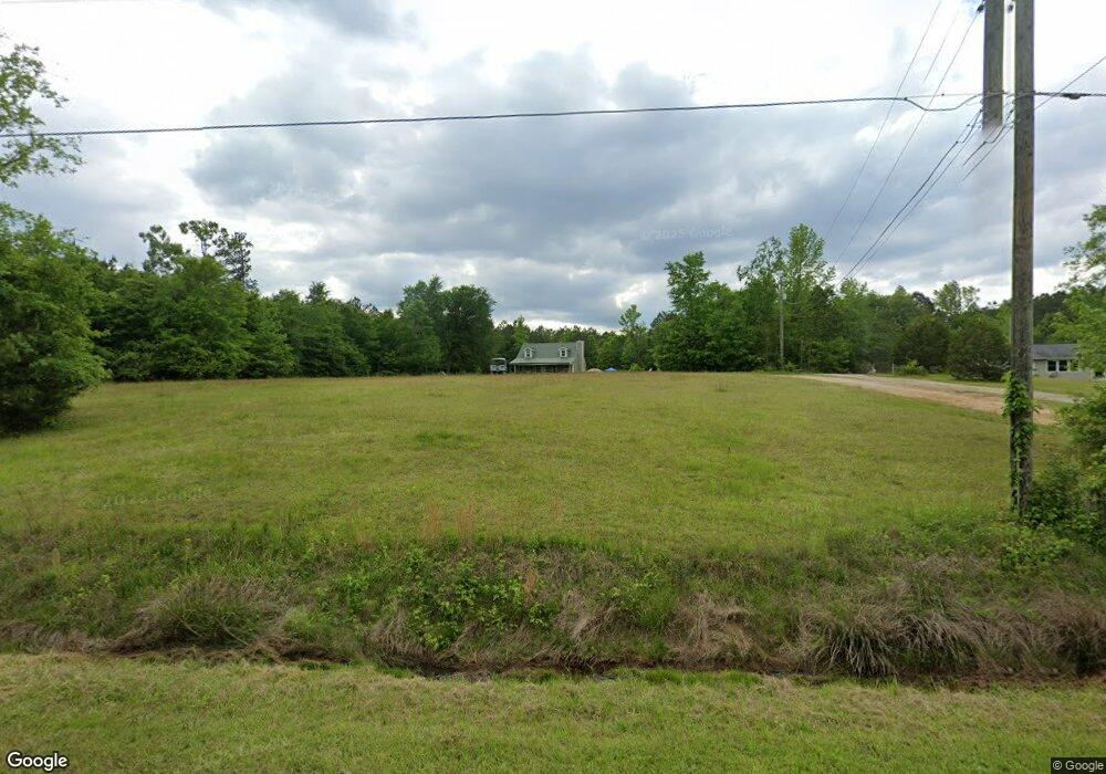
530 Jim Goodson Rd Griffin, GA 30223
Spalding County NeighborhoodEstimated Value: $250,000 - $377,000
--
Bed
2
Baths
1,938
Sq Ft
$153/Sq Ft
Est. Value
About This Home
This home is located at 530 Jim Goodson Rd, Griffin, GA 30223 and is currently estimated at $296,586, approximately $153 per square foot. 530 Jim Goodson Rd is a home located in Spalding County with nearby schools including Orrs Elementary School, Carver Road Middle School, and Griffin High School.
Ownership History
Date
Name
Owned For
Owner Type
Purchase Details
Closed on
Dec 2, 2014
Sold by
Roberson Benjamin
Bought by
Deutsche Bank National Trust C and C/O Ocwen Loan Servicing Llc
Current Estimated Value
Purchase Details
Closed on
Jul 12, 2006
Sold by
Herrin Michael T and Herrin Angela L
Bought by
Roberson Benjamin and Roberson Robin
Home Financials for this Owner
Home Financials are based on the most recent Mortgage that was taken out on this home.
Original Mortgage
$26,068
Interest Rate
6.6%
Mortgage Type
New Conventional
Purchase Details
Closed on
Oct 24, 1978
Sold by
Bates Leon
Bought by
Herrin Michael T and Vickie Pamela
Purchase Details
Closed on
Mar 29, 1977
Sold by
The Alpha 21 Group Inc
Bought by
Bates Leon
Purchase Details
Closed on
Sep 11, 1973
Sold by
Bates Otis
Bought by
The Alpha 21 Group Inc
Create a Home Valuation Report for This Property
The Home Valuation Report is an in-depth analysis detailing your home's value as well as a comparison with similar homes in the area
Home Values in the Area
Average Home Value in this Area
Purchase History
| Date | Buyer | Sale Price | Title Company |
|---|---|---|---|
| Deutsche Bank National Trust C | $121,348 | -- | |
| Deutsche Bank National Trust C | $121,348 | -- | |
| Roberson Benjamin | $130,400 | -- | |
| Herrin Michael T | $7,500 | -- | |
| Bates Leon | -- | -- | |
| The Alpha 21 Group Inc | -- | -- |
Source: Public Records
Mortgage History
| Date | Status | Borrower | Loan Amount |
|---|---|---|---|
| Previous Owner | Roberson Benjamin | $26,068 |
Source: Public Records
Tax History Compared to Growth
Tax History
| Year | Tax Paid | Tax Assessment Tax Assessment Total Assessment is a certain percentage of the fair market value that is determined by local assessors to be the total taxable value of land and additions on the property. | Land | Improvement |
|---|---|---|---|---|
| 2024 | $2,237 | $65,007 | $17,472 | $47,535 |
| 2023 | $2,261 | $65,007 | $17,472 | $47,535 |
| 2022 | $1,911 | $54,350 | $13,440 | $40,910 |
| 2021 | $1,718 | $49,069 | $13,440 | $35,629 |
| 2020 | $1,725 | $49,069 | $13,440 | $35,629 |
| 2019 | $1,759 | $49,069 | $13,440 | $35,629 |
| 2018 | $1,679 | $45,750 | $13,440 | $32,310 |
| 2017 | $1,634 | $45,750 | $13,440 | $32,310 |
| 2016 | $1,663 | $45,750 | $13,440 | $32,310 |
| 2015 | $1,713 | $45,750 | $13,440 | $32,310 |
| 2014 | $1,747 | $45,750 | $13,440 | $32,310 |
Source: Public Records
Map
Nearby Homes
- 505 New Salem Rd
- 1317 Cheatham Rd
- 590 & 592 S New Salem Rd
- 164 David Elder Rd
- 1256 Vaughn Rd
- 580 Hardy Ln
- 837 Cheatham Rd
- 116 Quail Ln
- 1836 Pinecrest Dr
- 180 Davidson Dr
- 1019 Oakridge Dr
- 184 Quail Rd
- 99 Gay Rd
- 565 Sidney Dr
- 0 Deason St Unit 23730
- 0 Deason St Unit 10624935
- 265 Steele Rd
- 1102 Stiles Crossing
- 200 Ac W Ellis Rd
- 4101 W Ellis Rd
- 520 Jim Goodson Rd
- 539 Jim Goodson Rd
- 465 Jim Goodson Rd
- 567 Jim Goodson Rd
- 600 Jim Goodson Rd
- 475 Jim Goodson Rd
- 469 Jim Goodson Rd
- 595 Jim Goodson Rd
- 423 Jim Goodson Rd
- 445 Jim Goodson Rd
- 378 Jim Goodson Rd
- 376 Jim Goodson Rd
- 655 Jim Goodson Rd
- 654 Jim Goodson Rd
- 361 Jim Goodson Rd
- 356 Jim Goodson Rd
- 355 Jim Goodson Rd
- 340 Jim Goodson Rd
- 586 Vaughn School Rd
- 349 Jim Goodson Rd