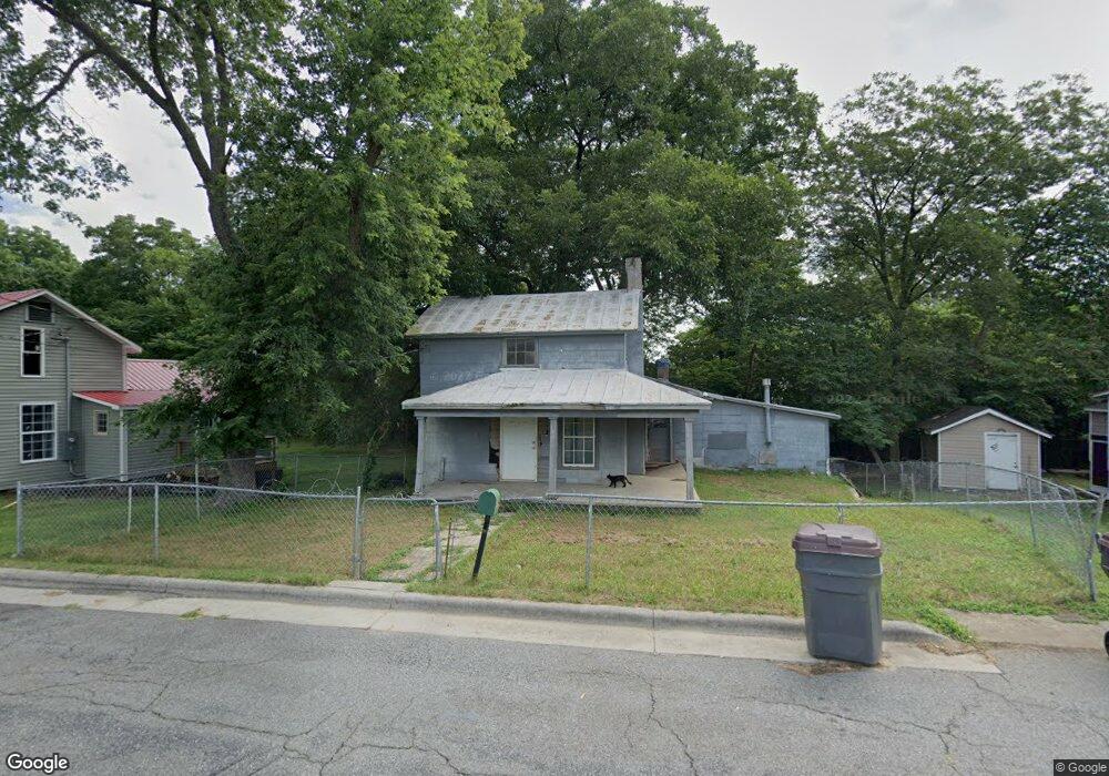
530 Mccoy St Reidsville, NC 27320
Estimated Value: $62,247 - $184,000
--
Bed
--
Bath
1,395
Sq Ft
$96/Sq Ft
Est. Value
About This Home
This home is located at 530 Mccoy St, Reidsville, NC 27320 and is currently estimated at $133,562, approximately $95 per square foot. 530 Mccoy St is a home located in Rockingham County with nearby schools including Reidsville High School, Moss Street Elementary, and Reidsville Middle School.
Ownership History
Date
Name
Owned For
Owner Type
Purchase Details
Closed on
Dec 9, 2021
Sold by
Frederick Benson
Bought by
Tickle Lawrence Edward
Current Estimated Value
Purchase Details
Closed on
Nov 22, 2021
Sold by
Zamudio Miranda Tickle and Zamudio Rene Mauricio
Bought by
Tickle Lawrence Edward
Purchase Details
Closed on
Nov 19, 2021
Sold by
Terrazas Anna Tickle
Bought by
Tickle Lawrence Edward
Purchase Details
Closed on
Jul 13, 2020
Sold by
Edwards Cindy Lea and Estate Of Charels A Haney
Bought by
Tickle Lawrence Edward
Purchase Details
Closed on
Sep 17, 1997
Sold by
Haney Charles Alvin
Bought by
County Of Rockingham
Create a Home Valuation Report for This Property
The Home Valuation Report is an in-depth analysis detailing your home's value as well as a comparison with similar homes in the area
Home Values in the Area
Average Home Value in this Area
Purchase History
| Date | Buyer | Sale Price | Title Company |
|---|---|---|---|
| Tickle Lawrence Edward | -- | None Available | |
| Tickle Lawrence Edward | -- | None Available | |
| Tickle Lawrence Edward | -- | None Available | |
| Tickle Lawrence Edward | $21,000 | None Available | |
| County Of Rockingham | -- | None Available |
Source: Public Records
Tax History Compared to Growth
Tax History
| Year | Tax Paid | Tax Assessment Tax Assessment Total Assessment is a certain percentage of the fair market value that is determined by local assessors to be the total taxable value of land and additions on the property. | Land | Improvement |
|---|---|---|---|---|
| 2025 | $492 | $39,684 | $4,419 | $35,265 |
| 2024 | $492 | $39,684 | $4,419 | $35,265 |
| 2023 | $331 | $23,114 | $3,564 | $19,550 |
| 2022 | $331 | $23,114 | $3,564 | $19,550 |
| 2021 | $331 | $23,114 | $3,564 | $19,550 |
| 2020 | $331 | $23,114 | $3,564 | $19,550 |
| 2019 | $331 | $23,114 | $3,564 | $19,550 |
| 2018 | $0 | $24,461 | $5,826 | $18,635 |
| 2017 | $0 | $24,461 | $5,826 | $18,635 |
| 2015 | $3 | $24,461 | $5,826 | $18,635 |
| 2014 | -- | $24,461 | $5,826 | $18,635 |
Source: Public Records
Map
Nearby Homes
- 515 Barnes St
- 511 Barnes St
- 502 Thomas St
- 802 Montgomery St
- 607 Lancaster Dr
- 816 Barnes St
- 612 Thomas St
- 105 Edna St
- 802 Lawsonville Ave
- 335 S Branch St
- 1107 Walnut St
- 00 Robinson Cir
- 315 Hubbard St
- 312 Church St
- 202 Woodrow St
- 810 Walker St
- 716 Watson St
- 1213 Barnes St
- 801 Watson St
- 403 Pennsylvania Ave