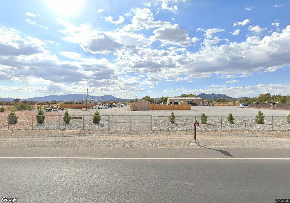
530 N Leslie St Pahrump, NV 89060
Estimated Value: $28,742 - $340,000
--
Bed
--
Bath
1,800
Sq Ft
$113/Sq Ft
Est. Value
About This Home
This home is located at 530 N Leslie St, Pahrump, NV 89060 and is currently estimated at $203,186, approximately $112 per square foot. 530 N Leslie St is a home with nearby schools including Manse Elementary School, Rosemary Clarke Middle School, and Pahrump Valley High School.
Ownership History
Date
Name
Owned For
Owner Type
Purchase Details
Closed on
Nov 23, 2016
Sold by
Hagen Patricia A and Hagen Jerome A
Bought by
Hagen Herman
Current Estimated Value
Purchase Details
Closed on
Nov 8, 2016
Sold by
Hagen Herman
Bought by
Redmond Matheau and Snowden Hayley
Purchase Details
Closed on
Oct 27, 2016
Sold by
Birdsong Bradley T and Birdsong Melissa
Bought by
Hagen Herman
Purchase Details
Closed on
Mar 15, 2016
Sold by
Birdsona Meliss H
Bought by
Hagen Hermita and Hagen Hermita C
Purchase Details
Closed on
Oct 22, 2008
Sold by
Hagen Jerome A
Bought by
Birdsong Melissa
Purchase Details
Closed on
Jan 4, 2007
Sold by
Hagen Mary
Bought by
Hagen Jerome A
Create a Home Valuation Report for This Property
The Home Valuation Report is an in-depth analysis detailing your home's value as well as a comparison with similar homes in the area
Home Values in the Area
Average Home Value in this Area
Purchase History
| Date | Buyer | Sale Price | Title Company |
|---|---|---|---|
| Hagen Herman | -- | Cow County Title Co | |
| Redmond Matheau | $15,000 | Cow County Title Co | |
| Hagen Herman | -- | Cow County Title Co | |
| Hagen Herman | -- | Cow County Title Co | |
| Hagen Hermita | $21,686 | None Available | |
| Birdsong Melissa | -- | None Available | |
| Hagen Jerome A | -- | None Available |
Source: Public Records
Tax History Compared to Growth
Tax History
| Year | Tax Paid | Tax Assessment Tax Assessment Total Assessment is a certain percentage of the fair market value that is determined by local assessors to be the total taxable value of land and additions on the property. | Land | Improvement |
|---|---|---|---|---|
| 2025 | $420 | $32,056 | $4,929 | $27,127 |
| 2024 | $420 | $12,906 | $4,929 | $7,977 |
| 2023 | $420 | $12,387 | $4,929 | $7,458 |
| 2022 | $362 | $10,463 | $4,929 | $5,534 |
| 2021 | $340 | $9,384 | $3,943 | $5,441 |
| 2020 | $328 | $9,433 | $3,943 | $5,490 |
| 2019 | $308 | $8,550 | $3,943 | $4,607 |
| 2018 | $295 | $7,608 | $3,154 | $4,454 |
| 2017 | $295 | $7,587 | $3,154 | $4,433 |
| 2016 | $297 | $7,590 | $3,154 | $4,436 |
| 2015 | $298 | $8,220 | $3,154 | $5,066 |
| 2014 | $320 | $8,196 | $3,154 | $5,042 |
Source: Public Records
Map
Nearby Homes
- 781 N Leslie St
- 2090 Shady Ln
- 300 W Leslie St
- 2341 Shady Ln
- 1771 W Sagehen St
- 2460 Mary Beth Ct
- 2360 Mary Beth Ct
- 220 N David St
- 1130 N Leslie St
- 2590 W Luke St
- 2141 W Basin Ave
- 2171 W Basin Ave
- 71 Union Pacific St
- 2681 Shady Ln
- 1391 Piltz Rd
- 2221 W Windsong Ln
- 2721 W Irene St
- 1950 W Horn Rd
- 1311 W Betty Ave
- 2431 Dyer Ct
- 521 N Leslie St
- 561 N Leslie St
- 570 N Leslie St
- 570 N Leslie St
- 570 N Leslie St
- 601 N Leslie St
- 640 N Leslie St
- 421 N Leslie St
- 420 Chapparel Ave
- 641 Diamond Cir
- 1961 Isaac St
- 471 Chapparel Ave
- 1931 Isaac St
- 2150 W Betty Ave
- 671 Diamond Cir
- 611 Dodie Ln
- 1901 Isaac St
- 640 Diamond Cir
- 1881 Isaac St
- 701 Diamond Cir