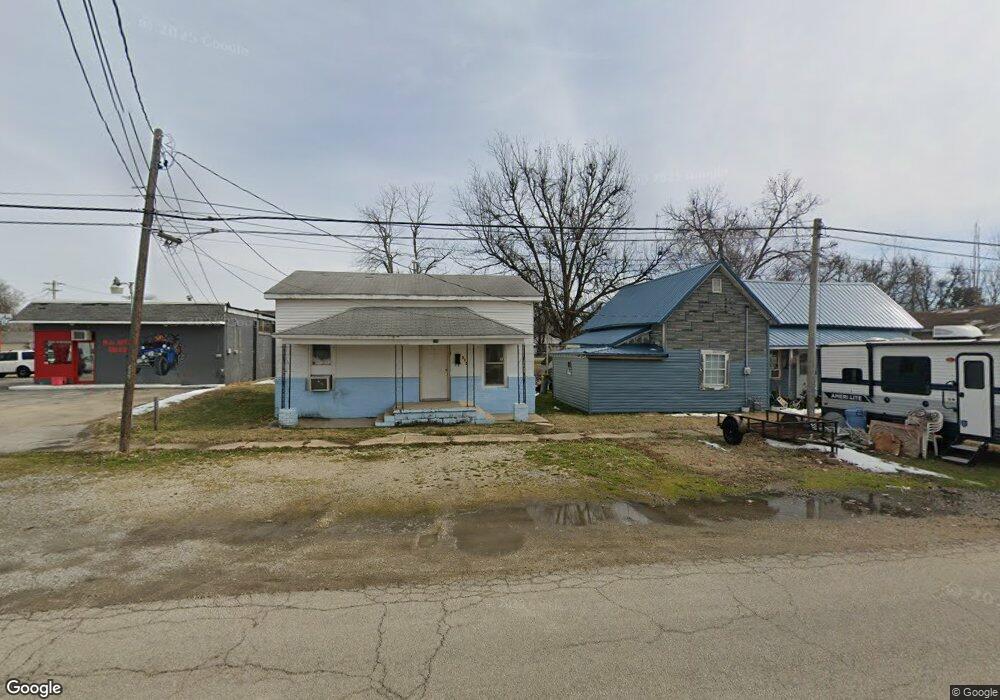
530 N Locust St Dexter, MO 63841
Estimated Value: $49,527 - $92,000
3
Beds
1
Bath
904
Sq Ft
$87/Sq Ft
Est. Value
About This Home
This home is located at 530 N Locust St, Dexter, MO 63841 and is currently estimated at $78,882, approximately $87 per square foot. 530 N Locust St is a home located in Stoddard County with nearby schools including Southwest Elementary School, Central Elementary School, and T.S. Hill Middle School.
Ownership History
Date
Name
Owned For
Owner Type
Purchase Details
Closed on
Oct 25, 2019
Sold by
Miles Bancshares Inc
Bought by
Brown Michael and Brown Jennifer
Current Estimated Value
Home Financials for this Owner
Home Financials are based on the most recent Mortgage that was taken out on this home.
Original Mortgage
$49,000
Outstanding Balance
$43,014
Interest Rate
3.6%
Mortgage Type
New Conventional
Estimated Equity
$35,868
Purchase Details
Closed on
Feb 2, 2018
Sold by
Robert Helton and Robert Shirley
Bought by
Ray Casey Dean
Create a Home Valuation Report for This Property
The Home Valuation Report is an in-depth analysis detailing your home's value as well as a comparison with similar homes in the area
Home Values in the Area
Average Home Value in this Area
Purchase History
| Date | Buyer | Sale Price | Title Company |
|---|---|---|---|
| Brown Michael | $12,001 | Other | |
| Ray Casey Dean | $52,593 | National Title & Escrow Inc |
Source: Public Records
Mortgage History
| Date | Status | Borrower | Loan Amount |
|---|---|---|---|
| Open | Brown Michael | $49,000 |
Source: Public Records
Tax History
| Year | Tax Paid | Tax Assessment Tax Assessment Total Assessment is a certain percentage of the fair market value that is determined by local assessors to be the total taxable value of land and additions on the property. | Land | Improvement |
|---|---|---|---|---|
| 2025 | $157 | $3,686 | $0 | $0 |
| 2024 | $2 | $3,382 | $0 | $0 |
| 2023 | $156 | $3,382 | $0 | $0 |
| 2022 | $143 | $3,097 | $0 | $0 |
| 2021 | $143 | $3,097 | $0 | $0 |
| 2020 | $132 | $2,698 | $0 | $0 |
| 2019 | $132 | $2,850 | $0 | $0 |
| 2018 | $124 | $2,698 | $0 | $0 |
| 2016 | $114 | $2,546 | $0 | $0 |
| 2015 | -- | $2,546 | $0 | $0 |
| 2014 | -- | $2,489 | $0 | $0 |
| 2013 | -- | $0 | $0 | $0 |
Source: Public Records
Map
Nearby Homes
- 9 W Truitt St
- 723 N Elm St
- 801 N Poplar St
- 125 W Saint Francis St
- 708 N Hickory St
- 902 N Poplar St
- 339 W Castor St
- 435 W Elk St
- 1008 N Mulberry St
- 121 S Poplar St
- 3 S Hickory St
- 128 S Mulberry St
- 1002 Cottage Ln
- 324 Vine St
- 130 Hunt St
- 110 Carter St
- 18328 Lake Circle Dr
- 106 W Grant St
- 0 E Kenton Rd Unit MAR25009938
- 345 S Catalpa St
- 526 N Locust St
- 522 N Locust St
- 520 N Locust St
- 117 E Saint Francis St
- 101 E Saint Francis St
- 521 N Elm St
- 525 N Locust St
- 515 N Elm St
- 107 E Saint Francis St
- 111 E Saint Francis St
- 614 N Elm St Unit 612
- 0 Bus 60w & Bus 60e Unit 9927332
- 616 N Locust St
- 125 E Saint Francis St
- 620 N Locust St
- 518 N Elm St Unit B
- 518 N Elm St
- 126 E Saint Francis St Unit 112
- 620 N Elm St Unit 620 1/2
- 518A N Elm St
Your Personal Tour Guide
Ask me questions while you tour the home.