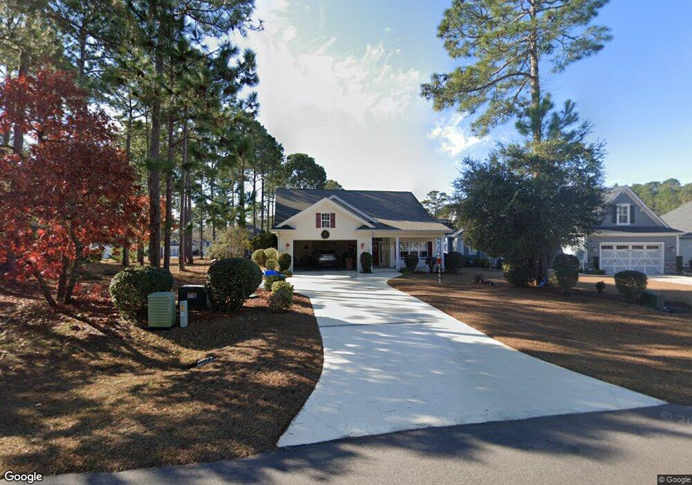
530 Planters Ridge Dr Sunset Beach, NC 28468
Estimated Value: $462,000 - $498,000
3
Beds
2
Baths
1,711
Sq Ft
$280/Sq Ft
Est. Value
About This Home
This home is located at 530 Planters Ridge Dr, Sunset Beach, NC 28468 and is currently estimated at $479,865, approximately $280 per square foot. 530 Planters Ridge Dr is a home located in Brunswick County with nearby schools including Jessie Mae Monroe Elementary School, Shallotte Middle School, and West Brunswick High School.
Ownership History
Date
Name
Owned For
Owner Type
Purchase Details
Closed on
Mar 24, 2010
Sold by
Richards William H
Bought by
Richards William H and William H Richards Trust
Current Estimated Value
Home Financials for this Owner
Home Financials are based on the most recent Mortgage that was taken out on this home.
Original Mortgage
$285,000
Outstanding Balance
$267,812
Interest Rate
2.74%
Mortgage Type
Reverse Mortgage Home Equity Conversion Mortgage
Estimated Equity
$212,053
Purchase Details
Closed on
Apr 20, 2005
Sold by
Sea Trail Corp
Bought by
Richards William H and The William H Richards Trust
Home Financials for this Owner
Home Financials are based on the most recent Mortgage that was taken out on this home.
Original Mortgage
$57,199
Interest Rate
5.79%
Mortgage Type
Future Advance Clause Open End Mortgage
Create a Home Valuation Report for This Property
The Home Valuation Report is an in-depth analysis detailing your home's value as well as a comparison with similar homes in the area
Home Values in the Area
Average Home Value in this Area
Purchase History
| Date | Buyer | Sale Price | Title Company |
|---|---|---|---|
| Richards William H | -- | None Available | |
| Richards William H | $67,000 | None Available |
Source: Public Records
Mortgage History
| Date | Status | Borrower | Loan Amount |
|---|---|---|---|
| Open | Richards William H | $285,000 | |
| Closed | Richards William H | $57,199 |
Source: Public Records
Tax History Compared to Growth
Tax History
| Year | Tax Paid | Tax Assessment Tax Assessment Total Assessment is a certain percentage of the fair market value that is determined by local assessors to be the total taxable value of land and additions on the property. | Land | Improvement |
|---|---|---|---|---|
| 2025 | $1,175 | $388,430 | $46,000 | $342,430 |
| 2024 | $1,175 | $388,430 | $46,000 | $342,430 |
| 2023 | $1,005 | $388,430 | $46,000 | $342,430 |
| 2022 | $1,005 | $252,670 | $45,000 | $207,670 |
| 2021 | $1,005 | $252,670 | $45,000 | $207,670 |
| 2020 | $1,005 | $252,670 | $45,000 | $207,670 |
| 2019 | $1,005 | $47,490 | $45,000 | $2,490 |
| 2018 | $907 | $47,980 | $45,000 | $2,980 |
| 2017 | $862 | $47,980 | $45,000 | $2,980 |
| 2016 | $837 | $47,980 | $45,000 | $2,980 |
| 2015 | $837 | $228,430 | $45,000 | $183,430 |
| 2014 | $786 | $250,708 | $80,000 | $170,708 |
Source: Public Records
Map
Nearby Homes
- L-42 Brookwood Park
- 602 Planters Ridge Dr
- 205 Brookwood Park Ct
- 725 Bermuda Walk
- 8317 Dunes Ridge Place
- 602 Bermuda Walk
- 272 Crooked Gulley Cir
- 1068 Sea Bourne Way
- 1100 Sea Bourne Way
- 8238 Old Georgetown Rd SW
- 320 Crooked Gulley Cir
- 301 Planter's Ridge Dr
- 305 Planters Ridge SW
- 305 Planter's Ridge Dr
- 205 Jones Byrd Ct
- 141 Avian Dr Unit 3818
- 140 Avian Dr Unit 3709
- 135 Forest Walk SW
- 202 Jones Byrd Ct
- 133 Avian Dr Unit 3412
- 528 Planter's Ridge Dr
- 528 Planter's Ridge Dr Unit 18
- 526 Planter's Ridge Dr
- 534 Planter's Ridge Dr
- 536 Planter's Ridge Dr
- 220 Brookwood Park Ct
- 214 Brookwood Park Ct
- 22 Brookwood Park Plat
- 222 Brookwood Park Ct
- 524 Planters Ridge Dr
- 523 Planters Ridge Dr
- 525 Planter's Ridge Dr
- 210 Brookwood Park Ct
- Lot 57 Brookwood Park Ct
- Lot 35 Brookwood Park Ct
- Lot 36 Brookwood Park Ct Unit Lot 36
- 34 Brookwood Park Ct
- 0 Brookwood Park Ct
- 0 Gulley Ct
- 36 Brookwood Park Ct