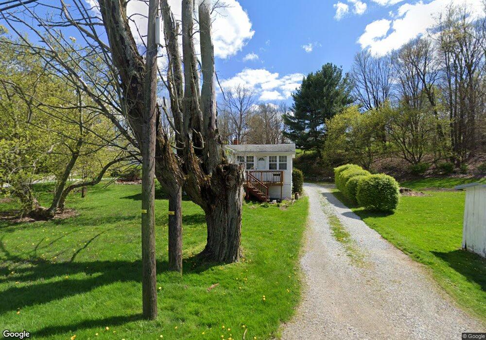
530 Randolph Rd Mogadore, OH 44260
Estimated Value: $211,000 - $357,000
1
Bed
1
Bath
1,024
Sq Ft
$262/Sq Ft
Est. Value
About This Home
This home is located at 530 Randolph Rd, Mogadore, OH 44260 and is currently estimated at $268,325, approximately $262 per square foot. 530 Randolph Rd is a home located in Portage County with nearby schools including Suffield Elementary School, Field Middle School, and Field High School.
Ownership History
Date
Name
Owned For
Owner Type
Purchase Details
Closed on
Aug 5, 2024
Sold by
Chamness Shawn D and Chamness Abby W
Bought by
Harmon Robert and Matthews Kelly
Current Estimated Value
Home Financials for this Owner
Home Financials are based on the most recent Mortgage that was taken out on this home.
Original Mortgage
$195,000
Interest Rate
6.95%
Mortgage Type
New Conventional
Purchase Details
Closed on
Jul 13, 2023
Sold by
Stein Havard F and Stein Deanna Lee
Bought by
Chamness Shawn D and Chamness Abby W
Home Financials for this Owner
Home Financials are based on the most recent Mortgage that was taken out on this home.
Original Mortgage
$318,250
Interest Rate
6.79%
Mortgage Type
New Conventional
Create a Home Valuation Report for This Property
The Home Valuation Report is an in-depth analysis detailing your home's value as well as a comparison with similar homes in the area
Home Values in the Area
Average Home Value in this Area
Purchase History
| Date | Buyer | Sale Price | Title Company |
|---|---|---|---|
| Harmon Robert | -- | None Listed On Document | |
| Mon Robert Har | $370,000 | None Listed On Document | |
| Chamness Shawn D | $335,000 | None Listed On Document |
Source: Public Records
Mortgage History
| Date | Status | Borrower | Loan Amount |
|---|---|---|---|
| Previous Owner | Mon Robert Har | $195,000 | |
| Previous Owner | Chamness Shawn D | $318,250 |
Source: Public Records
Tax History Compared to Growth
Tax History
| Year | Tax Paid | Tax Assessment Tax Assessment Total Assessment is a certain percentage of the fair market value that is determined by local assessors to be the total taxable value of land and additions on the property. | Land | Improvement |
|---|---|---|---|---|
| 2024 | $4,258 | $106,440 | $44,030 | $62,410 |
| 2023 | $3,284 | $66,120 | $22,330 | $43,790 |
| 2022 | $2,838 | $66,120 | $22,330 | $43,790 |
| 2021 | $2,807 | $66,120 | $22,330 | $43,790 |
| 2020 | $2,691 | $58,520 | $22,330 | $36,190 |
| 2019 | $2,705 | $58,520 | $22,330 | $36,190 |
| 2018 | $2,136 | $55,660 | $24,540 | $31,120 |
| 2017 | $2,136 | $55,660 | $24,540 | $31,120 |
| 2016 | $2,121 | $55,660 | $24,540 | $31,120 |
| 2015 | $2,123 | $55,660 | $24,540 | $31,120 |
| 2014 | $2,066 | $55,660 | $24,540 | $31,120 |
| 2013 | $2,049 | $55,660 | $24,540 | $31,120 |
Source: Public Records
Map
Nearby Homes
- 268 Randolph Rd
- 596 Ticknor Rd
- 112 Sunrise Blvd E
- 2662 Martin Rd
- 3985 Etter Rd
- 3874 Prospect St
- 26 Walnut Ct
- 38 Walnut Ct
- 377 S Cleveland Ave
- 1660 Martin Rd
- 2835 Sunnybrook Rd
- 3756 Curtis St
- 3763 Orchard St
- 0 Randolph Rd Unit 5112744
- 3736 Louise St
- 3702 Orchard St
- 496 James Ave
- 0 Edith Ave Unit 5137069
- 0 Gilchrist Rd
- V/L Southeast Ave
- 530 Randolph Rd
- 476 Randolph Rd
- 487 Randolph Rd
- V/L Randolph Rd
- 2284 Sunnybrook Rd
- 598 Randolph Rd
- 456 Randolph Rd
- 606 Randolph Rd
- 608 Randolph Rd
- 2301 Sunnybrook Rd
- 2310 Sunnybrook Rd
- 436 Randolph Rd
- 441 Randolph Rd
- 607 Randolph Rd
- 626 Randolph Rd
- 2324 Sunnybrook Rd
- 2296 Bixler Dr
- 2283 Bixler Dr
- 2317 Sunnybrook Rd
- 2333 Sunnybrook Rd