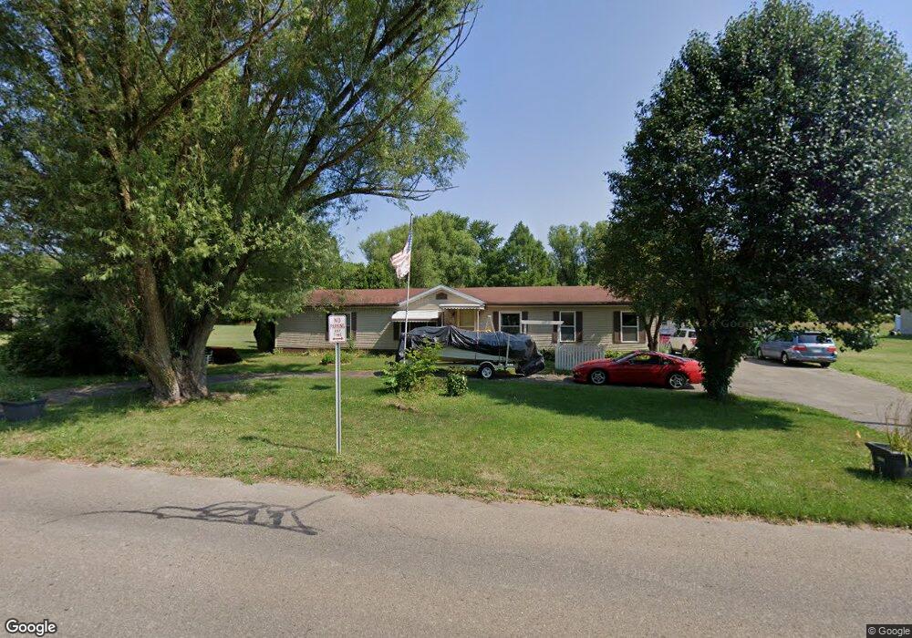
530 River St Alliance, OH 44601
Estimated Value: $152,000 - $182,000
3
Beds
2
Baths
1,782
Sq Ft
$93/Sq Ft
Est. Value
About This Home
This home is located at 530 River St, Alliance, OH 44601 and is currently estimated at $166,470, approximately $93 per square foot. 530 River St is a home located in Stark County with nearby schools including Alliance Early Learning School, Alliance Intermediate School at Northside, and Alliance Middle School.
Ownership History
Date
Name
Owned For
Owner Type
Purchase Details
Closed on
Dec 10, 2004
Sold by
Nichols William S and Nichols Sandra K
Bought by
Jabeen Mahmooda and Mohammad Gulzar
Current Estimated Value
Home Financials for this Owner
Home Financials are based on the most recent Mortgage that was taken out on this home.
Original Mortgage
$92,055
Outstanding Balance
$46,040
Interest Rate
5.71%
Mortgage Type
FHA
Estimated Equity
$120,430
Purchase Details
Closed on
Sep 11, 1997
Sold by
Debee David W
Bought by
Nichols William S and Nichols Sandra
Create a Home Valuation Report for This Property
The Home Valuation Report is an in-depth analysis detailing your home's value as well as a comparison with similar homes in the area
Home Values in the Area
Average Home Value in this Area
Purchase History
| Date | Buyer | Sale Price | Title Company |
|---|---|---|---|
| Jabeen Mahmooda | $93,500 | Union Title Company | |
| Nichols William S | $10,000 | -- |
Source: Public Records
Mortgage History
| Date | Status | Borrower | Loan Amount |
|---|---|---|---|
| Open | Jabeen Mahmooda | $92,055 |
Source: Public Records
Tax History Compared to Growth
Tax History
| Year | Tax Paid | Tax Assessment Tax Assessment Total Assessment is a certain percentage of the fair market value that is determined by local assessors to be the total taxable value of land and additions on the property. | Land | Improvement |
|---|---|---|---|---|
| 2025 | -- | $40,150 | $15,680 | $24,470 |
| 2024 | -- | $40,150 | $15,680 | $24,470 |
| 2023 | $819 | $20,380 | $5,010 | $15,370 |
| 2022 | $412 | $20,380 | $5,010 | $15,370 |
| 2021 | $825 | $20,380 | $5,010 | $15,370 |
| 2020 | $765 | $17,640 | $4,340 | $13,300 |
| 2019 | $754 | $17,650 | $4,340 | $13,310 |
| 2018 | $758 | $17,650 | $4,340 | $13,310 |
| 2017 | $761 | $17,440 | $3,640 | $13,800 |
| 2016 | $767 | $17,440 | $3,640 | $13,800 |
| 2015 | $774 | $17,440 | $3,640 | $13,800 |
| 2014 | $818 | $17,540 | $3,360 | $14,180 |
| 2013 | $408 | $17,540 | $3,360 | $14,180 |
Source: Public Records
Map
Nearby Homes
- 11344 Walnut Ave NE
- 11310 Webb Ave NE
- 15995 Elbrook St NE
- 652 N Webb Ave
- 11680 Walnut Ave NE
- 124 E Wayne St
- 710 N Freedom Ave
- 263 Franklin Ave
- 361 E Main St
- 1214 Jersey St
- 142 S Seneca Ave
- 356 E Broadway St
- V/L S Fredeom Ave
- 163 W Market St
- 511 W Ely St
- 432 S Linden Ave
- 329 1/2 W Main St
- 132 S Haines Ave
- 0 Meadowbrook Ave
- 000 Meadowbrook Ave
- 658 River St
- 450 River St
- 430 River St
- 427 River St
- 425 River St
- 420 River St
- 1133 Apple Ave
- 408 River St
- 405 River St
- tbd River St NE
- 15796 Waverly St NE
- 15774 Waverly St NE
- 0 3rd & Market Unit 959771
- 0 3rd & Market Unit 1030169
- 0 3rd & Market Unit 872333
- 0 3rd & Market Unit 936015
- 1205 Apple Ave
- 1011 Apple Ave
- 15818 Waverly St NE
- 347 Beech St