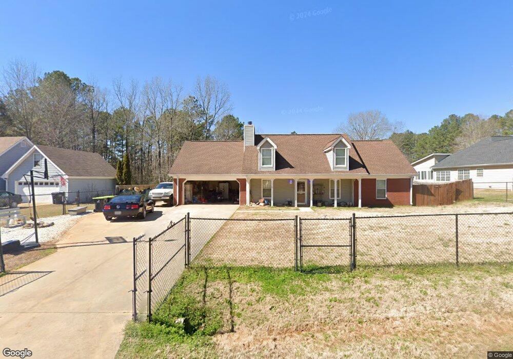
530 Robin Rd Unit 2 Covington, GA 30016
Estimated Value: $99,000 - $282,000
Studio
3
Baths
1,675
Sq Ft
$128/Sq Ft
Est. Value
About This Home
This home is located at 530 Robin Rd Unit 2, Covington, GA 30016 and is currently estimated at $214,000, approximately $127 per square foot. 530 Robin Rd Unit 2 is a home located in Newton County with nearby schools including Oak Hill Elementary School, Veterans Memorial Middle School, and Alcovy High School.
Ownership History
Date
Name
Owned For
Owner Type
Purchase Details
Closed on
Sep 18, 2025
Sold by
Browning Wayne Ferris
Bought by
Curiel Pedro
Current Estimated Value
Purchase Details
Closed on
Oct 13, 2014
Sold by
Patrick Vernon R
Bought by
Patrick Lisa L
Purchase Details
Closed on
Nov 29, 1995
Sold by
Thompson Bldrsinc
Bought by
Patrick Vernon R Lisa L
Create a Home Valuation Report for This Property
The Home Valuation Report is an in-depth analysis detailing your home's value as well as a comparison with similar homes in the area
Home Values in the Area
Average Home Value in this Area
Purchase History
| Date | Buyer | Sale Price | Title Company |
|---|---|---|---|
| Curiel Pedro | $100,000 | -- | |
| Patrick Lisa L | -- | -- | |
| Patrick Vernon R Lisa L | $91,000 | -- |
Source: Public Records
Mortgage History
| Date | Status | Borrower | Loan Amount |
|---|---|---|---|
| Closed | Patrick Vernon R Lisa L | $0 |
Source: Public Records
Tax History
| Year | Tax Paid | Tax Assessment Tax Assessment Total Assessment is a certain percentage of the fair market value that is determined by local assessors to be the total taxable value of land and additions on the property. | Land | Improvement |
|---|---|---|---|---|
| 2025 | $2,798 | $118,120 | $16,800 | $101,320 |
| 2024 | $2,682 | $109,720 | $16,800 | $92,920 |
| 2023 | $3,360 | $127,680 | $7,600 | $120,080 |
| 2022 | $2,417 | $92,960 | $7,600 | $85,360 |
| 2021 | $2,393 | $82,800 | $7,600 | $75,200 |
| 2020 | $2,304 | $72,480 | $7,600 | $64,880 |
| 2019 | $1,959 | $61,320 | $7,600 | $53,720 |
| 2018 | $1,892 | $59,000 | $7,600 | $51,400 |
| 2017 | $1,904 | $59,360 | $7,600 | $51,760 |
| 2016 | $1,719 | $53,960 | $4,000 | $49,960 |
| 2015 | $1,610 | $50,800 | $2,000 | $48,800 |
| 2014 | $1,607 | $50,800 | $0 | $0 |
Source: Public Records
Map
Nearby Homes
- 0 Goldfinch Dr
- 0 Goldfinch Dr Unit 7564125
- 125 Cardinal Ct Unit 1
- 130 Goldfinch Dr
- 125 Goldfinch Dr
- 2215 Oak Hill Rd
- 50 Butler Bridge Cir
- 5240 Highway 20 S
- 5737 Highway 20 S
- 6023 Highway 20 S
- 35 Fourwood Dr
- 1925 Oak Hill Rd
- 110 Chapel Heights Way
- 2020 Bailey Creek Rd
- 20 W Forest Dr
- 0 Butler Bridge Rd Unit 19792691
- 30 Creekside Ct
- 120 Wintergreen Ct
- 255 Hugh Dr
- 55 the Falls Blvd
- 510 Robin Rd Unit 2
- 540 Robin Rd
- 550 Robin Rd Unit 2
- 545 Robin Rd Unit 2
- 640 Robin Rd
- 515 Robin Rd Unit 2
- 515 Robin Rd
- 535 Robin Rd
- 560 Robin Rd Unit 2
- 525 Robin Rd
- 650 Robin Rd Unit 2
- 565 Robin Rd Unit 2
- 655 Robin Rd Unit 2
- 655 Robin Rd
- 575 Robin Rd
- 635 Robin Rd
- 625 Robin Rd Unit 2
- 615 Robin Rd Unit 2
- 35 Goldfinch Dr
- 65 Cardinal Ct
Your Personal Tour Guide
Ask me questions while you tour the home.