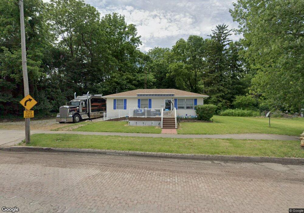
530 S Front St Fremont, OH 43420
Estimated Value: $110,000 - $139,000
3
Beds
1
Bath
1,008
Sq Ft
$125/Sq Ft
Est. Value
About This Home
This home is located at 530 S Front St, Fremont, OH 43420 and is currently estimated at $125,730, approximately $124 per square foot. 530 S Front St is a home located in Sandusky County with nearby schools including Fremont Ross High School, Bishop Hoffman Catholic School - This is St Joe's School now, and St. Joseph School.
Ownership History
Date
Name
Owned For
Owner Type
Purchase Details
Closed on
Jan 30, 1998
Sold by
Sandusky County Habitat
Bought by
Tom Michael and Tom Michael Lori
Current Estimated Value
Purchase Details
Closed on
Jun 2, 1994
Sold by
Furnell T Osbin
Bought by
Sandusky County Habitat For Humanity
Purchase Details
Closed on
Sep 1, 1993
Sold by
Wymer Lori L
Bought by
Wymer Lori L
Purchase Details
Closed on
Jan 1, 1991
Bought by
Wymer Lori L
Create a Home Valuation Report for This Property
The Home Valuation Report is an in-depth analysis detailing your home's value as well as a comparison with similar homes in the area
Home Values in the Area
Average Home Value in this Area
Purchase History
| Date | Buyer | Sale Price | Title Company |
|---|---|---|---|
| Tom Michael | $53,500 | -- | |
| Sandusky County Habitat For Humanity | $4,000 | -- | |
| Wymer Lori L | $8,000 | -- | |
| Wymer Lori L | -- | -- |
Source: Public Records
Tax History Compared to Growth
Tax History
| Year | Tax Paid | Tax Assessment Tax Assessment Total Assessment is a certain percentage of the fair market value that is determined by local assessors to be the total taxable value of land and additions on the property. | Land | Improvement |
|---|---|---|---|---|
| 2024 | $1,294 | $37,030 | $9,100 | $27,930 |
| 2023 | $1,396 | $28,280 | $7,210 | $21,070 |
| 2022 | $1,120 | $28,280 | $7,210 | $21,070 |
| 2021 | $1,156 | $28,280 | $7,210 | $21,070 |
| 2020 | $1,205 | $29,020 | $7,210 | $21,810 |
| 2019 | $1,203 | $29,020 | $7,210 | $21,810 |
| 2018 | $1,185 | $29,020 | $7,210 | $21,810 |
| 2017 | $1,165 | $27,970 | $7,210 | $20,760 |
| 2016 | $1,025 | $27,970 | $7,210 | $20,760 |
| 2015 | $1,009 | $27,970 | $7,210 | $20,760 |
| 2014 | $1,041 | $27,510 | $7,140 | $20,370 |
| 2013 | $1,018 | $27,510 | $7,140 | $20,370 |
Source: Public Records
Map
Nearby Homes
- 515 S Arch St
- 619 Hayes Ave
- 625 Bush Place
- 616 S Wood St
- 815 South St
- 208 E State St
- 1015 Hayes Ave
- 1037 Buckland Ave
- 905 Twinn St
- 1028 June St
- 600 S Buchanan St
- 1013 Whittlesey St
- 224 Sandusky Ave Unit 226
- 0 S Buchanan St
- 906 Amsden Blvd
- 216 S Buchanan St
- 427 N Clover St
- 714 E State St
- 516 N Front St
- 322 4th St
- 522 S Front St
- 523 S Arch St
- 518 S Front St
- 302 Tiffin St
- 207 Allen St
- 525 S Front St Unit 525
- 521 S Arch St
- 605 S Front St
- 521 S Front St
- 310 Tiffin St
- 514 S Front St Unit 516
- 519 S Front St
- 412 Vine St
- 312 Tiffin St
- 515 S Front St
- 420 Vine St
- 509 S Arch St Unit 511
- 526 Bidwell Ave
- 610 Bidwell Ave
- 623 S Front St