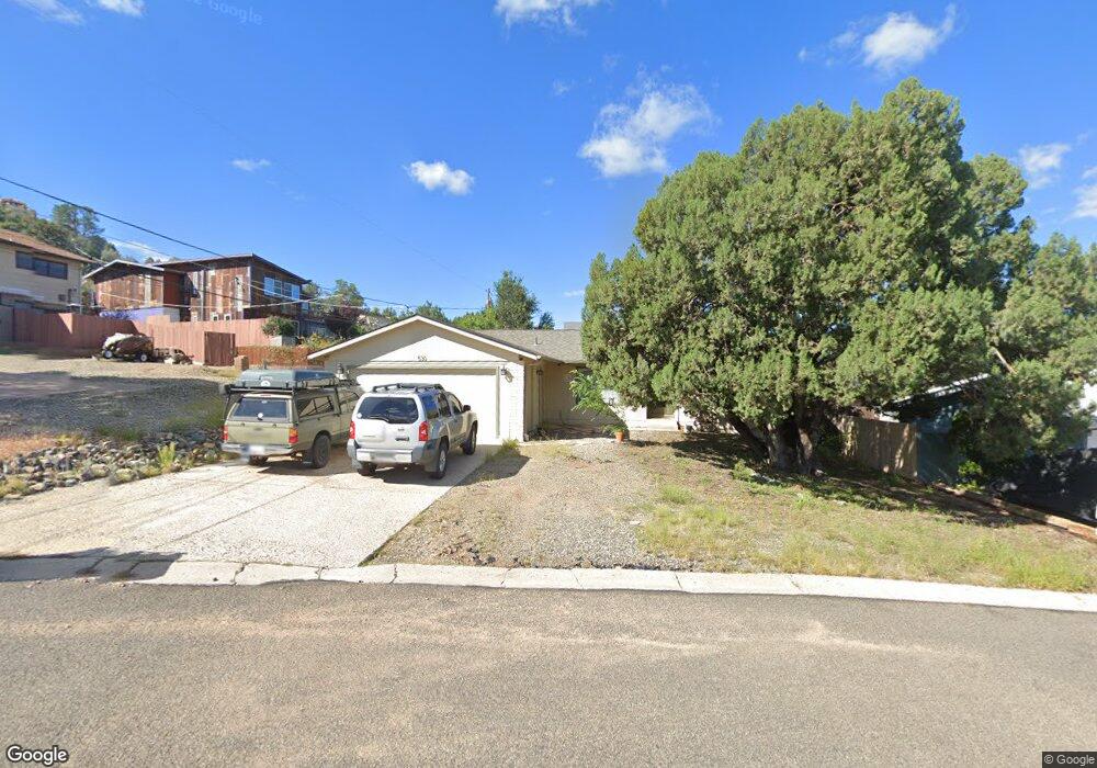
530 S Skyview Dr Prescott, AZ 86303
Estimated Value: $418,735 - $480,000
3
Beds
2
Baths
1,442
Sq Ft
$309/Sq Ft
Est. Value
About This Home
This home is located at 530 S Skyview Dr, Prescott, AZ 86303 and is currently estimated at $445,684, approximately $309 per square foot. 530 S Skyview Dr is a home located in Yavapai County with nearby schools including Taylor Hicks School, Granite Mountain Middle School, and Prescott Mile High Middle School.
Ownership History
Date
Name
Owned For
Owner Type
Purchase Details
Closed on
Feb 15, 2011
Sold by
Federal National Mortgage Association
Bought by
Reyes Adam N
Current Estimated Value
Home Financials for this Owner
Home Financials are based on the most recent Mortgage that was taken out on this home.
Original Mortgage
$102,800
Outstanding Balance
$70,210
Interest Rate
4.74%
Mortgage Type
New Conventional
Estimated Equity
$375,474
Purchase Details
Closed on
Apr 22, 2008
Sold by
Burk Stephen D and Burk Sue A
Bought by
Huffaker Teresa M
Home Financials for this Owner
Home Financials are based on the most recent Mortgage that was taken out on this home.
Original Mortgage
$166,250
Interest Rate
5.88%
Mortgage Type
New Conventional
Purchase Details
Closed on
Apr 21, 2003
Sold by
Morgan Daniel L and Morgan Carol Sue
Bought by
Burk Stephen D and Burk Sue A
Home Financials for this Owner
Home Financials are based on the most recent Mortgage that was taken out on this home.
Original Mortgage
$119,900
Interest Rate
5.71%
Mortgage Type
New Conventional
Purchase Details
Closed on
Jun 21, 2002
Sold by
Unkenholz Richard A and Unkenholz Patricia N
Bought by
Unkenholz Richard A and Unkenholz Patricia N
Purchase Details
Closed on
May 2, 2001
Sold by
Norwest Bank Minnesota National Assn
Bought by
Morgan Daniel L and Morgan Carole Sue
Home Financials for this Owner
Home Financials are based on the most recent Mortgage that was taken out on this home.
Original Mortgage
$90,400
Interest Rate
6.89%
Mortgage Type
New Conventional
Purchase Details
Closed on
Nov 5, 1998
Sold by
Hafner Dale B and Hafner Ruth A
Bought by
Grierson Thomas J and Grierson Deborah D
Home Financials for this Owner
Home Financials are based on the most recent Mortgage that was taken out on this home.
Original Mortgage
$25,200
Interest Rate
6.84%
Mortgage Type
Seller Take Back
Purchase Details
Closed on
May 21, 1996
Sold by
Swartz Mildred V
Bought by
Hafner Dale B and Hafner Ruth A
Create a Home Valuation Report for This Property
The Home Valuation Report is an in-depth analysis detailing your home's value as well as a comparison with similar homes in the area
Home Values in the Area
Average Home Value in this Area
Purchase History
| Date | Buyer | Sale Price | Title Company |
|---|---|---|---|
| Reyes Adam N | $128,500 | Yavapai Title Agency Inc | |
| Huffaker Teresa M | $175,000 | Yavapai Title Agency | |
| Burk Stephen D | $149,900 | Capital Title Agency | |
| Unkenholz Richard A | -- | -- | |
| Morgan Daniel L | $113,000 | First American Title | |
| Grierson Thomas J | $126,000 | First American Title | |
| Hafner Dale B | $107,000 | First American Title |
Source: Public Records
Mortgage History
| Date | Status | Borrower | Loan Amount |
|---|---|---|---|
| Open | Reyes Adam N | $102,800 | |
| Previous Owner | Huffaker Teresa M | $166,250 | |
| Previous Owner | Burk Stephen D | $119,900 | |
| Previous Owner | Morgan Daniel L | $90,400 | |
| Previous Owner | Grierson Thomas J | $25,200 | |
| Closed | Grierson Thomas J | $100,800 | |
| Closed | Morgan Daniel L | $11,300 |
Source: Public Records
Tax History Compared to Growth
Tax History
| Year | Tax Paid | Tax Assessment Tax Assessment Total Assessment is a certain percentage of the fair market value that is determined by local assessors to be the total taxable value of land and additions on the property. | Land | Improvement |
|---|---|---|---|---|
| 2026 | $1,484 | $32,643 | -- | -- |
| 2024 | $1,432 | $32,425 | -- | -- |
| 2023 | $1,432 | $26,890 | $0 | $0 |
| 2022 | $1,384 | $22,849 | $6,327 | $16,522 |
| 2021 | $1,423 | $22,408 | $5,520 | $16,888 |
| 2020 | $1,406 | $0 | $0 | $0 |
| 2019 | $1,379 | $0 | $0 | $0 |
| 2018 | $1,315 | $0 | $0 | $0 |
| 2017 | $1,258 | $0 | $0 | $0 |
| 2016 | $1,232 | $0 | $0 | $0 |
| 2015 | $1,187 | $0 | $0 | $0 |
| 2014 | $1,155 | $0 | $0 | $0 |
Source: Public Records
Map
Nearby Homes
- 1284 McDonald Dr
- 1203 McDonald Dr
- 1228 McDonald Dr Unit 1/2
- 1228 McDonald Dr Unit 52
- 1228 McDonald Dr
- 432 Newport Dr Unit 86
- 395 Newport Dr
- 450 Broadview Dr
- 000 S Canyon Dr
- 386 Newport Dr
- 1300 Newport Ridge Dr Unit 116
- 1300 Newport Ridge Dr
- 500 Broadview Dr
- 631 S Canyon Dr E
- 277 Jacob Ln
- 1238 Jordin Dr Unit 60
- 300 Newport Dr
- 550 Eastwood Place
- 1232 Jordin Dr
- 630 S Hill Dr
- 556 S Skyview Dr
- 562 S Skyview Dr
- 507 S Skyview Cir
- 506 S Skyview Dr
- 570 S Skyview Dr
- 505 S Skyview Cir
- 572 S Skyview Dr
- 531 S Skyview Dr
- 519 S Skyview Dr
- 0 S Bradshaw Dr Unit PAR897809
- 0 S Bradshaw Dr Unit PAR370873
- 0 S Bradshaw Dr Unit PAR374307
- 0 S Bradshaw Dr Unit 991847
- 0 S Bradshaw Dr Unit 993426
- 0 S Bradshaw Dr Unit 981764
- 0 S Bradshaw Dr Unit 981766
- 0 S Bradshaw Dr Unit 981767
- 0 S Bradshaw Dr Unit 5355447
- 511 S Skyview Dr
- 501 S Bradshaw Dr