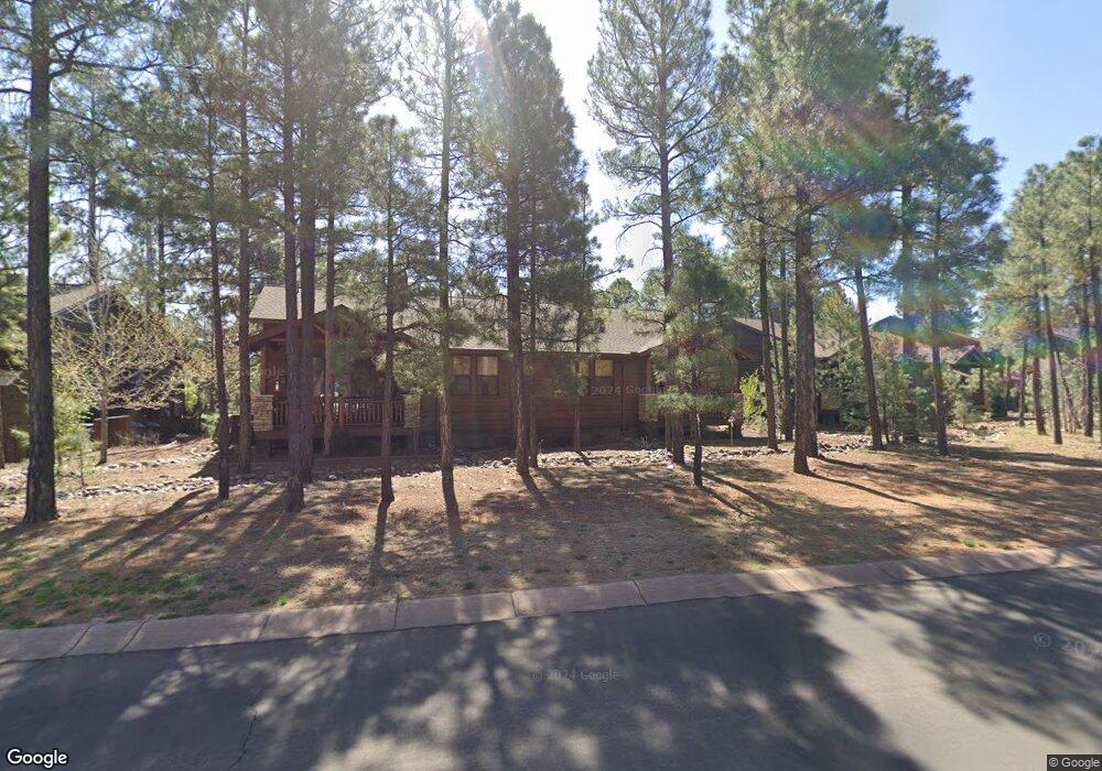
530 Spirea Ln Show Low, AZ 85901
Estimated Value: $393,000 - $419,855
2
Beds
2
Baths
1,212
Sq Ft
$332/Sq Ft
Est. Value
About This Home
This home is located at 530 Spirea Ln, Show Low, AZ 85901 and is currently estimated at $402,464, approximately $332 per square foot. 530 Spirea Ln is a home located in Navajo County with nearby schools including Show Low High School, Nikolaus Homestead Elementary School, and Show Low Junior High School.
Ownership History
Date
Name
Owned For
Owner Type
Purchase Details
Closed on
Sep 13, 2020
Sold by
Junker Carl F and Carl F Junker Trust
Bought by
Noyes Mark and Noyes Lauren
Current Estimated Value
Purchase Details
Closed on
Dec 21, 2006
Sold by
The Golf Villas At Show Low
Bought by
Junker Carl F and Junker Deborah H
Home Financials for this Owner
Home Financials are based on the most recent Mortgage that was taken out on this home.
Original Mortgage
$190,000
Interest Rate
6.12%
Mortgage Type
New Conventional
Create a Home Valuation Report for This Property
The Home Valuation Report is an in-depth analysis detailing your home's value as well as a comparison with similar homes in the area
Home Values in the Area
Average Home Value in this Area
Purchase History
| Date | Buyer | Sale Price | Title Company |
|---|---|---|---|
| Noyes Mark | $265,000 | Pioneer Title Agency | |
| Junker Carl F | $348,549 | Transnation Title |
Source: Public Records
Mortgage History
| Date | Status | Borrower | Loan Amount |
|---|---|---|---|
| Previous Owner | Junker Carl F | $190,000 |
Source: Public Records
Tax History Compared to Growth
Tax History
| Year | Tax Paid | Tax Assessment Tax Assessment Total Assessment is a certain percentage of the fair market value that is determined by local assessors to be the total taxable value of land and additions on the property. | Land | Improvement |
|---|---|---|---|---|
| 2026 | $1,935 | -- | -- | -- |
| 2025 | $1,905 | $29,221 | $1,800 | $27,421 |
| 2024 | $1,803 | $29,885 | $1,840 | $28,045 |
| 2023 | $1,905 | $19,001 | $1,600 | $17,401 |
| 2022 | $1,803 | $0 | $0 | $0 |
| 2021 | $1,872 | $0 | $0 | $0 |
| 2020 | $1,759 | $0 | $0 | $0 |
| 2019 | $1,755 | $0 | $0 | $0 |
| 2018 | $1,674 | $0 | $0 | $0 |
| 2017 | $1,546 | $0 | $0 | $0 |
| 2016 | $1,523 | $0 | $0 | $0 |
| 2015 | $1,430 | $12,006 | $1,500 | $10,506 |
Source: Public Records
Map
Nearby Homes
- 3331 W Tobasa Ln
- 831 S Rockcress Ln
- 490 S Rockcress Ln
- 3360 W Mariposa Ln
- 3321 W Mariposa Ln
- 630 S Rockcress Ln
- 811 S Rockcress Ln
- 660 S 30th Ave
- 3130 W Young
- 401 S 31st Dr
- 3519 W Torreon Ct
- 3030 W Young
- 991 S Spirea Ln
- 3020 W Lodgepole Ln
- 3200 W Black Oak Loop
- 3240 W Black Oak Loop
- 3600 W Torreon Ct
- 2770 W Whipple St
- 640 S 27th Ave
- 2681 W Reidhead
- 540 Spirea Ln
- 520 S Spirea Ln
- 520 Spirea Ln
- 510 Spirea Ln
- 560 Spirea Ln
- 570 Spirea Ln
- 500 Spirea Ln
- 531 Spirea Ln
- 490 Spirea Ln
- 580 Spirea Ln
- 541 Spirea Ln
- 3310 W Tobasa Ln
- 3310 W Tobasa Ln Unit 33
- 561 Spirea Ln
- 590 Spirea Ln
- 501 Spirea Ln Unit 54
- 501 Spirea Ln
- 571 Spirea Ln
- 491 Spirea Ln
- 600 Spirea Ln