Estimated Value: $575,000 - $699,000
3
Beds
3
Baths
2,058
Sq Ft
$308/Sq Ft
Est. Value
About This Home
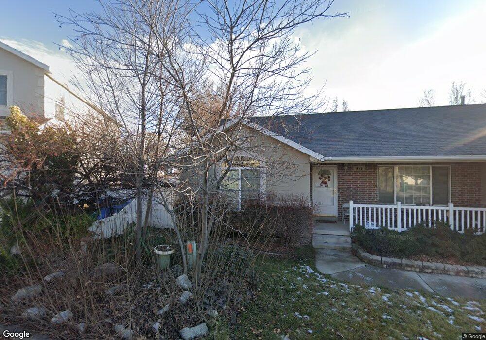
This home is located at 530 W 1200 N, Lehi, UT 84043 and is currently estimated at $633,134, approximately $307 per square foot. 530 W 1200 N is a home located in Utah County with nearby schools including Lehi Elementary School, Lehi Junior High School, and Lehi High School.
Ownership History
Date
Name
Owned For
Owner Type
Purchase Details
Closed on
Jul 12, 2021
Sold by
Barnes Alva and Barnes Patsy
Bought by
Barnes Alva and Barnes Patsy
Current Estimated Value
Purchase Details
Closed on
May 14, 1999
Sold by
The Monroe Gallier Family Trust and Gallier Monroe G
Bought by
Gallier Glenn R and Gallier Dorene D
Purchase Details
Closed on
Mar 18, 1998
Sold by
Gallier Monroe G and Gallier Mignon A
Bought by
Gallier Glenn R and Gallier Dorene D
Create a Home Valuation Report for This Property
The Home Valuation Report is an in-depth analysis detailing your home's value as well as a comparison with similar homes in the area
Home Values in the Area
Average Home Value in this Area
Purchase History
| Date | Buyer | Sale Price | Title Company |
|---|---|---|---|
| Barnes Alva | -- | None Available | |
| Gallier Glenn R | -- | -- | |
| Gallier Glenn R | -- | -- |
Source: Public Records
Tax History Compared to Growth
Tax History
| Year | Tax Paid | Tax Assessment Tax Assessment Total Assessment is a certain percentage of the fair market value that is determined by local assessors to be the total taxable value of land and additions on the property. | Land | Improvement |
|---|---|---|---|---|
| 2025 | $2,601 | $321,860 | $255,800 | $329,400 |
| 2024 | $2,601 | $304,370 | $0 | $0 |
| 2023 | $2,452 | $311,575 | $0 | $0 |
| 2022 | $2,246 | $276,650 | $0 | $0 |
| 2021 | $1,995 | $371,600 | $126,100 | $245,500 |
| 2020 | $1,881 | $346,200 | $116,800 | $229,400 |
| 2019 | $1,653 | $316,300 | $116,800 | $199,500 |
| 2018 | $1,643 | $297,200 | $106,800 | $190,400 |
| 2017 | $1,590 | $152,900 | $0 | $0 |
| 2016 | $1,590 | $141,900 | $0 | $0 |
| 2015 | $1,620 | $137,225 | $0 | $0 |
| 2014 | $1,519 | $127,930 | $0 | $0 |
Source: Public Records
Map
Nearby Homes
- 1301 N 900 W Unit 12
- 902 W 1500 N
- 1150 N 200 W Unit 6
- 996 N 200 W
- 1817 W Bad Rock Cir
- 155 W State St Unit TRLR 3
- 443 W 820 N
- 1094 W 1425 N
- 1755 N 250 W
- 68 W State St
- 1329 N 100 E Unit 21
- 1610 N 1125 W
- 1295 N 190 E
- 7 E State St
- 1011 W Mountain Way Unit 316
- 578 N Woods Dr
- 1132 Titan Dr
- 1332 W 1500 N
- 1032 Titan Dr
- 1272 W 1800 N