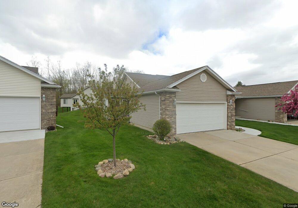
530 White Pine Blvd Unit 22 Lansing, MI 48917
Estimated Value: $298,000 - $329,000
2
Beds
2
Baths
1,270
Sq Ft
$245/Sq Ft
Est. Value
About This Home
This home is located at 530 White Pine Blvd Unit 22, Lansing, MI 48917 and is currently estimated at $311,244, approximately $245 per square foot. 530 White Pine Blvd Unit 22 is a home located in Eaton County with nearby schools including Delta Center Elementary School, Leon W. Hayes Middle School, and Grand Ledge High School.
Ownership History
Date
Name
Owned For
Owner Type
Purchase Details
Closed on
Apr 18, 2018
Sold by
Marine Roberta L
Bought by
Marine Cheryl
Current Estimated Value
Purchase Details
Closed on
Jun 7, 2010
Sold by
Auto Owners Insurance Company
Bought by
Marine Roberta L
Purchase Details
Closed on
Aug 21, 2009
Sold by
Porter Luke and Porter Kari
Bought by
Auto Owners Insurance Company
Purchase Details
Closed on
Nov 21, 2008
Sold by
Long James P and Long Ann Elizabeth
Bought by
Porter Luke and Porter Kari
Home Financials for this Owner
Home Financials are based on the most recent Mortgage that was taken out on this home.
Original Mortgage
$133,241
Interest Rate
6.48%
Mortgage Type
FHA
Purchase Details
Closed on
Jun 6, 2006
Sold by
Long Rose Marie V and Long Rose Marie
Bought by
Long Rose Marie and Rose Marie V Long Trust
Create a Home Valuation Report for This Property
The Home Valuation Report is an in-depth analysis detailing your home's value as well as a comparison with similar homes in the area
Home Values in the Area
Average Home Value in this Area
Purchase History
| Date | Buyer | Sale Price | Title Company |
|---|---|---|---|
| Marine Cheryl | -- | None Available | |
| Marine Roberta L | $130,000 | Stewart Title Agency | |
| Auto Owners Insurance Company | $132,500 | Stewart Title | |
| Porter Luke | $135,000 | Tri County Title Agency Llc | |
| Long Rose Marie | -- | None Available |
Source: Public Records
Mortgage History
| Date | Status | Borrower | Loan Amount |
|---|---|---|---|
| Previous Owner | Porter Luke | $133,241 |
Source: Public Records
Tax History Compared to Growth
Tax History
| Year | Tax Paid | Tax Assessment Tax Assessment Total Assessment is a certain percentage of the fair market value that is determined by local assessors to be the total taxable value of land and additions on the property. | Land | Improvement |
|---|---|---|---|---|
| 2025 | $3,639 | $131,900 | $0 | $0 |
| 2024 | $1,831 | $117,200 | $0 | $0 |
| 2023 | $1,706 | $103,100 | $0 | $0 |
| 2022 | $3,072 | $92,600 | $0 | $0 |
| 2021 | $2,935 | $90,000 | $0 | $0 |
| 2020 | $2,892 | $85,800 | $0 | $0 |
| 2019 | $2,850 | $80,008 | $0 | $0 |
| 2018 | $2,671 | $79,500 | $0 | $0 |
| 2017 | $2,611 | $78,400 | $0 | $0 |
| 2016 | -- | $80,000 | $0 | $0 |
| 2015 | -- | $74,400 | $0 | $0 |
| 2014 | -- | $69,900 | $0 | $0 |
| 2013 | -- | $70,400 | $0 | $0 |
Source: Public Records
Map
Nearby Homes
- 7635 Blue Spruce Ln
- 611 S Canal Rd
- 7520 Williamsburg Rd
- 7327 Golf Gate Dr
- 7304 Player's Club Dr
- 110 N Canal Rd
- 229 Williamsburg Rd
- Lot 30 Doe Pass
- Lot 2 Laurelwood
- Lot 61 Doe Pass
- Lot 47 Doe Pass
- Lot 60 Doe Pass
- 7115 Ravenna Trail Unit 74
- 7119 Ravenna Trail Unit 73
- Lot 53 Doe Pass
- 1010 Firwood St
- 8522 Ember Glen Pass
- 11195 Prestwick Dr
- 7671 Royal Cove Dr
- 1205 Woodmeadow Unit 201
- 528 White Pine Blvd Unit 21
- 536 White Pine Blvd Unit 23
- 538 White Pine Blvd Unit 24
- 538 White Pine Blvd
- 531 White Pine Blvd
- 531 White Pine Blvd Unit 19
- 514 White Pine Blvd Unit 5
- 525 White Pine Blvd Unit 20
- 533 White Pine Blvd Unit 18
- 512 White Pine Blvd Unit 6
- 604 White Pine Blvd
- 604 White Pine Blvd Unit 13
- 515 White Pine Blvd Unit 3
- 515 White Pine Blvd
- 513 White Pine Blvd
- 7616 Sugar Maple Cir
- 517 White Pine Blvd
- 606 White Pine Blvd
- 523 White Pine Blvd
- 523 White Pine Blvd Unit 1