Estimated Value: $277,887 - $309,000
3
Beds
2
Baths
1,266
Sq Ft
$232/Sq Ft
Est. Value
About This Home
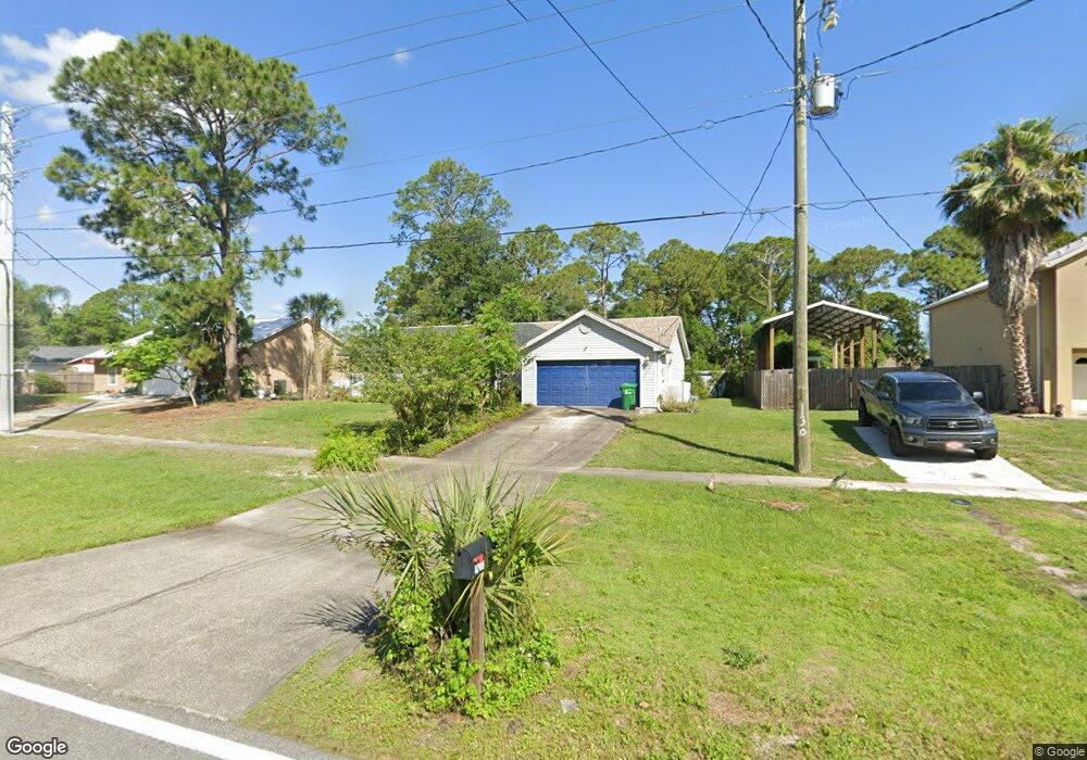
This home is located at 5300 Curtis Blvd, Cocoa, FL 32927 and is currently estimated at $294,222, approximately $232 per square foot. 5300 Curtis Blvd is a home located in Brevard County with nearby schools including Enterprise Elementary School, Space Coast Junior/Senior High School, and Sculptor Charter School.
Ownership History
Date
Name
Owned For
Owner Type
Purchase Details
Closed on
May 4, 2006
Sold by
Adamson Kim M and Adamson Mary E
Bought by
Arnold Patricia L and Heffernan James Michael
Current Estimated Value
Home Financials for this Owner
Home Financials are based on the most recent Mortgage that was taken out on this home.
Original Mortgage
$194,000
Outstanding Balance
$124,506
Interest Rate
8.37%
Estimated Equity
$169,716
Purchase Details
Closed on
Aug 29, 2003
Sold by
Munch Oscar Harry and Munch Melissa M
Bought by
Adamson Kim M and Adamson Mary E
Home Financials for this Owner
Home Financials are based on the most recent Mortgage that was taken out on this home.
Original Mortgage
$110,210
Interest Rate
5.94%
Create a Home Valuation Report for This Property
The Home Valuation Report is an in-depth analysis detailing your home's value as well as a comparison with similar homes in the area
Home Values in the Area
Average Home Value in this Area
Purchase History
| Date | Buyer | Sale Price | Title Company |
|---|---|---|---|
| Arnold Patricia L | $194,000 | Liberty Title | |
| Adamson Kim M | $107,000 | Security First Title Partner |
Source: Public Records
Mortgage History
| Date | Status | Borrower | Loan Amount |
|---|---|---|---|
| Open | Arnold Patricia L | $194,000 | |
| Previous Owner | Adamson Kim M | $110,210 |
Source: Public Records
Tax History Compared to Growth
Tax History
| Year | Tax Paid | Tax Assessment Tax Assessment Total Assessment is a certain percentage of the fair market value that is determined by local assessors to be the total taxable value of land and additions on the property. | Land | Improvement |
|---|---|---|---|---|
| 2025 | $1,034 | $76,350 | -- | -- |
| 2024 | $1,014 | $74,200 | -- | -- |
| 2023 | $1,014 | $72,040 | $0 | $0 |
| 2022 | $957 | $69,950 | $0 | $0 |
| 2021 | $959 | $67,920 | $0 | $0 |
| 2020 | $914 | $66,990 | $0 | $0 |
| 2019 | $861 | $65,490 | $0 | $0 |
| 2018 | $862 | $64,270 | $0 | $0 |
| 2017 | $863 | $62,950 | $0 | $0 |
| 2016 | $871 | $61,660 | $18,000 | $43,660 |
| 2015 | $877 | $61,240 | $15,000 | $46,240 |
| 2014 | $882 | $60,760 | $11,000 | $49,760 |
Source: Public Records
Map
Nearby Homes
- 6615 Dock Ave
- 6760 Cairo Rd
- 00 Unknown
- 6581 Bancroft Ave
- 6775 Buxton Ave
- 5575 Curtis Blvd
- 4650 N Highway 1 Hwy
- 6620 Grissom Pkwy
- 0000 Grissom Pkwy
- 7065 Hundred Acre Dr
- 5220 Holden Rd
- 5715 Fairbridge St
- 6375 Cable Ave
- 5275 Holden Rd
- 6735 Grissom Pkwy
- 5215 Holden Rd
- 5130 Carter St
- 5155 Mayflower St
- 5460 Holden Rd
- 5446 Jamaica Rd
- 5330 Curtis Blvd Unit 7
- 5290 Curtis Blvd
- 5360 Curtis Blvd
- 6617 Cecil Rd
- 6633 Cecil Rd
- 6609 Cecil Rd
- 5315 Curtis Blvd
- 5305 Curtis Blvd
- 6565 Elliott Ave
- 6555 Elliot Ave
- 6555 Elliott Ave
- 6510 Ember Ave
- 6641 Cecil Rd
- 6575 Elliott Ave
- 5270 Curtis Blvd
- 5191 Arlington Rd
- 6620 Cecil Rd
- 5375 Curtis Blvd
- 5185 Arlington Rd
- 5260 Curtis Blvd