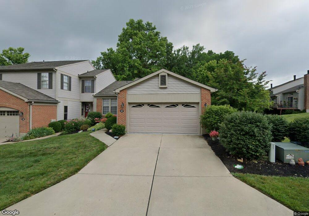
5300 Londonderry Dr Cincinnati, OH 45241
Highpoint NeighborhoodEstimated Value: $298,000 - $393,000
3
Beds
3
Baths
1,974
Sq Ft
$168/Sq Ft
Est. Value
About This Home
This home is located at 5300 Londonderry Dr, Cincinnati, OH 45241 and is currently estimated at $330,667, approximately $167 per square foot. 5300 Londonderry Dr is a home located in Hamilton County with nearby schools including Stewart Elementary School, Princeton Community Middle School, and Princeton High School.
Ownership History
Date
Name
Owned For
Owner Type
Purchase Details
Closed on
Aug 5, 2021
Sold by
Winstel John and Winstel Mary
Bought by
Luehrmann Josephine
Current Estimated Value
Purchase Details
Closed on
Mar 25, 2021
Sold by
Williams Beth A and Williams Anthony Michael
Bought by
Winstel John and Winstel Mary
Purchase Details
Closed on
Nov 26, 2013
Sold by
Leber Donald E and Leber Barbara A
Bought by
Leber Donald E and Leber Barbara A
Purchase Details
Closed on
Nov 22, 1994
Sold by
Leber Donald E and Leber Barbara A
Bought by
Leber Donald E and Leber Barbara A
Purchase Details
Closed on
Jun 21, 1994
Sold by
Patton Sandra Y
Bought by
Leber Donald E and Leber Barbara A
Home Financials for this Owner
Home Financials are based on the most recent Mortgage that was taken out on this home.
Original Mortgage
$57,000
Interest Rate
8.66%
Create a Home Valuation Report for This Property
The Home Valuation Report is an in-depth analysis detailing your home's value as well as a comparison with similar homes in the area
Home Values in the Area
Average Home Value in this Area
Purchase History
| Date | Buyer | Sale Price | Title Company |
|---|---|---|---|
| Luehrmann Josephine | -- | None Available | |
| Winstel John | $280,000 | None Available | |
| Leber Donald E | -- | Attorney | |
| Leber Barbara A | -- | Attorney | |
| Leber Donald E | -- | Attorney | |
| Leber Donald E | -- | -- | |
| Leber Donald E | -- | -- | |
| Leber Donald E | -- | -- |
Source: Public Records
Mortgage History
| Date | Status | Borrower | Loan Amount |
|---|---|---|---|
| Previous Owner | Leber Donald E | $57,000 |
Source: Public Records
Tax History Compared to Growth
Tax History
| Year | Tax Paid | Tax Assessment Tax Assessment Total Assessment is a certain percentage of the fair market value that is determined by local assessors to be the total taxable value of land and additions on the property. | Land | Improvement |
|---|---|---|---|---|
| 2024 | $3,562 | $98,000 | $10,500 | $87,500 |
| 2023 | $3,600 | $98,000 | $10,500 | $87,500 |
| 2022 | $3,980 | $87,668 | $7,980 | $79,688 |
| 2021 | $4,303 | $87,668 | $7,980 | $79,688 |
| 2020 | $3,916 | $87,668 | $7,980 | $79,688 |
| 2019 | $3,674 | $76,902 | $7,000 | $69,902 |
| 2018 | $3,446 | $76,902 | $7,000 | $69,902 |
| 2017 | $3,220 | $76,902 | $7,000 | $69,902 |
| 2016 | $2,745 | $66,500 | $7,000 | $59,500 |
| 2015 | $2,779 | $66,500 | $7,000 | $59,500 |
| 2014 | $2,789 | $66,500 | $7,000 | $59,500 |
| 2013 | $2,724 | $66,500 | $7,000 | $59,500 |
Source: Public Records
Map
Nearby Homes
- 12195 Thames Place
- 11960 Big Ben Ct
- 5725 Sovereign Dr
- 12160 Village Woods Dr
- 5026 Lord Alfred Ct
- 10117 Bennington Dr
- 5600 E Kemper Rd
- 7119 Windwood Dr
- 6520 Lewis Clark Trail
- 6424 Camp Superior Dr
- 9843 Tall Timber Dr
- 7122 Walnutwood Dr
- 9712 Lupine Dr
- 7879 Hickory Hill Ln
- 3875 Hauck Rd
- 7327 Dimmick Rd
- 9647 Friar Tuck Dr
- 9616 Holly Leaf Cir
- 11220 Foremark Dr
- 4420 Cornell Rd
- 5284 Londonderry Dr
- 5276 Londonderry Dr
- 5268 Londonderry Dr
- 12035 Thames Place
- 5260 Londonderry Dr
- 12045 Thames Place
- 5275 Londonderry Dr
- 12055 Thames Place
- 5267 Londonderry Dr
- 12065 Thames Place
- 5259 Londonderry Dr
- 12075 Thames Place
- 5252 Londonderry Dr
- 12085 Thames Place
- 5243 Londonderry Dr
- 5244 Londonderry Dr
- 5260 Barony Place
- 5268 Barony Place
- 5235 Londonderry Dr
- 5276 Barony Place