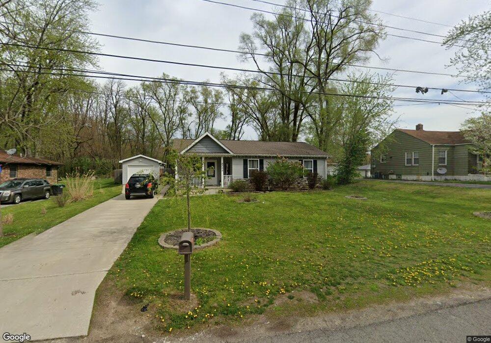
5300 Mulberry Ave Portage, IN 46368
Estimated Value: $211,000 - $250,000
3
Beds
1
Bath
1,116
Sq Ft
$207/Sq Ft
Est. Value
About This Home
This home is located at 5300 Mulberry Ave, Portage, IN 46368 and is currently estimated at $231,363, approximately $207 per square foot. 5300 Mulberry Ave is a home with nearby schools including Wallace Aylesworth Elementary, William Fegely Middle School, and Portage High School.
Ownership History
Date
Name
Owned For
Owner Type
Purchase Details
Closed on
Nov 28, 2016
Sold by
Humanity Of Porter County Inc
Bought by
Delk William and Bartman Jennifer
Current Estimated Value
Home Financials for this Owner
Home Financials are based on the most recent Mortgage that was taken out on this home.
Original Mortgage
$95,772
Outstanding Balance
$46,096
Interest Rate
3.52%
Mortgage Type
Stand Alone Second
Estimated Equity
$185,267
Purchase Details
Closed on
Sep 15, 2015
Sold by
Hewitt C Edward C and Hewitt Patricia L
Bought by
Habitat For Humanity Of Porter Cnty Inc
Create a Home Valuation Report for This Property
The Home Valuation Report is an in-depth analysis detailing your home's value as well as a comparison with similar homes in the area
Home Values in the Area
Average Home Value in this Area
Purchase History
| Date | Buyer | Sale Price | Title Company |
|---|---|---|---|
| Delk William | -- | Chicago Title Insurance Co | |
| Habitat For Humanity Of Porter Cnty Inc | -- | None Available |
Source: Public Records
Mortgage History
| Date | Status | Borrower | Loan Amount |
|---|---|---|---|
| Open | Delk William | $95,772 |
Source: Public Records
Tax History Compared to Growth
Tax History
| Year | Tax Paid | Tax Assessment Tax Assessment Total Assessment is a certain percentage of the fair market value that is determined by local assessors to be the total taxable value of land and additions on the property. | Land | Improvement |
|---|---|---|---|---|
| 2024 | $2,283 | $220,300 | $43,200 | $177,100 |
| 2023 | $2,263 | $217,000 | $41,600 | $175,400 |
| 2022 | $2,030 | $199,800 | $41,600 | $158,200 |
| 2021 | $1,880 | $182,600 | $41,600 | $141,000 |
| 2020 | $1,714 | $170,100 | $39,400 | $130,700 |
| 2019 | $1,589 | $157,600 | $39,400 | $118,200 |
| 2018 | $1,576 | $154,100 | $39,400 | $114,700 |
| 2017 | $1,584 | $156,400 | $25,600 | $130,800 |
| 2016 | $296 | $14,800 | $14,800 | $0 |
| 2014 | $314 | $15,700 | $15,700 | $0 |
| 2013 | -- | $15,500 | $15,500 | $0 |
Source: Public Records
Map
Nearby Homes
- 5272 Concord Ave
- 5426 Mulberry Ave
- 5723 Independence Ave
- 2853 Belmont St
- 5193 Terry Ave
- 2954 Ardell St
- 5103 Sunrise Ave
- 2980 Elmwood St
- 5550 Morehouse Ct
- 5630 Mulberry Ave
- 5294 Lyndell Ave
- 5300 Lyndell Ave
- 2698 County Line Rd
- 3049 Debra St
- 3093 May St
- 4980 E 27th Ave
- 2957 County Line Rd
- 2565 Charles St
- 3109 Oakwood St
- 2167 Wells St
- 5294 Mulberry Ave
- 5308 Mulberry Ave
- 5292-94 Mulberry Ave
- 5292 Mulberry Ave
- 2754 Brown St
- 2738 Brown St
- 5284-86 Mulberry Ave
- 5284 Mulberry Ave Unit 86
- 5293 Mulberry Ave
- 5305 Concord Ave
- 2766 Brown St Unit 68
- 2732 Brown St
- 5301 Mulberry Ave
- 5285 Mulberry Ave
- 5276 Mulberry Ave
- 2770 Brown St
- 2755 Brown St
- 5277 Mulberry Ave Unit 79
- 5327 Lexington Ave
- 5296 Royal Ave