5301 Burning Tree Rd Kalamazoo, MI 49009
Estimated Value: $429,393 - $464,000
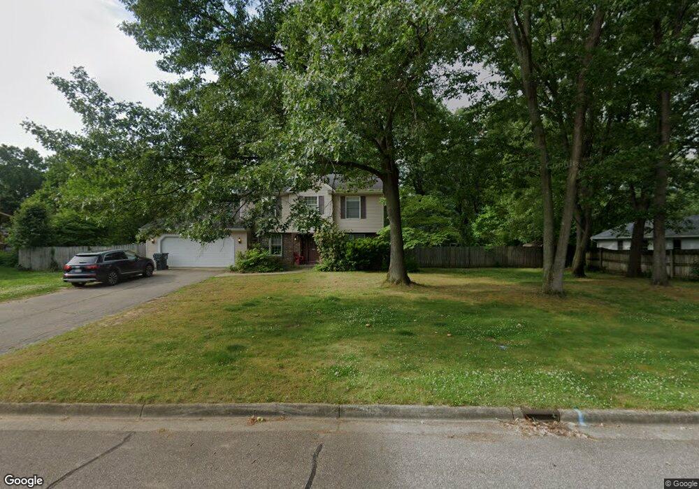
About This Home
This home is located at 5301 Burning Tree Rd, Kalamazoo, MI 49009 and is currently estimated at $445,848, approximately $190 per square foot. 5301 Burning Tree Rd is a home located in Kalamazoo County with nearby schools including 12th Street Elementary School, Portage West Middle School, and Portage Central High School.
Ownership History
We collect this data history from publicly available records. To have your information removed, we recommend requesting removal directly through your county’s website.
Purchase Details
Purchase Details
Home Financials for this Owner
Home Financials are based on the most recent Mortgage that was taken out on this home.Purchase Details
Home Values in the Area
Average Home Value in this Area
Purchase History
We collect this data history from publicly available records. To have your information removed, we recommend requesting removal directly through your county’s website.
| Date | Buyer | Sale Price | Title Company |
|---|---|---|---|
| -- | None Available | ||
| $240,000 | Lighthouse Title | ||
| $176,529 | None Available |
Mortgage History
We collect this data history from publicly available records. To have your information removed, we recommend requesting removal directly through your county’s website.
| Date | Status | Borrower | Loan Amount |
|---|---|---|---|
| Previous Owner | $192,000 |
Tax History
We collect this data history from publicly available records. To have your information removed, we recommend requesting removal directly through your county’s website.
| Year | Tax Paid | Tax Assessment Tax Assessment Total Assessment is a certain percentage of the fair market value that is determined by local assessors to be the total taxable value of land and additions on the property. | Land | Improvement |
|---|---|---|---|---|
| 2025 | $1,452 | $185,200 | $0 | $0 |
| 2024 | $1,410 | $173,500 | $0 | $0 |
| 2023 | $1,345 | $157,500 | $0 | $0 |
| 2022 | $4,405 | $141,600 | $0 | $0 |
| 2021 | $4,280 | $132,900 | $0 | $0 |
| 2020 | $4,179 | $130,200 | $0 | $0 |
| 2019 | $3,823 | $125,500 | $0 | $0 |
| 2018 | $2,354 | $126,100 | $0 | $0 |
| 2017 | -- | $125,700 | $0 | $0 |
| 2016 | -- | $121,200 | $0 | $0 |
| 2015 | -- | $105,000 | $13,200 | $91,800 |
| 2014 | -- | $105,000 | $0 | $0 |
Map
- 7702 Hunters Ridge Dr
- 7611 Thrasher Ln
- 5390 Saddle Club Dr
- 5434 Saddle Club Dr
- 5141 Lewsinda Ave
- 5680 Attleberry Ave
- 7942 S 12th St
- 5283 W Q Ave
- 5850 Dunwoody Ct
- 6787 Tiger Lily Dr Unit 55
- 6035 S 12th St
- 5978 Boxthorn Trail
- 6737 Annandale Dr
- 5304 Whippoorwill Dr
- 6675 Cypress Bay Dr Unit 86
- 5533 S Red Pine Cir
- 7704 S 10th St
- 7082 S 10th St
- 5420 Woodrush Ave Unit 39
- 5380 Brinson Ln
- 5317 Burning Tree Rd
- 5304 Stoney Brook Rd
- 5285 Burning Tree Rd
- 5296 Stoney Brook Rd
- 5330 Stoney Brook Rd
- 5290 Burning Tree Rd
- 5326 Burning Tree Rd
- 5258 Stoney Brook Rd
- 5353 Burning Tree Rd
- 5348 Burning Tree Rd
- 7289 Hunters Ridge Dr
- 5268 Burning Tree Rd
- 5358 Stoney Brook Rd
- 5287 Stoney Brook Rd
- 5311 Heathrow Ave
- 5275 Heathrow Ave
- 7538 Hunters Ridge Dr
- 5349 Stoney Brook Rd
- 5244 Burning Tree Rd
- 5273 Stoney Brook Rd
Ask me questions while you tour the home.