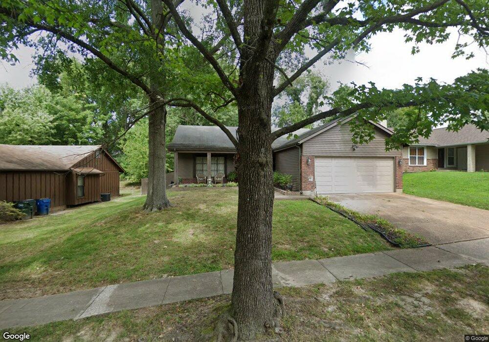
5301 Trailbend Dr Florissant, MO 63033
Estimated Value: $214,000 - $234,000
3
Beds
2
Baths
1,786
Sq Ft
$127/Sq Ft
Est. Value
About This Home
This home is located at 5301 Trailbend Dr, Florissant, MO 63033 and is currently estimated at $226,147, approximately $126 per square foot. 5301 Trailbend Dr is a home located in St. Louis County with nearby schools including Jamestown Elementary School, Central Middle School, and Hazelwood Central High School.
Ownership History
Date
Name
Owned For
Owner Type
Purchase Details
Closed on
Aug 23, 2007
Sold by
Davis Sandra and Pitts Paul Anthony
Bought by
Davis Sandra and Pitts Paul Anthony
Current Estimated Value
Home Financials for this Owner
Home Financials are based on the most recent Mortgage that was taken out on this home.
Original Mortgage
$129,000
Outstanding Balance
$81,926
Interest Rate
6.72%
Mortgage Type
Stand Alone Refi Refinance Of Original Loan
Estimated Equity
$144,221
Purchase Details
Closed on
Jul 7, 1998
Sold by
Townson Rodney F and Townson Aletha L
Bought by
Davis Sandra
Home Financials for this Owner
Home Financials are based on the most recent Mortgage that was taken out on this home.
Original Mortgage
$89,750
Interest Rate
10.62%
Create a Home Valuation Report for This Property
The Home Valuation Report is an in-depth analysis detailing your home's value as well as a comparison with similar homes in the area
Home Values in the Area
Average Home Value in this Area
Purchase History
| Date | Buyer | Sale Price | Title Company |
|---|---|---|---|
| Davis Sandra | -- | None Available | |
| Davis Sandra | -- | U S Title Guaranty Company I |
Source: Public Records
Mortgage History
| Date | Status | Borrower | Loan Amount |
|---|---|---|---|
| Open | Davis Sandra | $129,000 | |
| Closed | Davis Sandra | $89,750 | |
| Closed | Davis Sandra | $9,975 |
Source: Public Records
Tax History Compared to Growth
Tax History
| Year | Tax Paid | Tax Assessment Tax Assessment Total Assessment is a certain percentage of the fair market value that is determined by local assessors to be the total taxable value of land and additions on the property. | Land | Improvement |
|---|---|---|---|---|
| 2025 | $3,452 | $41,040 | $4,900 | $36,140 |
| 2024 | $3,452 | $38,280 | $4,900 | $33,380 |
| 2023 | $3,452 | $38,280 | $4,900 | $33,380 |
| 2022 | $3,090 | $29,300 | $5,720 | $23,580 |
| 2021 | $2,955 | $29,300 | $5,720 | $23,580 |
| 2020 | $2,793 | $26,090 | $3,760 | $22,330 |
| 2019 | $2,754 | $26,090 | $3,760 | $22,330 |
| 2018 | $2,587 | $22,630 | $2,600 | $20,030 |
| 2017 | $2,584 | $22,630 | $2,600 | $20,030 |
| 2016 | $1,735 | $14,920 | $2,950 | $11,970 |
| 2015 | $1,696 | $14,920 | $2,950 | $11,970 |
| 2014 | $1,497 | $13,090 | $3,270 | $9,820 |
Source: Public Records
Map
Nearby Homes
- 5226 Suntrail Dr
- 5239 Trailoaks Dr
- 5432 Trailbend Dr
- 5348 Trailoaks Dr
- 12582 Springtrail Dr
- 12292 Jerries Ln
- 12991 Mourville Ct
- 11951 Jerries Ln
- 12320 Missile Ln
- 12095 El Camara Dr
- 13001 Kinsley Heights Dr
- 12136 La Padera Ln
- 6320 Hadden Bay Dr
- 12111 La Padera Ln
- 6595 Dolphin Cir E Unit 131A
- 13032 Kinsley Heights Dr
- 6250 Pennyrich Ct
- 12705 Stubwood Dr
- 6587 Dolphin Cir E Unit 110B
- 12750 Needle Point Ct
- 5317 Trailbend Dr
- 5291 Trailbend Dr
- 5240 Springtrail Dr
- 5271 Trailbend Dr
- 5331 Trailbend Dr
- 5230 Springtrail Dr
- 5250 Springtrail Dr
- 5302 Trailbend Dr
- 5312 Trailbend Dr
- 5292 Trailbend Dr
- 5220 Springtrail Dr
- 5251 Trailbend Dr
- 5341 Trailbend Dr
- 5332 Trailbend Dr
- 5260 Springtrail Dr
- 5282 Trailbend Dr
- 5262 Trailbend Dr
- 5270 Springtrail Dr
- 5342 Trailbend Dr
- 5361 Trailbend Dr