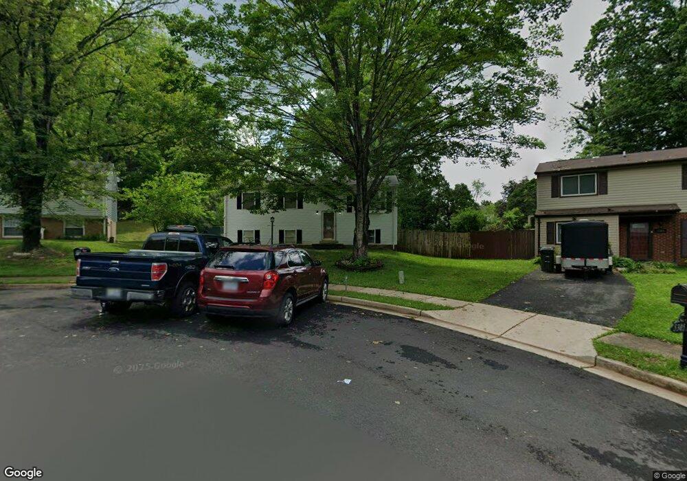
5303 Macwood Dr Woodbridge, VA 22193
Mapledale NeighborhoodEstimated Value: $477,000 - $489,000
4
Beds
2
Baths
960
Sq Ft
$502/Sq Ft
Est. Value
About This Home
This home is located at 5303 Macwood Dr, Woodbridge, VA 22193 and is currently estimated at $481,579, approximately $501 per square foot. 5303 Macwood Dr is a home located in Prince William County with nearby schools including Rosa Parks Elementary School, C.D. Hylton High School, and Stuart M. Beville Middle School.
Ownership History
Date
Name
Owned For
Owner Type
Purchase Details
Closed on
Jul 22, 2025
Sold by
Wood Clifford W
Bought by
Clifford Wayne Wood Jr Living Trust and Wood
Current Estimated Value
Purchase Details
Closed on
Jan 10, 2001
Sold by
Furr Floyd H
Bought by
Wood Clifford W
Home Financials for this Owner
Home Financials are based on the most recent Mortgage that was taken out on this home.
Original Mortgage
$125,400
Interest Rate
7.64%
Create a Home Valuation Report for This Property
The Home Valuation Report is an in-depth analysis detailing your home's value as well as a comparison with similar homes in the area
Home Values in the Area
Average Home Value in this Area
Purchase History
| Date | Buyer | Sale Price | Title Company |
|---|---|---|---|
| Clifford Wayne Wood Jr Living Trust | -- | None Listed On Document | |
| Wood Clifford W | $132,000 | -- |
Source: Public Records
Mortgage History
| Date | Status | Borrower | Loan Amount |
|---|---|---|---|
| Previous Owner | Wood Clifford W | $125,400 |
Source: Public Records
Tax History Compared to Growth
Tax History
| Year | Tax Paid | Tax Assessment Tax Assessment Total Assessment is a certain percentage of the fair market value that is determined by local assessors to be the total taxable value of land and additions on the property. | Land | Improvement |
|---|---|---|---|---|
| 2025 | $3,911 | $428,300 | $145,200 | $283,100 |
| 2024 | $3,911 | $393,300 | $135,200 | $258,100 |
| 2023 | $3,961 | $380,700 | $132,400 | $248,300 |
| 2022 | $4,140 | $363,500 | $122,600 | $240,900 |
| 2021 | $4,087 | $332,200 | $110,400 | $221,800 |
| 2020 | $4,486 | $289,400 | $104,200 | $185,200 |
| 2019 | $4,447 | $286,900 | $100,200 | $186,700 |
| 2018 | $3,249 | $269,100 | $97,200 | $171,900 |
| 2017 | $3,144 | $251,500 | $91,700 | $159,800 |
| 2016 | $3,019 | $243,500 | $89,100 | $154,400 |
| 2015 | $2,778 | $232,200 | $86,200 | $146,000 |
| 2014 | $2,778 | $218,600 | $83,700 | $134,900 |
Source: Public Records
Map
Nearby Homes
- 5308 Macwood Dr
- 13737 Moccasin Ct
- 13871 Langstone Dr
- 13441 Kerr Ct
- 5678 Roundtree Dr
- 14010 Mapledale Ave
- 13918 Lynhurst Dr
- 5655 Roundtree Dr
- 5710 Rhode Island Dr
- 13501 Photo Dr
- 5020 Quinlan Dr
- 5611 Roundtree Dr
- 4903 Kenyon Ct
- 13454 Princedale Dr
- 14072 Oxbridge Inn Ct
- 14160 Landon Ln
- 5876 Pontiac Dr
- 13652 Kingsman Rd
- 13217 Nickleson Dr
- 13540 Kaslo Dr
- 5301 Macwood Dr
- 13722 Mellowdew Ct
- 13724 Mellowdew Ct
- 5307 Macwood Dr
- 13726 Mellowdew Ct
- 13720 Mellowdew Ct
- 5300 Macwood Dr
- 5309 Macwood Dr
- 5302 Macwood Dr
- 5306 Macwood Dr
- 13728 Mellowdew Ct
- 5304 Macwood Dr
- 13721 Mellowdew Ct
- 5311 Macwood Dr
- 13725 Mellowdew Ct
- 13723 Mellowdew Ct
- 13727 Mellowdew Ct
- 13730 Mellowdew Ct
- 13730 Marilyn Ct
- 5313 Macwood Dr