Estimated Value: $255,000 - $476,000
--
Bed
1
Bath
2,771
Sq Ft
$145/Sq Ft
Est. Value
About This Home
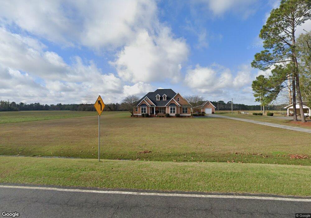
This home is located at 5303 Old Union Rd, Adel, GA 31620 and is currently estimated at $401,921, approximately $145 per square foot. 5303 Old Union Rd is a home located in Cook County with nearby schools including Cook Primary School, Cook Elementary School, and Cook County Middle School.
Ownership History
Date
Name
Owned For
Owner Type
Purchase Details
Closed on
Sep 26, 2007
Sold by
Folsom Janice G
Bought by
Lane Randall and Lane Kelly
Current Estimated Value
Purchase Details
Closed on
Jun 28, 2007
Sold by
Folsom Donald
Bought by
Lane Randall and Lane Kelly
Create a Home Valuation Report for This Property
The Home Valuation Report is an in-depth analysis detailing your home's value as well as a comparison with similar homes in the area
Home Values in the Area
Average Home Value in this Area
Purchase History
| Date | Buyer | Sale Price | Title Company |
|---|---|---|---|
| Lane Randall | -- | -- | |
| Lane Randall | -- | -- |
Source: Public Records
Tax History Compared to Growth
Tax History
| Year | Tax Paid | Tax Assessment Tax Assessment Total Assessment is a certain percentage of the fair market value that is determined by local assessors to be the total taxable value of land and additions on the property. | Land | Improvement |
|---|---|---|---|---|
| 2024 | $3,492 | $131,641 | $7,764 | $123,877 |
| 2023 | $2,874 | $108,707 | $7,764 | $100,943 |
| 2022 | $2,852 | $107,875 | $6,932 | $100,943 |
| 2021 | $2,561 | $90,635 | $6,932 | $83,703 |
| 2020 | $2,561 | $90,635 | $6,932 | $83,703 |
| 2019 | $2,563 | $90,635 | $6,932 | $83,703 |
| 2018 | $2,621 | $90,635 | $6,932 | $83,703 |
| 2017 | $2,565 | $90,635 | $6,932 | $83,703 |
| 2016 | $2,569 | $90,635 | $6,932 | $83,703 |
| 2015 | $2,574 | $90,636 | $6,932 | $83,703 |
| 2014 | $2,578 | $90,636 | $6,932 | $83,703 |
| 2013 | -- | $90,635 | $6,932 | $83,703 |
Source: Public Records
Map
Nearby Homes
- 2590 McConnell Bridge Rd
- 289 Arthur Newbern Rd
- 515 John Keigans Memorial
- 421 Best Cir
- 4711 Highway 37
- TBD Ga Hwy 76
- TBD Hwy 76
- 25 Stephen Williams Ln
- 123 Westover Dr
- 120 Westover Dr
- 134 Brandy Ct
- 0 Georgia 76
- 7051 Antioch Rd
- 11 Antioch Rd
- 3231 Old Quitman Rd
- 729 W 7th St
- 800 Old Quitman Rd
- 507 S Poplar St
- 103 N College St
- 304 E 3rd St
- 5315 Old Union Rd
- 5383 Old Union Rd
- 2999 McConnell Bridge Rd
- 2999 McConnell Bridge Rd
- 5705 Old Union Rd
- 3256 McConnell Bridge Rd
- 3274 McConnell Bridge Rd
- 5757 Old Union Rd
- 3374 McConnell Bridge Rd
- 3374 McConnell Bridge Rd
- 2930 McConnell Bridge Rd
- 3733 McConnell Bridge Rd
- 5821 Old Union Rd
- 2864 McConnell Bridge Rd
- 3794 McConnell Bridge Rd
- 3720 McConnell Bridge Rd
- 2708 McConnell Bridge Rd
- 37 Needham Rd
- 2706 McConnell Bridge Rd
- 2706 McConnell Bridge Rd Unit 1