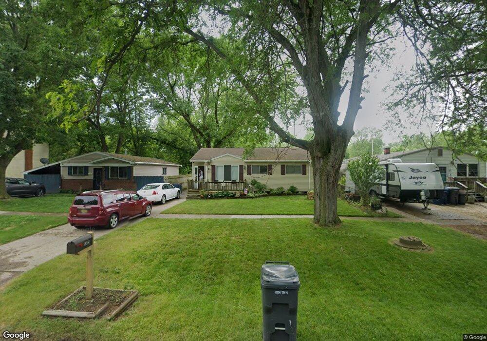
5305 Branch Rd Flint, MI 48506
Northeast Flint NeighborhoodEstimated Value: $61,000 - $71,000
3
Beds
2
Baths
930
Sq Ft
$70/Sq Ft
Est. Value
About This Home
This home is located at 5305 Branch Rd, Flint, MI 48506 and is currently estimated at $64,808, approximately $69 per square foot. 5305 Branch Rd is a home located in Genesee County with nearby schools including Brownell STEM Academy, Richfield Public School Academy, and Richfield Early Learning Center.
Ownership History
Date
Name
Owned For
Owner Type
Purchase Details
Closed on
Jun 14, 2002
Sold by
Kennedy Douglas Dale and Kennedy Kimberly Anne
Bought by
Mayville Steven W
Current Estimated Value
Home Financials for this Owner
Home Financials are based on the most recent Mortgage that was taken out on this home.
Original Mortgage
$48,025
Outstanding Balance
$25,808
Interest Rate
10.8%
Estimated Equity
$39,000
Create a Home Valuation Report for This Property
The Home Valuation Report is an in-depth analysis detailing your home's value as well as a comparison with similar homes in the area
Home Values in the Area
Average Home Value in this Area
Purchase History
| Date | Buyer | Sale Price | Title Company |
|---|---|---|---|
| Mayville Steven W | $37,500 | Titlequest Agency |
Source: Public Records
Mortgage History
| Date | Status | Borrower | Loan Amount |
|---|---|---|---|
| Open | Mayville Steven W | $48,025 |
Source: Public Records
Tax History
| Year | Tax Paid | Tax Assessment Tax Assessment Total Assessment is a certain percentage of the fair market value that is determined by local assessors to be the total taxable value of land and additions on the property. | Land | Improvement |
|---|---|---|---|---|
| 2025 | $974 | $28,300 | $0 | $0 |
| 2024 | $882 | $23,800 | $0 | $0 |
| 2023 | $867 | $20,000 | $0 | $0 |
| 2022 | $0 | $14,200 | $0 | $0 |
| 2021 | $900 | $14,500 | $0 | $0 |
| 2020 | $812 | $11,500 | $0 | $0 |
| 2019 | $831 | $12,400 | $0 | $0 |
| 2018 | $834 | $12,900 | $0 | $0 |
| 2017 | $810 | $0 | $0 | $0 |
| 2016 | $805 | $0 | $0 | $0 |
| 2015 | -- | $0 | $0 | $0 |
| 2014 | -- | $0 | $0 | $0 |
| 2012 | -- | $15,600 | $0 | $0 |
Source: Public Records
Map
Nearby Homes
- 2825 Eaton Place
- 2727 Eaton Place
- 4907 Delta Dr
- 2919 Hampstead Dr
- 5919 Western Rd
- 3364 E Pierson Rd
- 3456 E Pierson Rd
- 3294 Huggins Ave
- 2935 Richfield Rd
- 4298 N Center Rd
- 00 Richfield Rd
- 1704 E Webster Rd
- 4141 Hidden View Dr
- 3006 Agree Ave
- 5910 N Dort Hwy
- 3705 Aldon Ln
- 3118 Wyoming Ave
- 3010 Wyoming Ave
- 3210 Wyoming Ave
- 5190 Branch Rd
- 5301 Branch Rd
- 5309 Branch Rd
- 5217 Branch Rd
- 5313 Branch Rd
- 5213 Branch Rd
- 5317 Branch Rd
- 5302 Winsford By Way
- 5306 Winsford By Way
- 5401 Branch Rd
- 5205 Branch Rd
- 5206 Winsford Byway
- 5405 Branch Rd
- 2937 Eaton Place
- 5201 Branch Rd
- 5413 Branch Rd
- 2932 Eaton Place
- 5112 Winsford By Way
- 5113 Winsford By Way
- 2919 Eaton Place
- 4036 Branch Rd
Your Personal Tour Guide
Ask me questions while you tour the home.