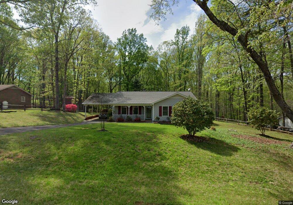
5305 Westrock Dr Pfafftown, NC 27040
Estimated Value: $236,606 - $290,000
3
Beds
2
Baths
1,352
Sq Ft
$195/Sq Ft
Est. Value
About This Home
This home is located at 5305 Westrock Dr, Pfafftown, NC 27040 and is currently estimated at $263,652, approximately $195 per square foot. 5305 Westrock Dr is a home located in Forsyth County with nearby schools including Vienna Elementary School, Thomas Jefferson Middle School, and Ronald W. Reagan High School.
Ownership History
Date
Name
Owned For
Owner Type
Purchase Details
Closed on
Jun 29, 2011
Sold by
Duffey Jane Shropshire Isaacs and Duffey Brett
Bought by
Laffoon William H
Current Estimated Value
Home Financials for this Owner
Home Financials are based on the most recent Mortgage that was taken out on this home.
Original Mortgage
$91,300
Outstanding Balance
$63,166
Interest Rate
4.63%
Mortgage Type
New Conventional
Estimated Equity
$200,486
Create a Home Valuation Report for This Property
The Home Valuation Report is an in-depth analysis detailing your home's value as well as a comparison with similar homes in the area
Home Values in the Area
Average Home Value in this Area
Purchase History
| Date | Buyer | Sale Price | Title Company |
|---|---|---|---|
| Laffoon William H | $115,000 | None Available |
Source: Public Records
Mortgage History
| Date | Status | Borrower | Loan Amount |
|---|---|---|---|
| Open | Laffoon William H | $91,300 |
Source: Public Records
Tax History Compared to Growth
Tax History
| Year | Tax Paid | Tax Assessment Tax Assessment Total Assessment is a certain percentage of the fair market value that is determined by local assessors to be the total taxable value of land and additions on the property. | Land | Improvement |
|---|---|---|---|---|
| 2024 | $1,115 | $145,400 | $27,000 | $118,400 |
| 2023 | $1,115 | $145,400 | $27,000 | $118,400 |
| 2022 | $1,115 | $145,400 | $27,000 | $118,400 |
| 2021 | $1,115 | $145,400 | $27,000 | $118,400 |
| 2020 | $902 | $107,900 | $23,000 | $84,900 |
| 2019 | $913 | $107,900 | $23,000 | $84,900 |
| 2018 | $865 | $107,900 | $23,000 | $84,900 |
| 2016 | $837 | $103,923 | $23,000 | $80,923 |
| 2015 | $837 | $103,923 | $23,000 | $80,923 |
| 2014 | $823 | $103,923 | $23,000 | $80,923 |
Source: Public Records
Map
Nearby Homes
- 2508 Patty Ln
- 4966 Yadkinville Rd
- 4966 Red Pine Ln
- 4942 Red Pine Ln
- 4116 Branch Point Ct
- 4526 Hanes Lake Dr
- 4514 Hanes Lake Dr
- 4538 Hanes Lake Dr
- 2891 Millwheel Rd
- 4556 Hanes Lake Dr
- 4568 Hanes Lake Dr
- 4555 Hanes Lake Dr
- 4580 Hanes Lake Dr
- 737 Cinnamon Hill Dr
- 731 Cinnamon Hill Dr
- 725 Cinnamon Hill Dr
- 0 Vincent Rd Unit 1176561
- 2520 Lakespring Ct
- 719 Cinnamon Hill Dr
- 713 Cinnamon Hill Dr
- 5309 Westrock Dr
- 5304 Westrock Dr
- 5313 Westrock Dr
- 5308 Bracy Ridge Ct
- 5300 Westrock Dr
- 5312 Bracy Ridge Ct
- 5308 W Rock Dr
- 5308 Westrock Dr
- 5300 Bracy Ridge Ct
- 5312 Westrock Dr
- 2531 Mount Salem Rd
- 2535 Mount Salem Rd
- 5305 Bracy Ridge Ct
- 5316 Bracy Ridge Ct
- 2519 Mount Salem Rd
- 5301 Bracy Ridge Ct
- 5309 Bent Tree Ct
- 5305 Bent Tree Ct
- 2515 Mount Salem Rd
- 5309 Bracy Ridge Ct