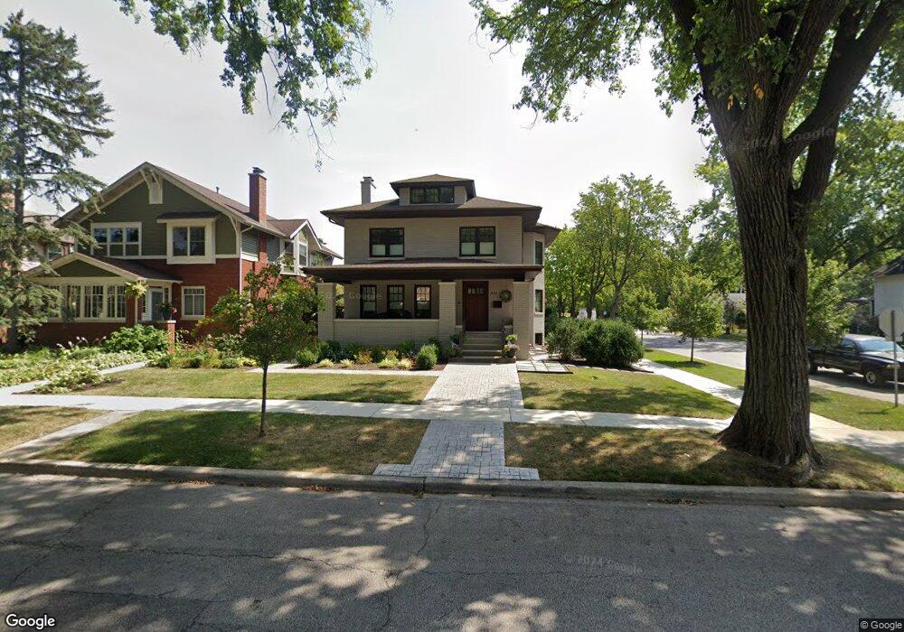
531 Courtland Ave Park Ridge, IL 60068
Estimated Value: $752,000 - $993,000
6
Beds
4
Baths
4,000
Sq Ft
$218/Sq Ft
Est. Value
About This Home
This home is located at 531 Courtland Ave, Park Ridge, IL 60068 and is currently estimated at $872,281, approximately $218 per square foot. 531 Courtland Ave is a home located in Cook County with nearby schools including Theodore Roosevelt Elementary School, Lincoln Middle School, and Maine South High School.
Ownership History
Date
Name
Owned For
Owner Type
Purchase Details
Closed on
Dec 30, 2024
Sold by
Antoinette L Lahart Trust and Lahart Antoinette L
Bought by
Martin Lahart 2007 Family Trust and Lahart
Current Estimated Value
Purchase Details
Closed on
Feb 2, 2024
Sold by
Lahart Antoinette L
Bought by
Antoinette L Lahart Trust and Lahart
Create a Home Valuation Report for This Property
The Home Valuation Report is an in-depth analysis detailing your home's value as well as a comparison with similar homes in the area
Home Values in the Area
Average Home Value in this Area
Purchase History
| Date | Buyer | Sale Price | Title Company |
|---|---|---|---|
| Martin Lahart 2007 Family Trust | $700,000 | None Listed On Document | |
| Antoinette L Lahart Trust | -- | None Listed On Document |
Source: Public Records
Tax History Compared to Growth
Tax History
| Year | Tax Paid | Tax Assessment Tax Assessment Total Assessment is a certain percentage of the fair market value that is determined by local assessors to be the total taxable value of land and additions on the property. | Land | Improvement |
|---|---|---|---|---|
| 2024 | $18,727 | $69,000 | $16,325 | $52,675 |
| 2023 | $17,944 | $69,000 | $16,325 | $52,675 |
| 2022 | $17,944 | $69,000 | $16,325 | $52,675 |
| 2021 | $18,213 | $59,883 | $10,083 | $49,800 |
| 2020 | $17,490 | $59,883 | $10,083 | $49,800 |
| 2019 | $4,099 | $15,728 | $10,083 | $5,645 |
| 2018 | $16,231 | $56,719 | $8,642 | $48,077 |
| 2017 | $16,162 | $56,719 | $8,642 | $48,077 |
| 2016 | $16,979 | $61,881 | $8,642 | $53,239 |
| 2015 | $14,177 | $50,462 | $7,202 | $43,260 |
| 2014 | $14,480 | $50,462 | $7,202 | $43,260 |
| 2013 | $13,699 | $50,462 | $7,202 | $43,260 |
Source: Public Records
Map
Nearby Homes
- 623 S Prospect Ave
- 301 S Prospect Ave
- 718 S Washington Ave
- 316 S Fairview Ave
- 249 S Vine Ave Unit B
- 428 S Clifton Ave
- 819 Albion Ave
- 400 S Northwest Hwy Unit 312B
- 820 W Talcott Rd
- 460 S Northwest Hwy Unit 307A
- 6852 N Northwest Hwy Unit 2B
- 6858 N Northwest Hwy Unit 2E
- 919 S Chester Ave
- 6815 N Olmsted Ave Unit 203
- 6841 N Northwest Hwy Unit 3C
- 1016 Arthur St
- 1220 Courtland Ave
- 1116 S Cumberland Ave
- 1015 Arthur St
- 1021 Cleveland Ave
- 527 Courtland Ave
- 523 Courtland Ave
- 605 Courtland Ave
- 519 Courtland Ave
- 506 Belleplaine Ave
- 506 Belle Plaine Ave
- 609 Courtland Ave
- 515 Courtland Ave
- 431 Stewart Ave
- 433 Stewart Ave
- 600 S Crescent Ave
- 437 Stewart Ave
- 513 Courtland Ave
- 526 Courtland Ave
- 604 S Crescent Ave
- 615 Courtland Ave
- 524 Courtland Ave
- 500 Belle Plaine Ave
- 500 Belleplaine Ave
- 600 Courtland Ave