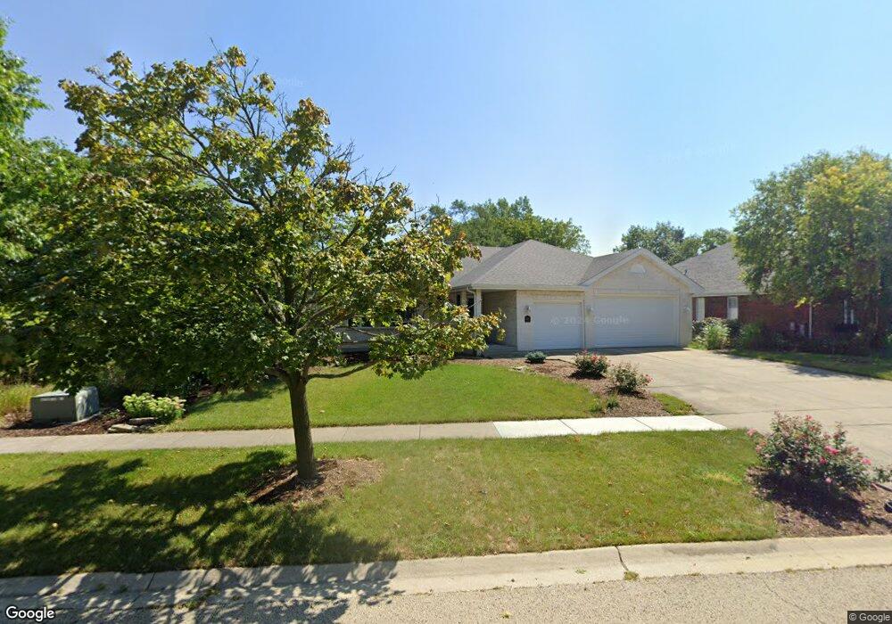
531 Kromray Rd Lemont, IL 60439
Northeast Lemont NeighborhoodEstimated Value: $672,147 - $787,000
3
Beds
3
Baths
2,711
Sq Ft
$262/Sq Ft
Est. Value
About This Home
This home is located at 531 Kromray Rd, Lemont, IL 60439 and is currently estimated at $711,287, approximately $262 per square foot. 531 Kromray Rd is a home located in Cook County with nearby schools including Oakwood School, River Valley School, and Old Quarry Middle School.
Ownership History
Date
Name
Owned For
Owner Type
Purchase Details
Closed on
Apr 17, 2012
Sold by
Neswold Mari Pauline and Neswold Mari P
Bought by
Neswold Mari P and Mari P Neswold Living Trust
Current Estimated Value
Purchase Details
Closed on
Nov 26, 2008
Sold by
Newswold Daniel James
Bought by
Neswold Mari Pauline
Purchase Details
Closed on
Feb 21, 1997
Sold by
State Bank Of Countryside
Bought by
Neswold Daniel J and Neswold Pauline M
Home Financials for this Owner
Home Financials are based on the most recent Mortgage that was taken out on this home.
Original Mortgage
$232,000
Interest Rate
7.93%
Create a Home Valuation Report for This Property
The Home Valuation Report is an in-depth analysis detailing your home's value as well as a comparison with similar homes in the area
Home Values in the Area
Average Home Value in this Area
Purchase History
| Date | Buyer | Sale Price | Title Company |
|---|---|---|---|
| Neswold Mari P | -- | None Available | |
| Neswold Mari Pauline | -- | None Available | |
| Neswold Daniel J | $294,500 | -- |
Source: Public Records
Mortgage History
| Date | Status | Borrower | Loan Amount |
|---|---|---|---|
| Previous Owner | Neswold Daniel J | $232,000 |
Source: Public Records
Tax History Compared to Growth
Tax History
| Year | Tax Paid | Tax Assessment Tax Assessment Total Assessment is a certain percentage of the fair market value that is determined by local assessors to be the total taxable value of land and additions on the property. | Land | Improvement |
|---|---|---|---|---|
| 2024 | $10,949 | $56,000 | $11,466 | $44,534 |
| 2023 | $9,067 | $56,000 | $11,466 | $44,534 |
| 2022 | $9,067 | $40,767 | $10,143 | $30,624 |
| 2021 | $8,811 | $40,767 | $10,143 | $30,624 |
| 2020 | $8,957 | $40,767 | $10,143 | $30,624 |
| 2019 | $8,814 | $41,536 | $10,143 | $31,393 |
| 2018 | $8,667 | $41,536 | $10,143 | $31,393 |
| 2017 | $8,552 | $41,536 | $10,143 | $31,393 |
| 2016 | $8,495 | $38,481 | $8,379 | $30,102 |
| 2015 | $8,593 | $38,481 | $8,379 | $30,102 |
| 2014 | $8,688 | $38,481 | $8,379 | $30,102 |
| 2013 | $10,105 | $47,084 | $8,379 | $38,705 |
Source: Public Records
Map
Nearby Homes
- 1170 Mccarthy Rd
- 11716 Center Dr
- 611 Houston St
- 14517 Albany Ave
- 1216 Country Ln
- 12183 Morandi Ct
- 12185 Morandi Ct
- 1200 Leinster Dr
- 12444 Killarney Dr
- 11174 Tuscany Ln
- 1297 Mccarthy Rd
- 614 Czacki St
- 1156 Covington Dr
- 700 Czacki St
- 8 Division Ct
- 523 Talcott Ave
- 1078 Amber Dr
- Fremont Plan at Covington Knolls
- Briarcliffe Plan at Covington Knolls
- Eden Plan at Covington Knolls
- 541 Kromray Rd
- 2 Misko Ct
- 4 Misko Ct
- 551 Kromray Rd
- 538 Carriage Ridge Ln
- 538 Carriage Ridge Ln Unit 1
- 540 Kromray Rd
- 528 Carriage Ridge Ln
- 530 Kromray Rd
- 548 Carriage Ridge Ln
- 561 Kromray Rd
- 520 Kromray Rd
- 518 Carriage Ridge Ln
- 560 Kromray Rd
- 519 Senon Dr
- 558 Carriage Ridge Ln
- 3 Misko Ct
- 521 Senon Dr
- 510 Kromray Rd
- 1 Misko Ct