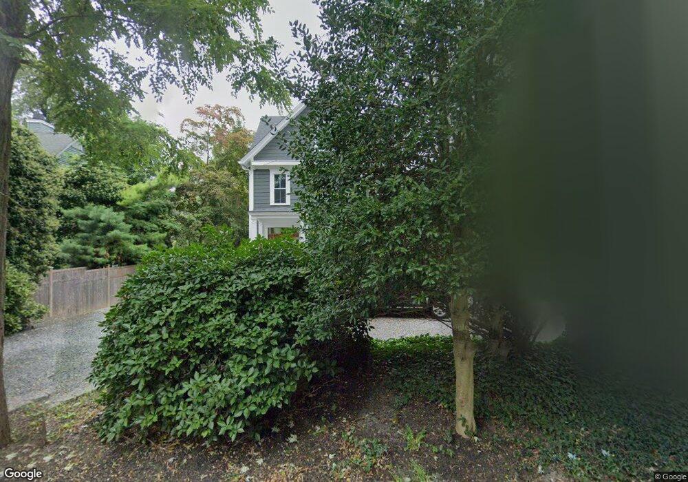
531 Locust Point Rd Rumson, NJ 07760
Estimated Value: $887,000 - $1,295,098
5
Beds
3
Baths
1,989
Sq Ft
$576/Sq Ft
Est. Value
About This Home
This home is located at 531 Locust Point Rd, Rumson, NJ 07760 and is currently estimated at $1,145,025, approximately $575 per square foot. 531 Locust Point Rd is a home located in Monmouth County with nearby schools including Navesink Elementary School, Bayshore Middle School, and Middletown - South High School.
Ownership History
Date
Name
Owned For
Owner Type
Purchase Details
Closed on
Feb 12, 1999
Sold by
Beguelin Natalie
Bought by
Sucato Peter and Sucato Kirsty
Current Estimated Value
Home Financials for this Owner
Home Financials are based on the most recent Mortgage that was taken out on this home.
Original Mortgage
$180,000
Interest Rate
6.78%
Mortgage Type
Purchase Money Mortgage
Create a Home Valuation Report for This Property
The Home Valuation Report is an in-depth analysis detailing your home's value as well as a comparison with similar homes in the area
Home Values in the Area
Average Home Value in this Area
Purchase History
| Date | Buyer | Sale Price | Title Company |
|---|---|---|---|
| Sucato Peter | $280,000 | -- |
Source: Public Records
Mortgage History
| Date | Status | Borrower | Loan Amount |
|---|---|---|---|
| Previous Owner | Sucato Peter | $180,000 |
Source: Public Records
Tax History Compared to Growth
Tax History
| Year | Tax Paid | Tax Assessment Tax Assessment Total Assessment is a certain percentage of the fair market value that is determined by local assessors to be the total taxable value of land and additions on the property. | Land | Improvement |
|---|---|---|---|---|
| 2025 | $15,644 | $963,300 | $685,600 | $277,700 |
| 2024 | $16,061 | $951,000 | $678,400 | $272,600 |
| 2023 | $16,061 | $924,100 | $643,900 | $280,200 |
| 2022 | $15,230 | $782,000 | $515,200 | $266,800 |
| 2021 | $15,230 | $736,300 | $499,000 | $237,300 |
| 2020 | $15,627 | $730,900 | $499,000 | $231,900 |
| 2019 | $15,409 | $729,600 | $499,000 | $230,600 |
| 2018 | $11,795 | $544,300 | $499,000 | $45,300 |
| 2017 | $12,280 | $561,000 | $499,000 | $62,000 |
| 2016 | $11,778 | $552,700 | $499,000 | $53,700 |
| 2015 | $12,139 | $550,000 | $499,000 | $51,000 |
| 2014 | $14,144 | $625,000 | $499,000 | $126,000 |
Source: Public Records
Map
Nearby Homes
- 139 Monmouth Ave
- 96 East Ave Unit 92
- 18 Clay Ct
- 934 Navesink River Rd
- 185 Monmouth Ave
- 38 East Ave
- 4 Isabella Ct
- 502 Central Ave
- HAMPSHIRE Plan at Central Ave
- 498 Central Ave
- 7100 Prospect Ave
- 6998 Prospect Ave
- 500 Central Ave
- 809 Navesink River Rd
- 49 Pape Dr
- 59 Asbury Ave
- 90 E Lincoln Ave
- 258 Ocean Blvd
- 18 Middletown Ave
- 608 Raritan Ave
- 529 Locust Point Rd
- 535 Locust Point Rd
- 525 Locust Point Rd
- 539 Locust Point Rd
- 521 Locust Point Rd
- 517 Locust Point Rd
- 543 Locust Point Rd
- 528 Locust Point Rd
- 28 Red Coach Ln
- 513 Locust Point Rd
- 524 Locust Point Rd
- 547 Locust Point Rd
- 509 Locust Point Rd
- 534 Locust Point Rd
- 30 Red Coach Ln
- 508 Locust Point Rd
- 551 Locust Point Rd
- 555 Locust Point Rd
- 501 Locust Point Rd
- 504 Locust Point Rd