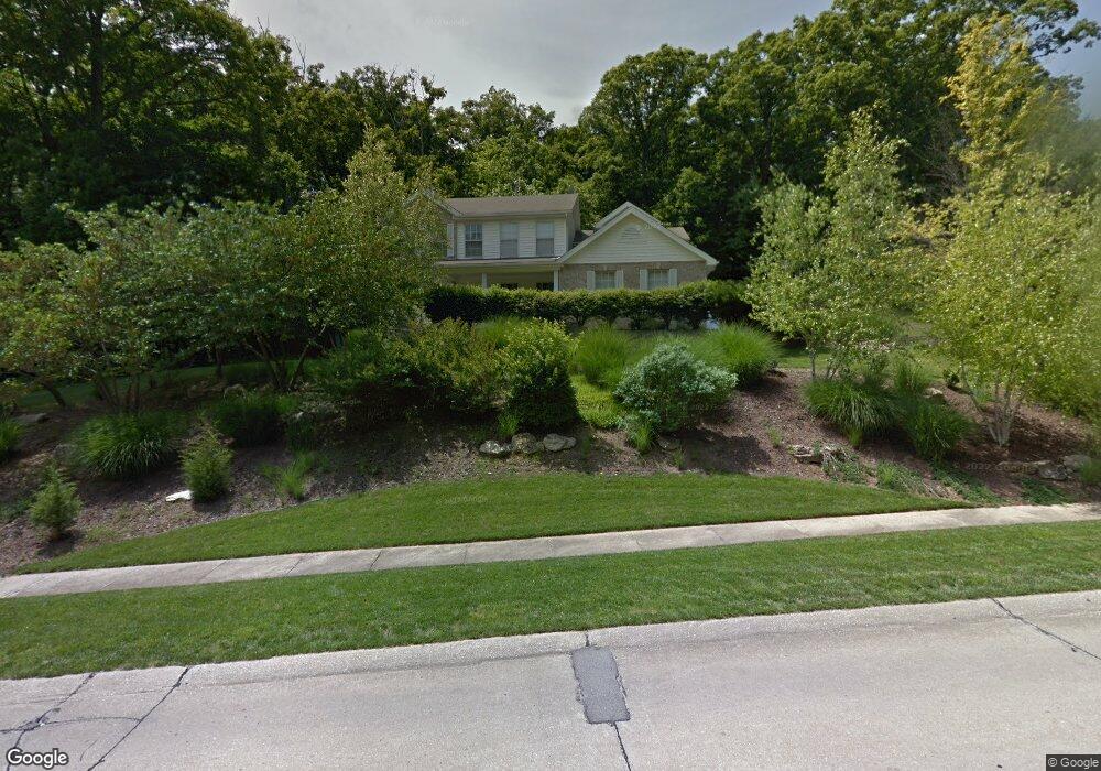
531 McBride Pointe Dr Ballwin, MO 63011
Estimated Value: $499,396 - $625,000
4
Beds
3
Baths
2,444
Sq Ft
$226/Sq Ft
Est. Value
About This Home
This home is located at 531 McBride Pointe Dr, Ballwin, MO 63011 and is currently estimated at $551,599, approximately $225 per square foot. 531 McBride Pointe Dr is a home located in St. Louis County with nearby schools including Babler Elementary School, Rockwood Valley Middle School, and Lafayette High School.
Ownership History
Date
Name
Owned For
Owner Type
Purchase Details
Closed on
Nov 15, 1999
Sold by
Deeter Robert D and Deeter Connie D
Bought by
Hudak Michael A and Hudak Justina A
Current Estimated Value
Home Financials for this Owner
Home Financials are based on the most recent Mortgage that was taken out on this home.
Original Mortgage
$163,500
Outstanding Balance
$48,961
Interest Rate
7.5%
Estimated Equity
$502,638
Purchase Details
Closed on
Nov 8, 1999
Sold by
Witte Maria T
Bought by
Living John J and Living Maria T Witte Revocable
Home Financials for this Owner
Home Financials are based on the most recent Mortgage that was taken out on this home.
Original Mortgage
$163,500
Outstanding Balance
$48,961
Interest Rate
7.5%
Estimated Equity
$502,638
Purchase Details
Closed on
Nov 24, 1998
Sold by
Buzzelli John L and Buzzelli John L
Bought by
Deeter Robert D and Deeter Connie D
Home Financials for this Owner
Home Financials are based on the most recent Mortgage that was taken out on this home.
Original Mortgage
$168,000
Interest Rate
6.69%
Create a Home Valuation Report for This Property
The Home Valuation Report is an in-depth analysis detailing your home's value as well as a comparison with similar homes in the area
Home Values in the Area
Average Home Value in this Area
Purchase History
| Date | Buyer | Sale Price | Title Company |
|---|---|---|---|
| Hudak Michael A | $223,500 | -- | |
| Living John J | -- | -- | |
| Deeter Robert D | $210,000 | -- |
Source: Public Records
Mortgage History
| Date | Status | Borrower | Loan Amount |
|---|---|---|---|
| Open | Hudak Michael A | $163,500 | |
| Previous Owner | Deeter Robert D | $168,000 |
Source: Public Records
Tax History
| Year | Tax Paid | Tax Assessment Tax Assessment Total Assessment is a certain percentage of the fair market value that is determined by local assessors to be the total taxable value of land and additions on the property. | Land | Improvement |
|---|---|---|---|---|
| 2025 | $5,383 | $86,560 | $35,490 | $51,070 |
| 2024 | $5,383 | $77,410 | $28,560 | $48,850 |
| 2023 | $5,383 | $77,410 | $28,560 | $48,850 |
| 2022 | $5,465 | $73,060 | $19,040 | $54,020 |
| 2021 | $5,425 | $73,060 | $19,040 | $54,020 |
| 2020 | $5,096 | $65,440 | $17,520 | $47,920 |
| 2019 | $5,117 | $65,440 | $17,520 | $47,920 |
| 2018 | $5,299 | $63,900 | $17,520 | $46,380 |
| 2017 | $5,172 | $63,900 | $17,520 | $46,380 |
| 2016 | $4,218 | $50,120 | $17,520 | $32,600 |
Source: Public Records
Map
Nearby Homes
- 583 McBride Pointe Dr
- 16403 Prestwick Place Ln
- 1839 Sullivan Pointe Dr
- 16404 Clayton Rd
- 1800 Wade Ct
- 1504 Englebrook Dr
- 2470 Indian Tree Cir
- 1635 Clayton Spur Ct
- 215 Cobblefield Ct
- 2140 Dartmouth Gate Ct
- 1909 Shepard Rd
- 1525 Virginia Dr
- 101 Strecker Rd
- 16532 Branchwood Dr
- 67 Strecker Rd
- 16421 Hollister Crossing Dr
- 2209 Ridgley Woods Dr
- 1605 Ridge Bend Dr
- 1517 Froesel Dr
- 16858 Babler View Dr
- 539 McBride Pointe Dr
- 523 McBride Pointe Dr
- 1907 Durango Pass Ct
- 1900 Durango Pass Ct
- 1915 Durango Pass Ct
- 1919 Durango Pass Ct
- 543 McBride Pointe Dr
- 1906 Gastorf Pointe Ct
- 16531 Clayton Rd
- 1906 Durango Pass Ct
- 1900 Gastorf Pointe Ct
- 1912 Gastorf Pointe Ct
- 1925 Durango Pass Ct
- 1926 Gastorf Pointe Ct
- 1912 Durango Pass Ct
- 1907 Gastorf Pointe Ct
- 1901 Gastorf Pointe Ct
- 682 Shadowridge Dr
- 1918 Durango Pass Ct
- 1915 Gastorf Pointe Ct
Your Personal Tour Guide
Ask me questions while you tour the home.