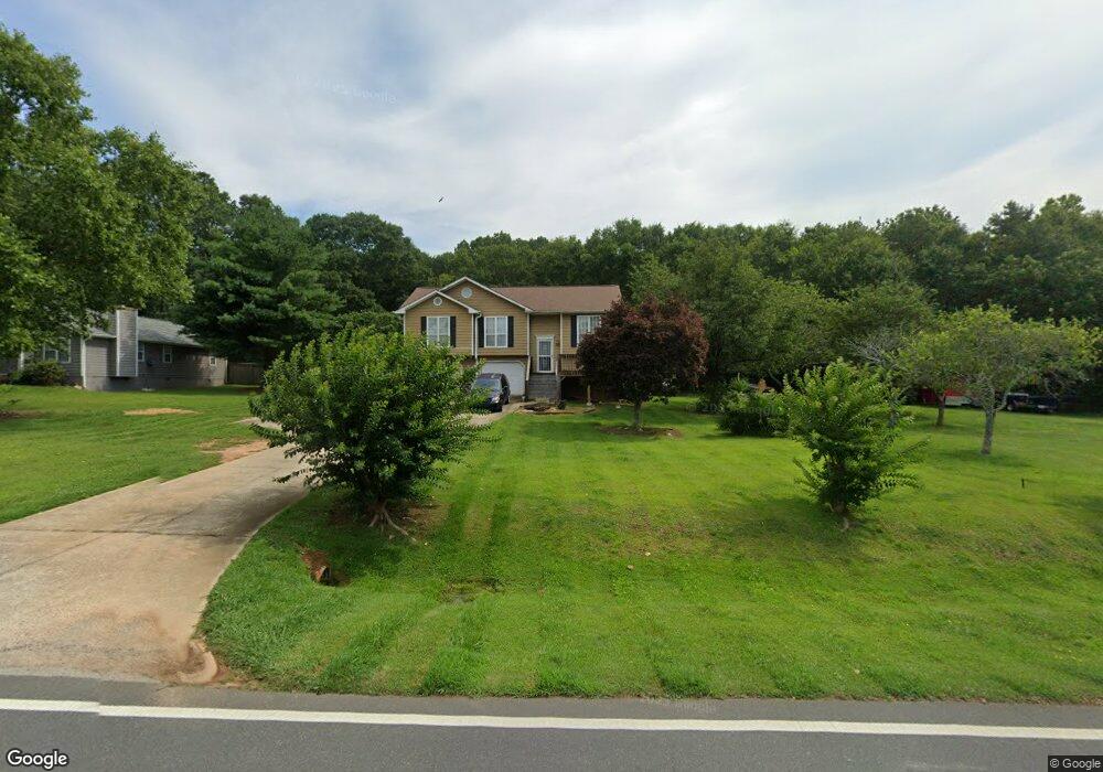
531 Miles Patrick Rd Winder, GA 30680
Estimated Value: $243,000 - $312,000
3
Beds
2
Baths
1,101
Sq Ft
$252/Sq Ft
Est. Value
About This Home
This home is located at 531 Miles Patrick Rd, Winder, GA 30680 and is currently estimated at $277,577, approximately $252 per square foot. 531 Miles Patrick Rd is a home located in Barrow County with nearby schools including County Line Elementary School, Russell Middle School, and Winder-Barrow High School.
Ownership History
Date
Name
Owned For
Owner Type
Purchase Details
Closed on
Dec 7, 1993
Sold by
Farmer David B
Bought by
Finch Anthony B
Current Estimated Value
Home Financials for this Owner
Home Financials are based on the most recent Mortgage that was taken out on this home.
Original Mortgage
$70,300
Interest Rate
6.85%
Create a Home Valuation Report for This Property
The Home Valuation Report is an in-depth analysis detailing your home's value as well as a comparison with similar homes in the area
Home Values in the Area
Average Home Value in this Area
Purchase History
| Date | Buyer | Sale Price | Title Company |
|---|---|---|---|
| Finch Anthony B | $74,000 | -- |
Source: Public Records
Mortgage History
| Date | Status | Borrower | Loan Amount |
|---|---|---|---|
| Closed | Finch Anthony B | $70,300 |
Source: Public Records
Tax History
| Year | Tax Paid | Tax Assessment Tax Assessment Total Assessment is a certain percentage of the fair market value that is determined by local assessors to be the total taxable value of land and additions on the property. | Land | Improvement |
|---|---|---|---|---|
| 2025 | $628 | $60,048 | $16,800 | $43,248 |
| 2024 | $1,463 | $58,844 | $16,800 | $42,044 |
| 2023 | $980 | $58,844 | $16,800 | $42,044 |
| 2022 | $1,582 | $51,367 | $16,800 | $34,567 |
| 2021 | $1,440 | $45,367 | $10,800 | $34,567 |
| 2020 | $1,418 | $45,367 | $10,800 | $34,567 |
| 2019 | $1,402 | $44,005 | $10,800 | $33,205 |
| 2018 | $1,393 | $44,005 | $10,800 | $33,205 |
| 2017 | $1,036 | $34,726 | $10,800 | $23,926 |
| 2016 | $1,023 | $34,071 | $12,000 | $22,071 |
| 2015 | $1,034 | $34,344 | $12,000 | $22,344 |
| 2014 | $814 | $28,497 | $5,880 | $22,617 |
| 2013 | -- | $27,457 | $5,880 | $21,577 |
Source: Public Records
Map
Nearby Homes
- 128 Northridge Dr
- 538 Valleyview Dr
- 2050 Whispering Way
- 932 Century Oak Dr
- 845 Idlewood Rd
- 27 Creekside Dr
- 311 Rockwell Church Rd NW
- 615 Wellington Dr
- 421 N 5th Ave
- 716 Michael Dr
- 0 E Northcrest Dr Unit 10648147
- 469 Plantation Dr
- 403 Ryan Cir
- 318 Ryan Rd
- 436 Northcrest Dr
- 236 Hidden Ct
- 222 Ryan Rd
- 223 Lacey Ln
- 326 Miles Patrick Rd
- 719 Mallard Dr
- 535 Miles Patrick Rd
- 96 Northridge Dr Unit 10
- 521 Miles Patrick Rd
- 539 Miles Patrick Rd
- 105 Northridge Dr
- 536 Miles Patrick Rd
- 543 Miles Patrick Rd
- 106 Northridge Dr
- 515 Miles Patrick Rd
- 109 Northridge Dr
- 540 Miles Patrick Rd Unit 1
- 547 Miles Patrick Rd
- 108 Northridge Dr
- 509 Miles Patrick Rd
- 512 Miles Patrick Rd
- 111 Northridge Dr
- 102 Ashwood Dr Unit 1
- 410 Northridge Ln
- 551 Miles Patrick Rd
- 506 Miles Patrick Rd
Your Personal Tour Guide
Ask me questions while you tour the home.