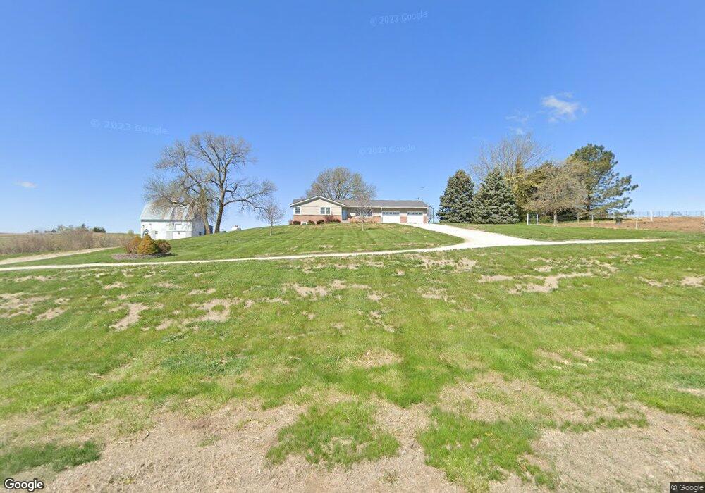
531 N 40th Rd Dunbar, NE 68346
Estimated Value: $287,000 - $447,000
4
Beds
2
Baths
1,262
Sq Ft
$298/Sq Ft
Est. Value
About This Home
This home is located at 531 N 40th Rd, Dunbar, NE 68346 and is currently estimated at $375,547, approximately $297 per square foot. 531 N 40th Rd is a home located in Otoe County with nearby schools including Elementary School at Syracuse and High School at Syracuse.
Ownership History
Date
Name
Owned For
Owner Type
Purchase Details
Closed on
Mar 3, 2022
Sold by
Rudolph Dolores A
Bought by
Ru-D Farms Llc
Current Estimated Value
Purchase Details
Closed on
Dec 22, 2021
Sold by
Rudolph Dolores A and Rudolph Daniel
Bought by
Rudolph Stender Llc
Purchase Details
Closed on
Dec 20, 2021
Sold by
Rudolph and Vanessa
Bought by
Rudolph Daniel
Create a Home Valuation Report for This Property
The Home Valuation Report is an in-depth analysis detailing your home's value as well as a comparison with similar homes in the area
Home Values in the Area
Average Home Value in this Area
Purchase History
| Date | Buyer | Sale Price | Title Company |
|---|---|---|---|
| Ru-D Farms Llc | -- | None Listed On Document | |
| Rudolph Stender Llc | $24,888 | None Listed On Document | |
| Rudolph Daniel | $83,000 | None Listed On Document | |
| Deters Sandra | $42,000 | None Listed On Document |
Source: Public Records
Tax History Compared to Growth
Tax History
| Year | Tax Paid | Tax Assessment Tax Assessment Total Assessment is a certain percentage of the fair market value that is determined by local assessors to be the total taxable value of land and additions on the property. | Land | Improvement |
|---|---|---|---|---|
| 2024 | $3,111 | $255,321 | $46,002 | $209,319 |
| 2023 | $3,345 | $232,110 | $41,820 | $190,290 |
| 2022 | $2,574 | $180,030 | $41,820 | $138,210 |
| 2021 | $2,496 | $180,030 | $41,820 | $138,210 |
| 2020 | $2,489 | $175,940 | $37,730 | $138,210 |
| 2019 | $2,343 | $163,370 | $37,730 | $125,640 |
| 2018 | $2,150 | $159,370 | $33,730 | $125,640 |
| 2017 | $1,939 | $149,030 | $33,730 | $115,300 |
| 2016 | $1,937 | $149,030 | $33,730 | $115,300 |
| 2015 | $1,957 | $149,030 | $33,730 | $115,300 |
| 2014 | $2,105 | $147,690 | $32,390 | $115,300 |
| 2012 | $2,104 | $144,750 | $29,450 | $115,300 |
Source: Public Records
Map
Nearby Homes