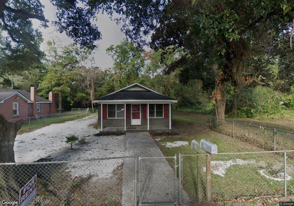
531 N Hazard St Georgetown, SC 29440
Estimated Value: $68,000 - $141,243
2
Beds
1
Bath
1,008
Sq Ft
$114/Sq Ft
Est. Value
About This Home
This home is located at 531 N Hazard St, Georgetown, SC 29440 and is currently estimated at $114,561, approximately $113 per square foot. 531 N Hazard St is a home located in Georgetown County with nearby schools including Kensington Elementary School, Georgetown Middle School, and Georgetown High School.
Ownership History
Date
Name
Owned For
Owner Type
Purchase Details
Closed on
Jun 13, 2025
Sold by
Stewart Elizabeth J and Stewart Michael
Bought by
Gibson Stanley
Current Estimated Value
Purchase Details
Closed on
Jul 11, 2014
Sold by
Stewart Michael
Bought by
Stewart Elias and Stewart Elizabeth J
Purchase Details
Closed on
Oct 3, 2008
Sold by
Thompson Diana R
Bought by
Stewart Michael
Create a Home Valuation Report for This Property
The Home Valuation Report is an in-depth analysis detailing your home's value as well as a comparison with similar homes in the area
Home Values in the Area
Average Home Value in this Area
Purchase History
| Date | Buyer | Sale Price | Title Company |
|---|---|---|---|
| Gibson Stanley | $65,000 | None Listed On Document | |
| Gibson Stanley | $65,000 | None Listed On Document | |
| Stewart Elias | -- | -- | |
| Stewart Michael | $25,500 | -- |
Source: Public Records
Tax History Compared to Growth
Tax History
| Year | Tax Paid | Tax Assessment Tax Assessment Total Assessment is a certain percentage of the fair market value that is determined by local assessors to be the total taxable value of land and additions on the property. | Land | Improvement |
|---|---|---|---|---|
| 2024 | $1,472 | $3,910 | $370 | $3,540 |
| 2023 | $1,472 | $3,910 | $370 | $3,540 |
| 2022 | $1,320 | $3,910 | $370 | $3,540 |
| 2021 | $1,279 | $0 | $0 | $0 |
| 2020 | $1,278 | $0 | $0 | $0 |
| 2019 | $1,208 | $0 | $0 | $0 |
| 2018 | $1,215 | $0 | $0 | $0 |
| 2017 | $1,101 | $0 | $0 | $0 |
| 2016 | $1,089 | $3,750 | $0 | $0 |
| 2015 | $1,035 | $0 | $0 | $0 |
| 2014 | $1,035 | $60,200 | $6,100 | $54,100 |
| 2012 | -- | $60,200 | $6,100 | $54,100 |
Source: Public Records
Map
Nearby Homes
- 1306 Richmond Dr
- 1508 Duke St
- 902 Palm St
- 2478 N Fraser St Unit 12+ acres
- 910 Willowbank Rd
- 2405 & 2407 Highmarket St
- 1121 Grimes St
- 1137 Palmetto St
- 125 N Fraser St
- 1510 Front St
- 1209 Prince St
- 0 Rainey Dr
- 105 S Merriman Rd
- 105 S Merriman Rd Unit 1
- 1010 Highmarket St
- 932 Duke St Unit Historic District of
- 133 Wood St
- 1019 Prince St
- 811 Prince St Unit Historic District
- 815 Front St Unit 2H
- 529 N Hazard St
- 603 N Hazard St
- 607 N Fraser St
- 523 N Hazard St
- 617 N Fraser St
- 607 N Hazard St
- 605 N Fraser St
- 600 N Congdon St
- 518 N Congdon St
- 619 N Fraser St
- 521 N Hazard St
- 520 N Congdon St
- 611 N Hazard St
- 601 N Fraser St
- 606 N Congdon St
- 517 N Hazard St
- 701 N Fraser St
- 701 N Fraser St
- 701 N Fraser St
- 701 N Fraser St