531 N Water St Decatur, IL 62523
--
Bed
--
Bath
4,560
Sq Ft
8,059
Sq Ft Lot
About This Home
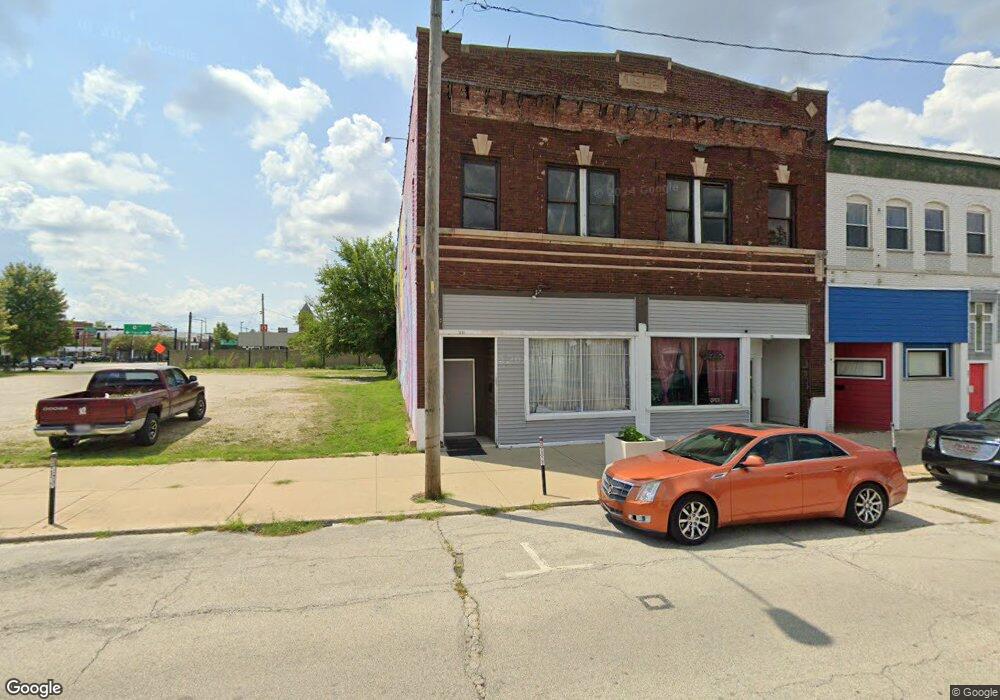
This home is located at 531 N Water St, Decatur, IL 62523. 531 N Water St is a home located in Macon County with nearby schools including Dennis Lab School, St. Patrick School, and Teen Challenge-Home For Girls.
Ownership History
Date
Name
Owned For
Owner Type
Purchase Details
Closed on
Mar 1, 1990
Create a Home Valuation Report for This Property
The Home Valuation Report is an in-depth analysis detailing your home's value as well as a comparison with similar homes in the area
Home Values in the Area
Average Home Value in this Area
Purchase History
| Date | Buyer | Sale Price | Title Company |
|---|---|---|---|
| -- | $15,000 | -- |
Source: Public Records
Tax History Compared to Growth
Tax History
| Year | Tax Paid | Tax Assessment Tax Assessment Total Assessment is a certain percentage of the fair market value that is determined by local assessors to be the total taxable value of land and additions on the property. | Land | Improvement |
|---|---|---|---|---|
| 2024 | $1,816 | $18,763 | $3,679 | $15,084 |
| 2023 | $1,801 | $18,099 | $3,549 | $14,550 |
| 2022 | $1,741 | $17,022 | $3,284 | $13,738 |
| 2021 | $1,636 | $15,897 | $3,067 | $12,830 |
| 2020 | $1,612 | $15,160 | $2,925 | $12,235 |
| 2019 | $1,612 | $15,160 | $2,925 | $12,235 |
| 2018 | $1,598 | $15,211 | $2,935 | $12,276 |
| 2017 | $1,636 | $15,617 | $3,013 | $12,604 |
| 2016 | $1,667 | $15,777 | $3,044 | $12,733 |
| 2015 | $1,584 | $15,498 | $2,990 | $12,508 |
| 2014 | $1,661 | $17,194 | $4,810 | $12,384 |
| 2013 | $1,703 | $17,840 | $4,991 | $12,849 |
Source: Public Records
Map
Nearby Homes
- 135 E Prairie Ave Unit 1-4
- 330 W William St
- 844 N Edward St
- 281 W Prairie Ave
- 415 W Green St
- 422 W William St
- 366 W Prairie Ave
- 233 N Edward St
- 320 W Main St
- 141 E Packard St
- 442 W Prairie Ave
- 452 W Prairie Ave
- 875 N Monroe St
- 609 W William St
- 440 W Macon St
- 450 W Macon St
- 1245 N Union St
- 254 N Pine St
- 717 W Prairie Ave Unit 2
- 612 W Macon St
- 530 N Water St
- 565 N Water St
- 140 E Cerro Gordo St
- 436 N Main St
- 410 N Water St
- 445 N Franklin St Unit A
- 445 N Franklin St
- 222 E North St
- 242 E North St
- 125 E North St
- 222 E Wabash Ave
- 733 N Main St
- 756 N Main St
- 735 N Main St
- 561 N Church St
- 735 N Main St
- 334 N Main St
- 201 W Eldorado St
- 224 W Eldorado St
- 765 N Main St