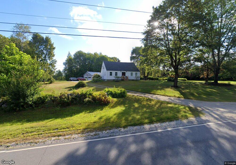
531 Parsonsfield Rd Limerick, ME 04048
Estimated Value: $365,000 - $429,000
3
Beds
1
Bath
1,116
Sq Ft
$350/Sq Ft
Est. Value
About This Home
This home is located at 531 Parsonsfield Rd, Limerick, ME 04048 and is currently estimated at $390,336, approximately $349 per square foot. 531 Parsonsfield Rd is a home located in York County with nearby schools including Massabesic High School and Ossipee Valley Christian School.
Ownership History
Date
Name
Owned For
Owner Type
Purchase Details
Closed on
Nov 21, 2013
Sold by
Fenderson Joseph M and Fenderson Wendy
Bought by
Fenderson Joseph M
Current Estimated Value
Home Financials for this Owner
Home Financials are based on the most recent Mortgage that was taken out on this home.
Original Mortgage
$70,000
Outstanding Balance
$17,769
Interest Rate
4.25%
Mortgage Type
Commercial
Estimated Equity
$372,567
Purchase Details
Closed on
Jul 7, 2006
Sold by
Tillson Patrick L
Bought by
Fenderson Wendy and Fenderson Joseph M
Home Financials for this Owner
Home Financials are based on the most recent Mortgage that was taken out on this home.
Original Mortgage
$76,000
Interest Rate
6.6%
Mortgage Type
Commercial
Create a Home Valuation Report for This Property
The Home Valuation Report is an in-depth analysis detailing your home's value as well as a comparison with similar homes in the area
Home Values in the Area
Average Home Value in this Area
Purchase History
| Date | Buyer | Sale Price | Title Company |
|---|---|---|---|
| Fenderson Joseph M | -- | -- | |
| Fenderson Wendy | -- | -- |
Source: Public Records
Mortgage History
| Date | Status | Borrower | Loan Amount |
|---|---|---|---|
| Open | Fenderson Joseph M | $70,000 | |
| Closed | Fenderson Wendy | $76,000 | |
| Closed | Fenderson Wendy | $9,500 |
Source: Public Records
Tax History Compared to Growth
Tax History
| Year | Tax Paid | Tax Assessment Tax Assessment Total Assessment is a certain percentage of the fair market value that is determined by local assessors to be the total taxable value of land and additions on the property. | Land | Improvement |
|---|---|---|---|---|
| 2025 | $3,025 | $318,402 | $91,472 | $226,930 |
| 2024 | $3,025 | $318,402 | $91,472 | $226,930 |
| 2023 | $2,332 | $153,408 | $46,800 | $106,608 |
| 2022 | $2,178 | $153,408 | $46,800 | $106,608 |
| 2021 | $2,037 | $122,726 | $37,440 | $85,286 |
| 2020 | $2,013 | $122,726 | $37,440 | $85,286 |
| 2019 | $1,933 | $122,726 | $37,440 | $85,286 |
| 2018 | $1,982 | $122,726 | $37,440 | $85,286 |
| 2017 | $2,171 | $122,726 | $37,440 | $85,286 |
| 2016 | $1,847 | $122,726 | $37,440 | $85,286 |
| 2015 | $1,792 | $122,726 | $37,440 | $85,286 |
| 2014 | $1,737 | $122,726 | $37,440 | $85,286 |
Source: Public Records
Map
Nearby Homes
- 80 Kelley Ln
- 243 Sokokis Trail N
- 27 Lynn Dr
- Lot 5 Fenderson Rd
- 148 Washington St Unit A
- 155 Quarry Rd
- 71 Quarry Rd
- 33 Maple St
- 21 Quarry Rd
- R13/038 Weeks Rd
- 36 Elm St
- 178 Maplecrest Rd
- 16 Whiteley Rd
- 27 Nocturne Rd
- 110 Pleasant Hill Rd
- 0 Stone Hill Rd
- 91 Pleasant Hill Rd
- 48 Pleasant Hill Rd
- 424 Maplecrest Rd
- 154 Staples Rd
- 551 Parsonsfield Rd
- 0 Maine 160
- 561 Parsonsfield Rd
- 521 Route 160
- 572 Parsonsfield Rd
- 496 Parsonsfield Rd
- 579 Parsonsfield Rd
- 484 Parsonsfield Rd
- 585 Parsonsfield Rd
- 464 Parsonsfield Rd
- 301 Parcel Parsonsfield Rd
- 404B Parsonsfield Rd
- TBD Parsonsfield Rd
- 9 Moffett Rd
- 12 Moffett Rd
- 1997 North Rd
- 450 Parsonsfield Rd
- 1990 North Rd
- 445 Parsonsfield Rd
- 440 Parsonsfield Rd