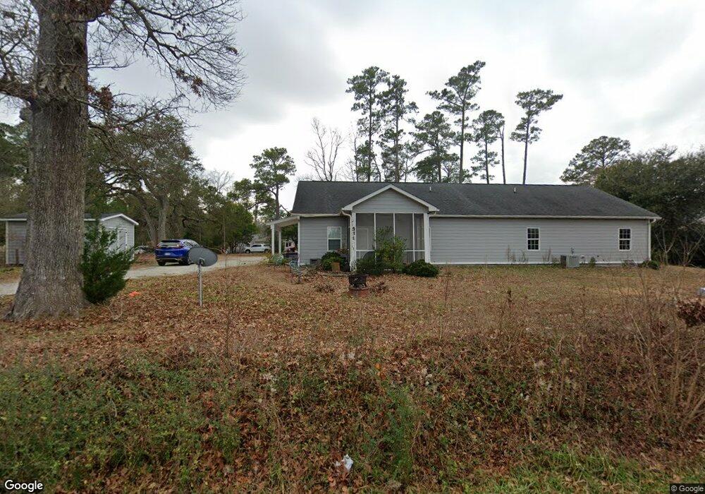
531 Peanut Rd Hampstead, NC 28443
Estimated Value: $343,000 - $471,000
2
Beds
2
Baths
1,156
Sq Ft
$347/Sq Ft
Est. Value
About This Home
This home is located at 531 Peanut Rd, Hampstead, NC 28443 and is currently estimated at $400,609, approximately $346 per square foot. 531 Peanut Rd is a home with nearby schools including South Topsail Elementary School, Topsail Middle School, and Topsail High School.
Ownership History
Date
Name
Owned For
Owner Type
Purchase Details
Closed on
Dec 12, 2019
Sold by
Barbour Barry Paul
Bought by
Paul Barbour & Son Of Wilmington Inc
Current Estimated Value
Purchase Details
Closed on
May 23, 2014
Sold by
Tart Jackie L
Bought by
Barber Barry Paul
Purchase Details
Closed on
Jul 28, 2010
Sold by
Cornette James
Bought by
Tart Jackie L
Create a Home Valuation Report for This Property
The Home Valuation Report is an in-depth analysis detailing your home's value as well as a comparison with similar homes in the area
Home Values in the Area
Average Home Value in this Area
Purchase History
| Date | Buyer | Sale Price | Title Company |
|---|---|---|---|
| Paul Barbour & Son Of Wilmington Inc | -- | None Available | |
| Barber Barry Paul | $237,000 | None Available | |
| Tart Jackie L | $41,000 | -- |
Source: Public Records
Tax History
| Year | Tax Paid | Tax Assessment Tax Assessment Total Assessment is a certain percentage of the fair market value that is determined by local assessors to be the total taxable value of land and additions on the property. | Land | Improvement |
|---|---|---|---|---|
| 2025 | $3,058 | $553,538 | $55,944 | $497,594 |
| 2024 | $3,058 | $309,003 | $29,940 | $279,063 |
| 2023 | $3,058 | $309,003 | $29,940 | $279,063 |
| 2022 | $2,792 | $309,003 | $29,940 | $279,063 |
| 2021 | $2,792 | $309,003 | $29,940 | $279,063 |
| 2020 | $2,792 | $309,003 | $29,940 | $279,063 |
| 2019 | $2,792 | $309,003 | $29,940 | $279,063 |
| 2018 | $2,042 | $183,632 | $13,000 | $170,632 |
| 2017 | $2,042 | $183,632 | $13,000 | $170,632 |
| 2016 | $2,024 | $183,632 | $13,000 | $170,632 |
| 2015 | $1,954 | $183,632 | $13,000 | $170,632 |
| 2014 | $1,575 | $183,632 | $13,000 | $170,632 |
| 2013 | -- | $183,632 | $13,000 | $170,632 |
| 2012 | -- | $183,632 | $13,000 | $170,632 |
Source: Public Records
Map
Nearby Homes
- 84 Aspen Rd
- 151 Pansy Ln
- Tract 2 State Highway 210
- Tract 1 State Highway 210
- 21 Violetear Ridge
- 225 Factory Rd
- Lot 0 State Highway 210
- 207 Whispering Pines Ct
- 439 Factory Rd
- 21801 U S 17
- 244 E Brookfield Branch Rd Unit 34
- Tbd Brookfield Branch Rd Unit 20
- 447 Factory Rd
- 91 Brookfield Branch Rd Unit 1
- 99 Brookfield Branch Rd Unit 2
- 140 Brookfield Branch Rd Unit 21
- 166 Brookfield Branch Rd Unit 24
- 158 Brookfield Branch Rd Unit 23
- 115 Brookfield Branch Rd Unit 4
- 174 Brookfield Branch Rd Unit 25
- 534 N Carolina 210
- 534 Nc Highway 210 W
- 586 Nc Highway 210 W
- 586 N Carolina 210
- 534 210 Hwy W
- 559 Nc Highway 210 W
- 508 Nc Highway 210 W
- 577 Nc Highway 210 W
- 601 Nc Highway 210 W
- 626 Nc Highway 210 W
- 480 Nc Highway 210 W
- 621 Nc Highway 210 W
- 442 Peanut Rd
- 450 Nc Highway 210 W
- 416 Peanut Rd
- 411 Peanut Rd
- 0 Peanut Rd
- 650 Peanut Rd
- 390 Peanut Rd
Your Personal Tour Guide
Ask me questions while you tour the home.