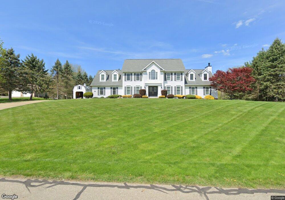
531 Roland Hills Dr Mogadore, OH 44260
Estimated Value: $488,103 - $549,000
4
Beds
3
Baths
3,313
Sq Ft
$158/Sq Ft
Est. Value
About This Home
This home is located at 531 Roland Hills Dr, Mogadore, OH 44260 and is currently estimated at $523,276, approximately $157 per square foot. 531 Roland Hills Dr is a home located in Portage County with nearby schools including Suffield Elementary School, Field Middle School, and Field High School.
Ownership History
Date
Name
Owned For
Owner Type
Purchase Details
Closed on
Jun 9, 2021
Sold by
Jackson Randy K and Jackson Nancy F
Bought by
Jackson Andrew
Current Estimated Value
Home Financials for this Owner
Home Financials are based on the most recent Mortgage that was taken out on this home.
Original Mortgage
$272,000
Outstanding Balance
$206,519
Interest Rate
2.9%
Mortgage Type
New Conventional
Estimated Equity
$316,757
Purchase Details
Closed on
Nov 8, 1993
Bought by
Jackson Randy K and Jackson Nancy F
Create a Home Valuation Report for This Property
The Home Valuation Report is an in-depth analysis detailing your home's value as well as a comparison with similar homes in the area
Home Values in the Area
Average Home Value in this Area
Purchase History
| Date | Buyer | Sale Price | Title Company |
|---|---|---|---|
| Jackson Andrew | $340,000 | America Land Title Llc | |
| Jackson Randy K | $30,900 | -- |
Source: Public Records
Mortgage History
| Date | Status | Borrower | Loan Amount |
|---|---|---|---|
| Open | Jackson Andrew | $272,000 |
Source: Public Records
Tax History Compared to Growth
Tax History
| Year | Tax Paid | Tax Assessment Tax Assessment Total Assessment is a certain percentage of the fair market value that is determined by local assessors to be the total taxable value of land and additions on the property. | Land | Improvement |
|---|---|---|---|---|
| 2024 | $7,411 | $157,360 | $15,750 | $141,610 |
| 2023 | $7,639 | $130,730 | $15,750 | $114,980 |
| 2022 | $7,661 | $130,730 | $15,750 | $114,980 |
| 2021 | $7,491 | $130,730 | $15,750 | $114,980 |
| 2020 | $6,644 | $104,200 | $15,750 | $88,450 |
| 2019 | $6,543 | $104,200 | $15,750 | $88,450 |
| 2018 | $5,539 | $104,270 | $15,750 | $88,520 |
| 2017 | $5,539 | $104,270 | $15,750 | $88,520 |
| 2016 | $5,531 | $104,270 | $15,750 | $88,520 |
| 2015 | $5,351 | $104,270 | $15,750 | $88,520 |
| 2014 | $4,765 | $96,220 | $15,750 | $80,470 |
| 2013 | $4,653 | $96,220 | $15,750 | $80,470 |
Source: Public Records
Map
Nearby Homes
- 3362 Sunnybrook Rd
- 2835 Sunnybrook Rd
- 2662 Martin Rd
- 3167 Mogadore Rd
- 596 Ticknor Rd
- V/L Southeast Ave
- 3241 State Route 43
- 112 Sunrise Blvd E
- 490 Vandalia Dr
- 280 Woodside Ln
- 187 Oakview Cir
- 1125 Dussel Rd
- 1330 Highpoint St
- 1239 Glenoak Dr
- 268 Randolph Rd
- 1075 Amy Trail
- 330 Hanna Dr
- 1088 Irish Rd
- 3946 Mctaggart Blvd
- 1489 Old Forge Rd
- 534 Roland Hills Dr
- 551 Roland Hills Dr
- 508 Roland Hills Dr
- 491 Roland Hills Dr
- 3075 Sunnybrook Rd
- 471 Roland Hills Dr
- 3066 Heron Dr
- 3121 Sunnybrook Rd
- 3151 Sunnybrook Rd
- 403 Roland Hills Dr
- 3061 Sunnybrook Rd
- 441 Roland Hills Dr
- 3058 Heron Dr
- 3132 Sunnybrook Rd
- 3061 Heron Dr
- 3112 Sunnybrook Rd
- 3022 Heron Dr
- 3037 Sunnybrook Rd
- 3015 Heron Dr
- 2986 Heron Dr