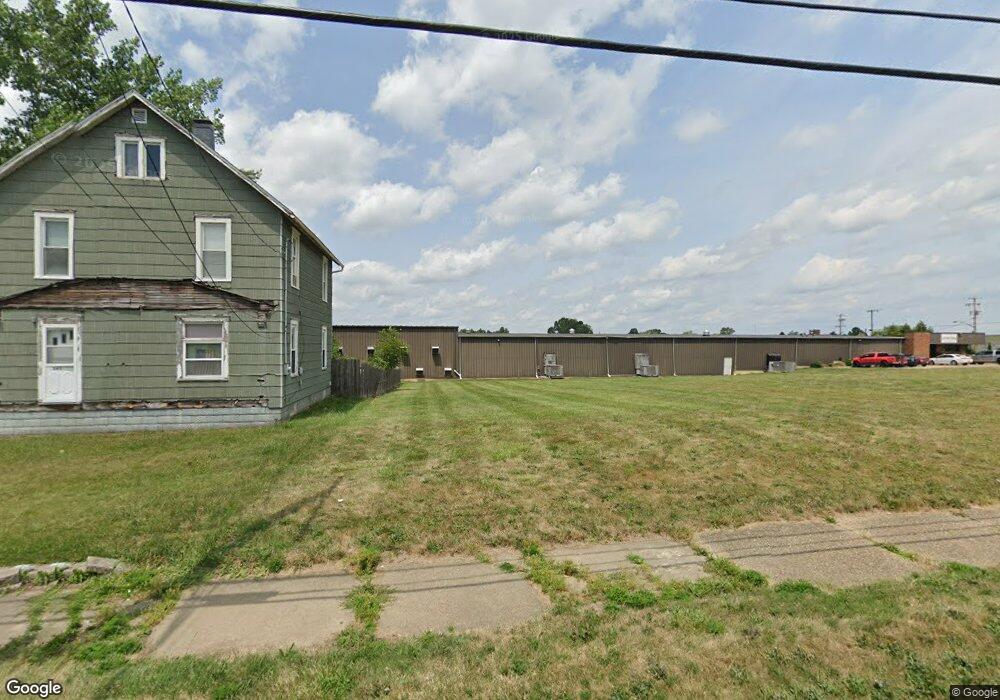
531 W Main St Alliance, OH 44601
2
Beds
1
Bath
1,167
Sq Ft
9,017
Sq Ft Lot
About This Home
This home is located at 531 W Main St, Alliance, OH 44601. 531 W Main St is a home located in Stark County with nearby schools including Alliance Early Learning School, Alliance Intermediate School at Northside, and Alliance Middle School.
Ownership History
Date
Name
Owned For
Owner Type
Purchase Details
Closed on
Nov 21, 2016
Sold by
Stark County Land Reutilization Corp
Bought by
46 North Rockhill Avenue Llc
Purchase Details
Closed on
Oct 27, 2016
Sold by
Manse Christopher J
Bought by
Stark County Land Reutilization Corporat
Purchase Details
Closed on
Oct 14, 2005
Sold by
Sickle Todd and Sickle Kathy
Bought by
Manse Christopher J
Purchase Details
Closed on
Dec 4, 1998
Sold by
Antha Sickle
Bought by
Sickle Todd and Sickle Kathy
Purchase Details
Closed on
Jan 13, 1989
Create a Home Valuation Report for This Property
The Home Valuation Report is an in-depth analysis detailing your home's value as well as a comparison with similar homes in the area
Home Values in the Area
Average Home Value in this Area
Purchase History
| Date | Buyer | Sale Price | Title Company |
|---|---|---|---|
| 46 North Rockhill Avenue Llc | -- | None Available | |
| Stark County Land Reutilization Corporat | -- | None Available | |
| Manse Christopher J | -- | -- | |
| Sickle Todd | $13,000 | -- | |
| -- | $18,000 | -- |
Source: Public Records
Tax History Compared to Growth
Tax History
| Year | Tax Paid | Tax Assessment Tax Assessment Total Assessment is a certain percentage of the fair market value that is determined by local assessors to be the total taxable value of land and additions on the property. | Land | Improvement |
|---|---|---|---|---|
| 2025 | -- | $1,330 | $1,330 | -- |
| 2024 | -- | $1,330 | $1,330 | -- |
| 2023 | $108 | $2,030 | $2,030 | -- |
| 2022 | $109 | $2,030 | $2,030 | $0 |
| 2021 | $108 | $2,030 | $2,030 | $0 |
| 2020 | $105 | $1,820 | $1,820 | $0 |
| 2019 | $102 | $1,820 | $1,820 | $0 |
| 2018 | $101 | $1,820 | $1,820 | $0 |
| 2017 | $0 | $2,380 | $2,380 | $0 |
| 2016 | $0 | $2,380 | $2,380 | $0 |
| 2015 | $114 | $2,380 | $2,380 | $0 |
| 2014 | $513 | $2,350 | $2,350 | $0 |
| 2013 | $56 | $2,350 | $2,350 | $0 |
Source: Public Records
Map
Nearby Homes
- 345 W Market St
- 329 1/2 W Main St
- 511 W Ely St
- 132 S Haines Ave
- 163 W Market St
- 725 W Summit St
- 432 Johnson Ave
- 645 W Summit St
- 734 Parkway Blvd
- 427 S Union Ave
- 140 W Summit St
- 505 N Union Ave
- 896 Parkway Blvd
- 000 Klinger Ave
- 000 Meadowbrook Ave
- 710 N Freedom Ave
- 124 E Wayne St
- 608 N Freedom Ave
- 738 Kingsway St
- 970 Kingsway St