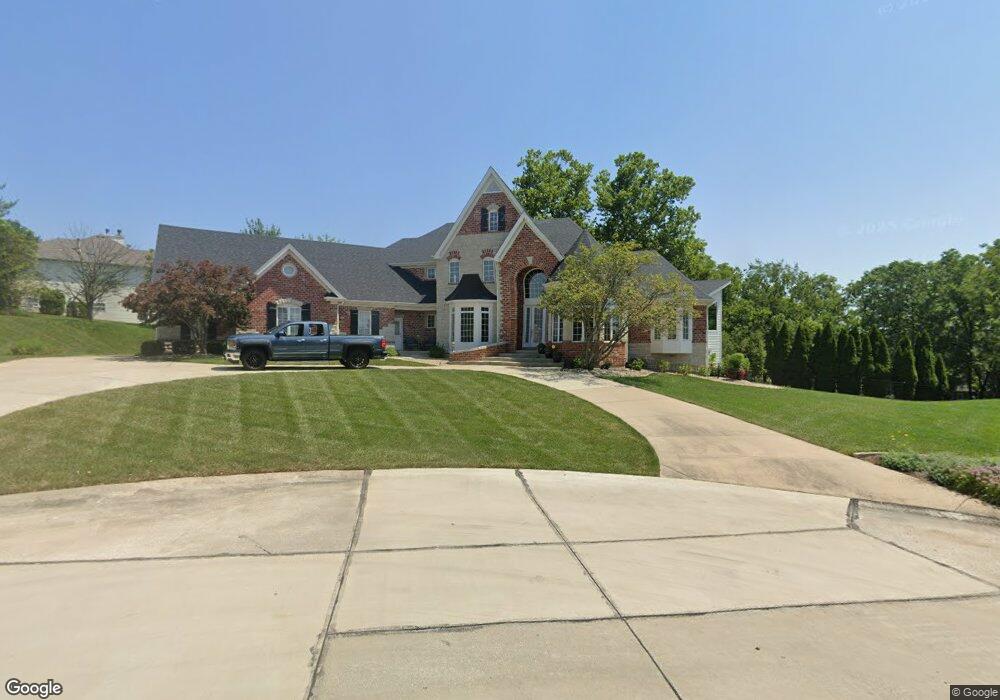
5310 Lancelot Dr Weldon Spring, MO 63304
Estimated Value: $1,487,962 - $1,719,000
5
Beds
5
Baths
5,258
Sq Ft
$306/Sq Ft
Est. Value
About This Home
This home is located at 5310 Lancelot Dr, Weldon Spring, MO 63304 and is currently estimated at $1,610,321, approximately $306 per square foot. 5310 Lancelot Dr is a home located in St. Charles County with nearby schools including Independence Elementary School, Bryan Middle School, and Francis Howell Union High School.
Ownership History
Date
Name
Owned For
Owner Type
Purchase Details
Closed on
Feb 16, 2018
Sold by
Orf Roger D and Orf Debra
Bought by
Orf Roger D and Orf Debra R
Current Estimated Value
Purchase Details
Closed on
Oct 15, 2010
Sold by
Billings William and Billings Kathy
Bought by
Orf Roger D and Orf Debra
Home Financials for this Owner
Home Financials are based on the most recent Mortgage that was taken out on this home.
Original Mortgage
$650,000
Outstanding Balance
$429,585
Interest Rate
4.38%
Mortgage Type
New Conventional
Estimated Equity
$1,180,736
Create a Home Valuation Report for This Property
The Home Valuation Report is an in-depth analysis detailing your home's value as well as a comparison with similar homes in the area
Home Values in the Area
Average Home Value in this Area
Purchase History
| Date | Buyer | Sale Price | Title Company |
|---|---|---|---|
| Orf Roger D | -- | None Available | |
| Orf Roger D | $820,000 | Ust |
Source: Public Records
Mortgage History
| Date | Status | Borrower | Loan Amount |
|---|---|---|---|
| Open | Orf Roger D | $650,000 |
Source: Public Records
Tax History
| Year | Tax Paid | Tax Assessment Tax Assessment Total Assessment is a certain percentage of the fair market value that is determined by local assessors to be the total taxable value of land and additions on the property. | Land | Improvement |
|---|---|---|---|---|
| 2025 | $14,007 | $258,332 | -- | -- |
| 2023 | $14,001 | $235,786 | $0 | $0 |
| 2022 | $11,850 | $185,373 | $0 | $0 |
| 2021 | $11,861 | $185,373 | $0 | $0 |
| 2020 | $11,180 | $169,122 | $0 | $0 |
| 2019 | $11,124 | $169,052 | $0 | $0 |
| 2018 | $11,531 | $167,556 | $0 | $0 |
| 2017 | $11,411 | $167,205 | $0 | $0 |
| 2016 | $11,269 | $159,050 | $0 | $0 |
| 2015 | $11,218 | $159,050 | $0 | $0 |
| 2014 | $10,914 | $150,109 | $0 | $0 |
Source: Public Records
Map
Nearby Homes
- 265 Camelot Dr
- 74 W Meath Ring
- 59 W Meath Ring
- 102 Enclave Terrace Ct
- 828 Nancy Ln
- 149 Shaelah Ct
- 1094 Whitmoor Dr
- 6 Whitmoor Ct
- 4 Upper Whitmoor Dr
- 4489 Austin Valley Ct
- 3624 Capri Way
- 5013 Royal Burgess Dr
- 3424 Capri Way
- 862 Whitmoor Dr
- 41 Wolfrum Rd
- 50 Crocknaraw Ln
- 5527 Hennsley Cir
- 323 San Marco Way
- 16 Knollwood Ct
- 1 Belcourt Cir
- 5306 Lancelot Dr
- 5314 Lancelot Dr
- 5307 Lancelot Dr
- 5311 Lancelot Dr
- 5315 Lancelot Dr
- 5318 Lancelot Dr
- 5319 Lancelot Dr
- 5322 Lancelot Dr
- 5327 Lancelot Dr
- 228 Camelot Dr
- 5335 Lancelot Dr
- 224 Camelot Dr
- 232 Camelot Dr
- 236 Camelot Dr
- 220 Camelot Dr
- 5339 Lancelot Dr
- 216 Camelot Dr
- 5330 Lancelot Dr
- 240 Camelot Dr
- 5334 Lancelot Dr
Your Personal Tour Guide
Ask me questions while you tour the home.