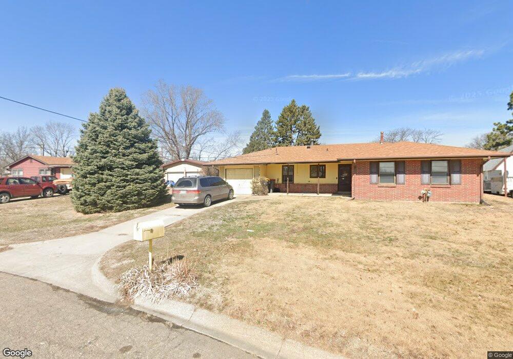
5310 Michael Cir Lincoln, NE 68524
Arnold Heights NeighborhoodEstimated Value: $172,000 - $216,000
3
Beds
2
Baths
1,232
Sq Ft
$158/Sq Ft
Est. Value
About This Home
This home is located at 5310 Michael Cir, Lincoln, NE 68524 and is currently estimated at $194,617, approximately $157 per square foot. 5310 Michael Cir is a home located in Lancaster County with nearby schools including Arnold Elementary School, Schoo Middle School, and North Star High School.
Ownership History
Date
Name
Owned For
Owner Type
Purchase Details
Closed on
Jun 4, 2018
Sold by
Charron Michael J and Charron Patricia A
Bought by
Alm Austin
Current Estimated Value
Home Financials for this Owner
Home Financials are based on the most recent Mortgage that was taken out on this home.
Original Mortgage
$102,400
Outstanding Balance
$88,170
Interest Rate
4.4%
Mortgage Type
VA
Estimated Equity
$106,447
Create a Home Valuation Report for This Property
The Home Valuation Report is an in-depth analysis detailing your home's value as well as a comparison with similar homes in the area
Home Values in the Area
Average Home Value in this Area
Purchase History
| Date | Buyer | Sale Price | Title Company |
|---|---|---|---|
| Alm Austin | $100,000 | Union Title Co Llc |
Source: Public Records
Mortgage History
| Date | Status | Borrower | Loan Amount |
|---|---|---|---|
| Open | Alm Austin | $102,400 |
Source: Public Records
Tax History Compared to Growth
Tax History
| Year | Tax Paid | Tax Assessment Tax Assessment Total Assessment is a certain percentage of the fair market value that is determined by local assessors to be the total taxable value of land and additions on the property. | Land | Improvement |
|---|---|---|---|---|
| 2025 | $2,468 | $178,900 | $57,200 | $121,700 |
| 2024 | $2,468 | $176,200 | $42,900 | $133,300 |
| 2023 | $2,747 | $163,900 | $33,000 | $130,900 |
| 2022 | $2,744 | $137,700 | $32,500 | $105,200 |
| 2021 | $2,596 | $137,700 | $25,000 | $112,700 |
| 2020 | $1,907 | $99,800 | $25,000 | $74,800 |
| 2019 | $1,907 | $99,800 | $25,000 | $74,800 |
| 2018 | $1,656 | $86,300 | $25,000 | $61,300 |
| 2017 | $1,672 | $86,300 | $25,000 | $61,300 |
| 2016 | $1,585 | $81,400 | $25,000 | $56,400 |
| 2015 | $1,574 | $81,400 | $25,000 | $56,400 |
| 2014 | $1,587 | $81,600 | $25,000 | $56,600 |
| 2013 | -- | $81,600 | $25,000 | $56,600 |
Source: Public Records
Map
Nearby Homes
- 5421 W Benton St
- 5401 W Benton St
- 3811 Castle Cir
- 3724 NW 49th St
- 4806 W Mathis St
- 4930 W Kingsley St
- 4121 NW 57th Ct
- 2909 NW 56 St
- 5407 W Butler Ave
- 4940 W Madison Ave
- 5411 Wilkins Cir
- 4140 W Huntington Ave
- 4135 W Huntington Ave
- 5031 W Condor Ln
- 2100 NW 45th St
- 5239 W Partridge Ln
- 5171 W Partridge Ln
- 5041 W Partridge Ln
- 4137 W Thatcher Ln
- 1722 NW 55th St
- 5320 Michael Cir
- 5300 Michael Cir
- 5315 W Luke St
- 5327 W Luke St
- 5301 W Luke St
- 5321 Michael Cir
- 3641 NW Michael St
- 3615 NW 54th St
- 5301 Michael Cir
- 3700 NW 53rd St
- 5311 Michael Cir
- 5441 W Benton St
- 3700 NW 54th St
- 3625 NW 54th St
- 5410 W Benton St
- 3631 NW Michael St
- 3701 NW 53rd St
- 3707 NW 54th St
- 3710 NW 53rd St
- 5431 W Benton St