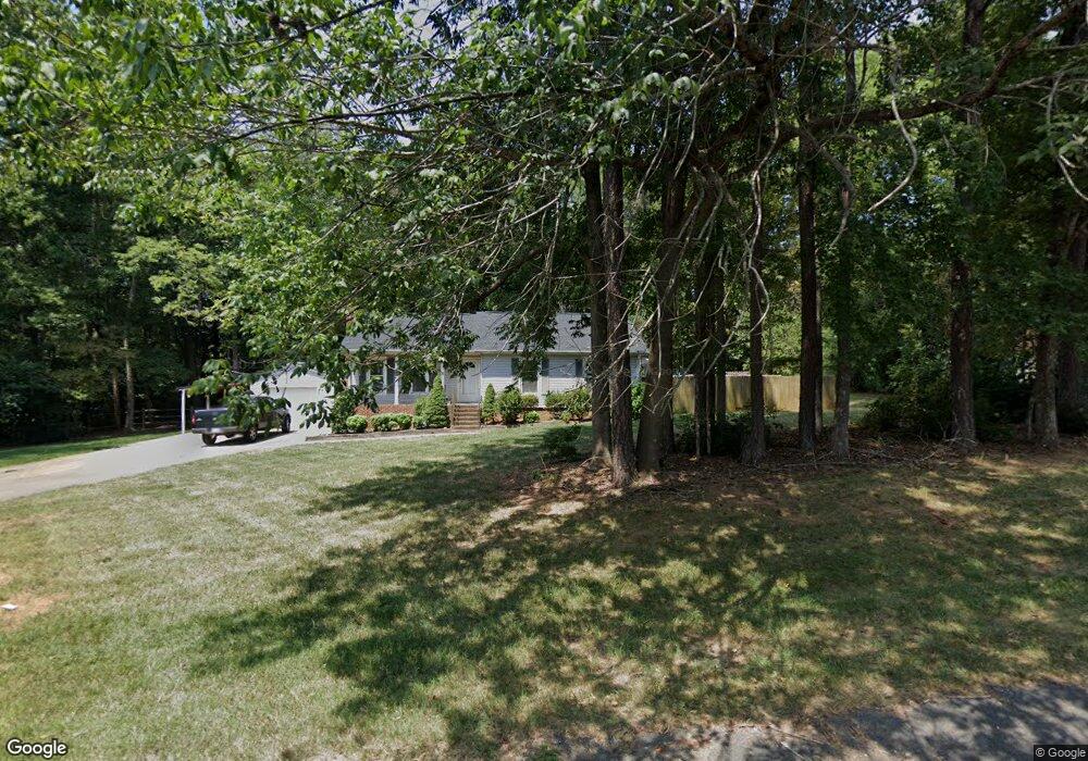
5311 Tanbark Ln Kannapolis, NC 28083
Estimated Value: $321,851 - $336,000
3
Beds
2
Baths
1,348
Sq Ft
$245/Sq Ft
Est. Value
About This Home
This home is located at 5311 Tanbark Ln, Kannapolis, NC 28083 and is currently estimated at $330,213, approximately $244 per square foot. 5311 Tanbark Ln is a home located in Cabarrus County with nearby schools including Mount Pleasant Elementary School, Mount Pleasant Middle School, and Mount Pleasant High School.
Ownership History
Date
Name
Owned For
Owner Type
Purchase Details
Closed on
Nov 30, 2005
Sold by
Jones Lieslotte and Jones Arthur David
Bought by
Praefke Donald M and Praefke Patricia M
Current Estimated Value
Home Financials for this Owner
Home Financials are based on the most recent Mortgage that was taken out on this home.
Original Mortgage
$119,770
Outstanding Balance
$65,624
Interest Rate
6.04%
Mortgage Type
FHA
Estimated Equity
$264,589
Purchase Details
Closed on
Sep 1, 1990
Bought by
Jones Arthur David
Purchase Details
Closed on
Aug 1, 1985
Create a Home Valuation Report for This Property
The Home Valuation Report is an in-depth analysis detailing your home's value as well as a comparison with similar homes in the area
Home Values in the Area
Average Home Value in this Area
Purchase History
| Date | Buyer | Sale Price | Title Company |
|---|---|---|---|
| Praefke Donald M | $147,500 | -- | |
| Jones Arthur David | $77,500 | -- | |
| -- | $68,500 | -- |
Source: Public Records
Mortgage History
| Date | Status | Borrower | Loan Amount |
|---|---|---|---|
| Open | Praefke Donald M | $119,770 |
Source: Public Records
Tax History Compared to Growth
Tax History
| Year | Tax Paid | Tax Assessment Tax Assessment Total Assessment is a certain percentage of the fair market value that is determined by local assessors to be the total taxable value of land and additions on the property. | Land | Improvement |
|---|---|---|---|---|
| 2025 | $1,999 | $295,660 | $65,000 | $230,660 |
| 2024 | $1,999 | $295,660 | $65,000 | $230,660 |
| 2023 | $1,435 | $166,820 | $34,000 | $132,820 |
| 2022 | $1,381 | $166,820 | $34,000 | $132,820 |
| 2021 | $1,381 | $166,820 | $34,000 | $132,820 |
| 2020 | $1,381 | $166,820 | $34,000 | $132,820 |
| 2019 | $1,119 | $135,170 | $26,000 | $109,170 |
| 2018 | $1,092 | $135,170 | $26,000 | $109,170 |
| 2017 | $1,038 | $135,170 | $26,000 | $109,170 |
| 2016 | $1,038 | $132,110 | $28,000 | $104,110 |
| 2015 | $1,015 | $132,110 | $28,000 | $104,110 |
| 2014 | $1,015 | $132,110 | $28,000 | $104,110 |
Source: Public Records
Map
Nearby Homes
- 5391 Sapp Rd
- 5875 Irish Potato Rd
- 3524 New Potato Dr
- 4630 Irish Potato Rd
- 6920 Goldfish Rd
- 3397 Camp Julia Rd
- 6475 Goldfish Rd
- 3535 Old Salisbury Concord Rd
- 4849 Samuel Richard St
- 5100 Patterson Rd
- 362 Farm Estates Dr
- 245 Farm Estates Dr
- 2707 Ireton Place
- 145 Wellington Estates Dr
- 165 Wellington Estates Dr
- 3007 Centergrove Rd
- 280 Ketner Farm Rd
- 2882 Centergrove Rd
- 150 Beth Dr
- 2661 Sides Rd
- 5307 Tanbark Ln
- 5319 Tanbark Ln
- 5306 Tanbark Ln
- 5300 Sapp Rd
- 5310 Tanbark Ln
- 5323 Tanbark Ln
- 5318 Tanbark Ln
- 5384 Sapp Rd
- 5322 Tanbark Ln
- 5377 Sapp Rd
- 5349 Sapp Rd
- 5304 Teakwood Dr
- 5119 Teakwood Dr
- 5310 Teakwood Dr
- 5113 Teakwood Dr
- 5109 Teakwood Dr
- 5205 Teakwood Dr
- 5226 Teakwood Dr
- 5106 Teakwood Dr
- 5327 Irish Potato Rd