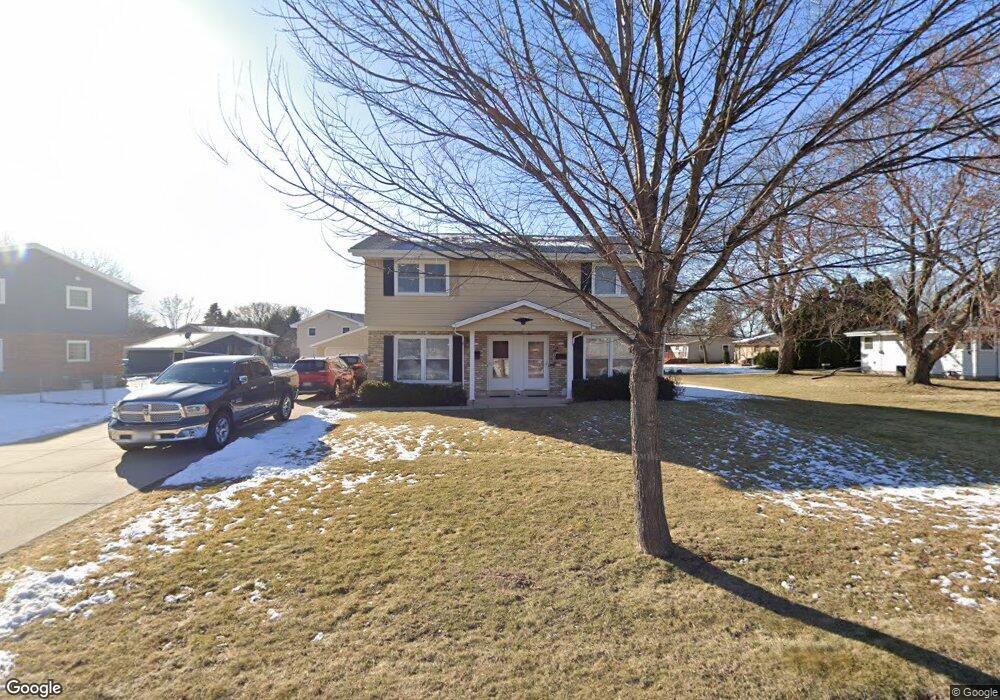
5312 Root River Dr Unit 1 Greendale, WI 53129
Estimated Value: $398,886 - $497,000
--
Bed
--
Bath
2,469
Sq Ft
$188/Sq Ft
Est. Value
About This Home
This home is located at 5312 Root River Dr Unit 1, Greendale, WI 53129 and is currently estimated at $464,972, approximately $188 per square foot. 5312 Root River Dr Unit 1 is a home located in Milwaukee County with nearby schools including College Park Elementary School, Greendale Middle School, and Greendale High School.
Ownership History
Date
Name
Owned For
Owner Type
Purchase Details
Closed on
Dec 7, 2015
Sold by
Denzien Thomas M and Denzien Andrea L
Bought by
5312-5314 Root River Drive Llc
Current Estimated Value
Purchase Details
Closed on
Aug 5, 2011
Sold by
Treu Matthew A
Bought by
Denzien Thomas M and Denzien Andrea L
Home Financials for this Owner
Home Financials are based on the most recent Mortgage that was taken out on this home.
Original Mortgage
$140,000
Interest Rate
4.54%
Mortgage Type
New Conventional
Purchase Details
Closed on
Sep 23, 2004
Sold by
Thomas John
Bought by
Treu Matthew A
Home Financials for this Owner
Home Financials are based on the most recent Mortgage that was taken out on this home.
Original Mortgage
$213,200
Interest Rate
5.89%
Mortgage Type
Purchase Money Mortgage
Create a Home Valuation Report for This Property
The Home Valuation Report is an in-depth analysis detailing your home's value as well as a comparison with similar homes in the area
Home Values in the Area
Average Home Value in this Area
Purchase History
| Date | Buyer | Sale Price | Title Company |
|---|---|---|---|
| 5312-5314 Root River Drive Llc | -- | Attorney | |
| Denzien Thomas M | $230,000 | Knight Barry Title Inc | |
| Treu Matthew A | $266,500 | -- |
Source: Public Records
Mortgage History
| Date | Status | Borrower | Loan Amount |
|---|---|---|---|
| Previous Owner | Denzien Thomas M | $140,000 | |
| Previous Owner | Treu Matthew A | $213,200 |
Source: Public Records
Tax History Compared to Growth
Tax History
| Year | Tax Paid | Tax Assessment Tax Assessment Total Assessment is a certain percentage of the fair market value that is determined by local assessors to be the total taxable value of land and additions on the property. | Land | Improvement |
|---|---|---|---|---|
| 2024 | $5,942 | $328,300 | $73,000 | $255,300 |
| 2023 | $5,545 | $283,700 | $73,000 | $210,700 |
| 2022 | $5,565 | $283,700 | $73,000 | $210,700 |
| 2021 | $6,226 | $241,900 | $65,200 | $176,700 |
| 2020 | $6,142 | $241,900 | $65,200 | $176,700 |
| 2019 | $6,154 | $241,900 | $65,200 | $176,700 |
| 2018 | $6,312 | $241,900 | $65,200 | $176,700 |
| 2017 | $5,984 | $236,100 | $62,700 | $173,400 |
| 2016 | $5,953 | $236,100 | $62,700 | $173,400 |
| 2015 | $6,161 | $233,900 | $62,700 | $171,200 |
| 2014 | $6,134 | $233,900 | $62,700 | $171,200 |
| 2013 | $6,241 | $233,900 | $62,700 | $171,200 |
Source: Public Records
Map
Nearby Homes
- 5818 Riverside Dr
- 5255 W Princeton Dr
- 4923 W Devinshire Dr
- 5232 W Princeton Pines Ct
- 5527 Oakwood St
- 5550 Oakwood Ct
- 6703 Riverdale Ln
- 5830 Lakeview Dr
- 5491 Laura Ln
- 4540 W Melissa Ct
- 6190 W Loomis Rd
- 4293 W College Ave
- 5732 W Rawson Ave
- 6958 S Craig Ct
- 7140 S 51st St
- 4021 W College Ave
- 4022 W College Ave
- 3950 W College Ave
- 7155 S 49th St
- 6980 Horizon Dr
- 5322 Root River Dr Unit 2
- 5328 Radcliff Dr
- 5328 Rainbow Dr Unit 3
- 5326 Radcliff Dr
- 5130 Russell Dr
- 5338 Rainbow Dr Unit 4
- 5237 Roberts Dr
- 5238 Roberts Dr
- 5336 Root River Dr Unit 3
- 5324 Radcliff Dr
- 5133 Russell Dr
- 5337 Rainbow Dr Unit 3
- 5397 Rainbow Dr Unit 9
- 5368 Rainbow Dr Unit 7
- 5128 Russell Dr
- 5235 Roberts Dr
- 5236 Roberts Dr
- 5327 Radcliff Dr
- 5325 Radcliff Dr
- 5366 Root River Dr Unit 6