Estimated Value: $165,000 - $178,000
3
Beds
1
Bath
1,030
Sq Ft
$166/Sq Ft
Est. Value
About This Home
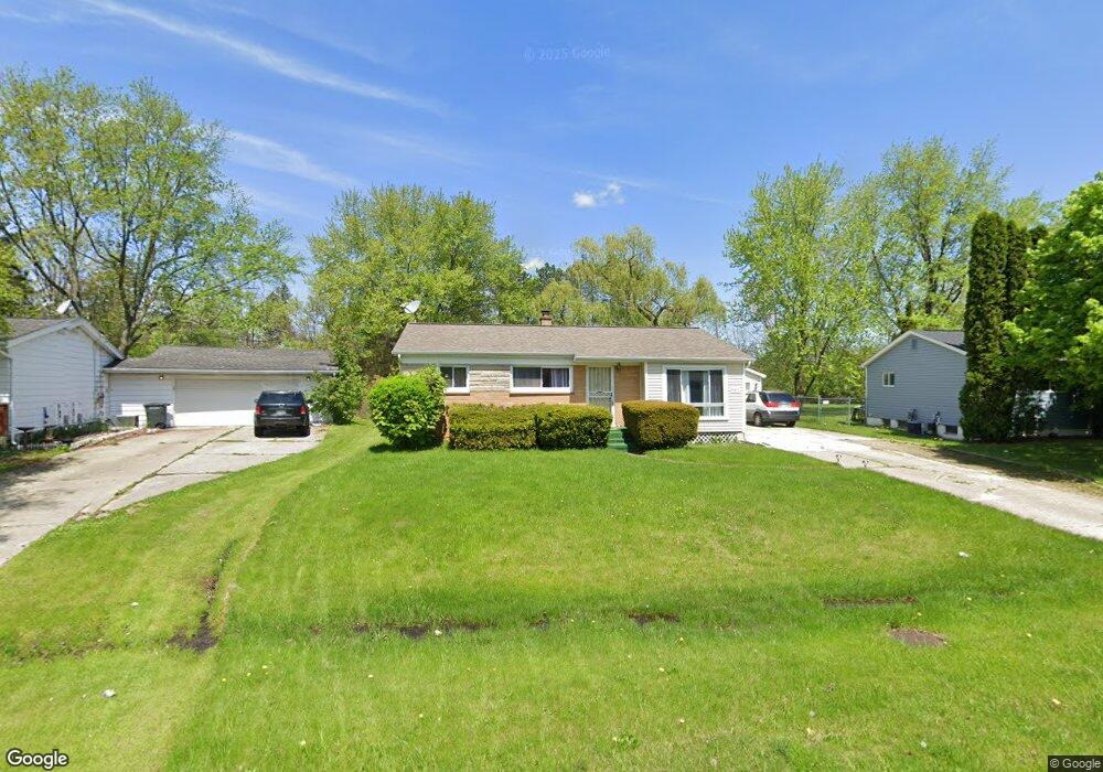
This home is located at 5312 Westchester Dr, Flint, MI 48532 and is currently estimated at $170,537, approximately $165 per square foot. 5312 Westchester Dr is a home located in Genesee County with nearby schools including Carman-Ainsworth High School, Genesee STEM Academy, and First Flint Seventh-day Adventist Christian School.
Ownership History
Date
Name
Owned For
Owner Type
Purchase Details
Closed on
Jun 20, 2017
Sold by
Silva Mark Athony
Bought by
Silver Jacquelin
Current Estimated Value
Home Financials for this Owner
Home Financials are based on the most recent Mortgage that was taken out on this home.
Original Mortgage
$80,559
Outstanding Balance
$62,802
Interest Rate
4.37%
Mortgage Type
FHA
Estimated Equity
$107,735
Purchase Details
Closed on
Nov 4, 2002
Sold by
Moore Eunice R and Estate Of Chester Edward Moore
Bought by
Silva Mark Anthony and Silva Jacqueline
Create a Home Valuation Report for This Property
The Home Valuation Report is an in-depth analysis detailing your home's value as well as a comparison with similar homes in the area
Home Values in the Area
Average Home Value in this Area
Purchase History
| Date | Buyer | Sale Price | Title Company |
|---|---|---|---|
| Silver Jacquelin | -- | None Available | |
| Silva Mark Anthony | $109,900 | -- |
Source: Public Records
Mortgage History
| Date | Status | Borrower | Loan Amount |
|---|---|---|---|
| Open | Silver Jacquelin | $80,559 |
Source: Public Records
Tax History Compared to Growth
Tax History
| Year | Tax Paid | Tax Assessment Tax Assessment Total Assessment is a certain percentage of the fair market value that is determined by local assessors to be the total taxable value of land and additions on the property. | Land | Improvement |
|---|---|---|---|---|
| 2025 | $1,859 | $71,400 | $0 | $0 |
| 2024 | $932 | $72,700 | $0 | $0 |
| 2023 | $890 | $63,000 | $0 | $0 |
| 2022 | $801 | $53,600 | $0 | $0 |
| 2021 | $1,626 | $46,600 | $0 | $0 |
| 2020 | $799 | $41,500 | $0 | $0 |
| 2019 | $788 | $37,900 | $0 | $0 |
| 2018 | $1,559 | $35,100 | $0 | $0 |
| 2017 | $1,813 | $35,100 | $0 | $0 |
| 2016 | $1,480 | $34,100 | $0 | $0 |
| 2015 | $1,323 | $34,200 | $0 | $0 |
| 2014 | $785 | $32,900 | $0 | $0 |
| 2012 | -- | $32,200 | $32,200 | $0 |
Source: Public Records
Map
Nearby Homes
- 5406 Litchfield Dr
- 5323 Elmsford Dr
- 0000 Reuben Reuben St
- 1460 S Dye Rd
- 5503 Westchester Dr
- 1417 Grassmere Ave
- 5489 Brobeck St
- 6007 Corunna Rd
- 1442 Mintola Ave
- 2462 Valley Oaks Cir
- 5345 Birchtree Ct
- 2356 S Dye Rd
- 6098 Corunna Rd
- 1455 S Linden Rd
- 4480 Corunna Rd
- 4474 Corunna Rd
- 6090 Lancaster Dr
- 3.9 Acres W Court St
- 000 Corunna Rd
- 5325 N Dyewood Dr
- 5318 Westchester Dr
- 5328 Westchester Dr
- 5304 Westchester Dr
- 2076 Deerfield Dr
- 5298 Westchester Dr
- 5337 Corunna Rd
- 5334 Westchester Dr
- 5340 Westchester Dr
- 5331 Westchester Dr
- 5297 Westchester Dr Unit Bldg-Unit
- 5297 Westchester Dr
- 2073 Deerfield Dr
- 5335 Westchester Dr
- 5350 Westchester Dr
- 2079 Deerfield Dr
- 2091 Kenwood Dr
- 2085 Kenwood Dr
- 5369 Devon Ct
- 5341 Westchester Dr
- 2077 Kenwood Dr