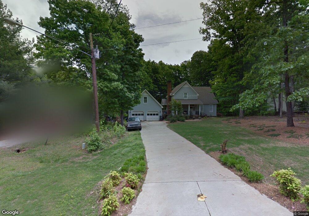
5313 April Wind Dr Fuquay Varina, NC 27526
Estimated Value: $332,000 - $367,000
--
Bed
2
Baths
1,704
Sq Ft
$208/Sq Ft
Est. Value
About This Home
This home is located at 5313 April Wind Dr, Fuquay Varina, NC 27526 and is currently estimated at $353,855, approximately $207 per square foot. 5313 April Wind Dr is a home located in Wake County with nearby schools including Banks Road Elementary School and West Lake Middle.
Ownership History
Date
Name
Owned For
Owner Type
Purchase Details
Closed on
Feb 28, 2002
Sold by
Conkling Mark A
Bought by
Howard Patrick L and Howard Julie Freeman
Current Estimated Value
Home Financials for this Owner
Home Financials are based on the most recent Mortgage that was taken out on this home.
Original Mortgage
$95,400
Outstanding Balance
$39,150
Interest Rate
6.81%
Estimated Equity
$314,705
Create a Home Valuation Report for This Property
The Home Valuation Report is an in-depth analysis detailing your home's value as well as a comparison with similar homes in the area
Home Values in the Area
Average Home Value in this Area
Purchase History
| Date | Buyer | Sale Price | Title Company |
|---|---|---|---|
| Howard Patrick L | $120,000 | -- |
Source: Public Records
Mortgage History
| Date | Status | Borrower | Loan Amount |
|---|---|---|---|
| Open | Howard Patrick L | $95,400 |
Source: Public Records
Tax History Compared to Growth
Tax History
| Year | Tax Paid | Tax Assessment Tax Assessment Total Assessment is a certain percentage of the fair market value that is determined by local assessors to be the total taxable value of land and additions on the property. | Land | Improvement |
|---|---|---|---|---|
| 2025 | $2,127 | $329,414 | $85,000 | $244,414 |
| 2024 | $2,066 | $329,414 | $85,000 | $244,414 |
| 2023 | $1,791 | $227,078 | $58,000 | $169,078 |
| 2022 | $1,660 | $227,078 | $58,000 | $169,078 |
| 2021 | $1,616 | $227,078 | $58,000 | $169,078 |
| 2020 | $1,589 | $227,078 | $58,000 | $169,078 |
| 2019 | $1,481 | $178,945 | $48,000 | $130,945 |
| 2018 | $1,363 | $178,945 | $48,000 | $130,945 |
| 2017 | $1,292 | $178,945 | $48,000 | $130,945 |
| 2016 | $1,266 | $178,945 | $48,000 | $130,945 |
| 2015 | $1,183 | $167,438 | $48,000 | $119,438 |
| 2014 | $1,122 | $167,438 | $48,000 | $119,438 |
Source: Public Records
Map
Nearby Homes
- 3324 Air Park Rd
- 3400 Air Park Rd
- 1601 Malcus Ct Unit 65
- 3320 Highgate Rd
- 9045 Chelsea Dr
- 4012 Sorrell Brothers Ct
- 9008 Chelsea Dr
- 4008 Bankshire Ln
- 3205 Banks Rd
- 2417 Ridgeford Ct
- 2029 Howson Rd
- 1504 Malcus Ct Unit 52
- 4313 Darius Ln
- 4313 Darius Ln Unit 25
- 6208 Silver Spring Ct
- 4225 Hilltop Needmore Rd
- 4229 Hilltop Needmore Rd
- 5417 Willow Bridge Ln
- Macon Plan at Rowland's Grant
- Madison Plan at Rowland's Grant
- 5317 April Wind Dr
- 5309 April Wind Dr
- 5321 April Wind Dr
- 5312 April Wind Dr
- 5311 April Wind Dr
- 5314 April Wind Dr
- 5325 April Wind Dr
- 5316 April Wind Dr
- 5308 April Wind Dr
- 5320 April Wind Dr
- 5324 April Wind Dr
- 5329 April Wind Dr
- 5328 April Wind Dr
- 5333 April Wind Dr
- 5332 April Wind Dr
- 3520 Wind Haven Dr
- 5336 April Wind Dr
- 3516 Wind Haven Dr
- 3521 Wind Haven Dr
- 5340 April Wind Dr