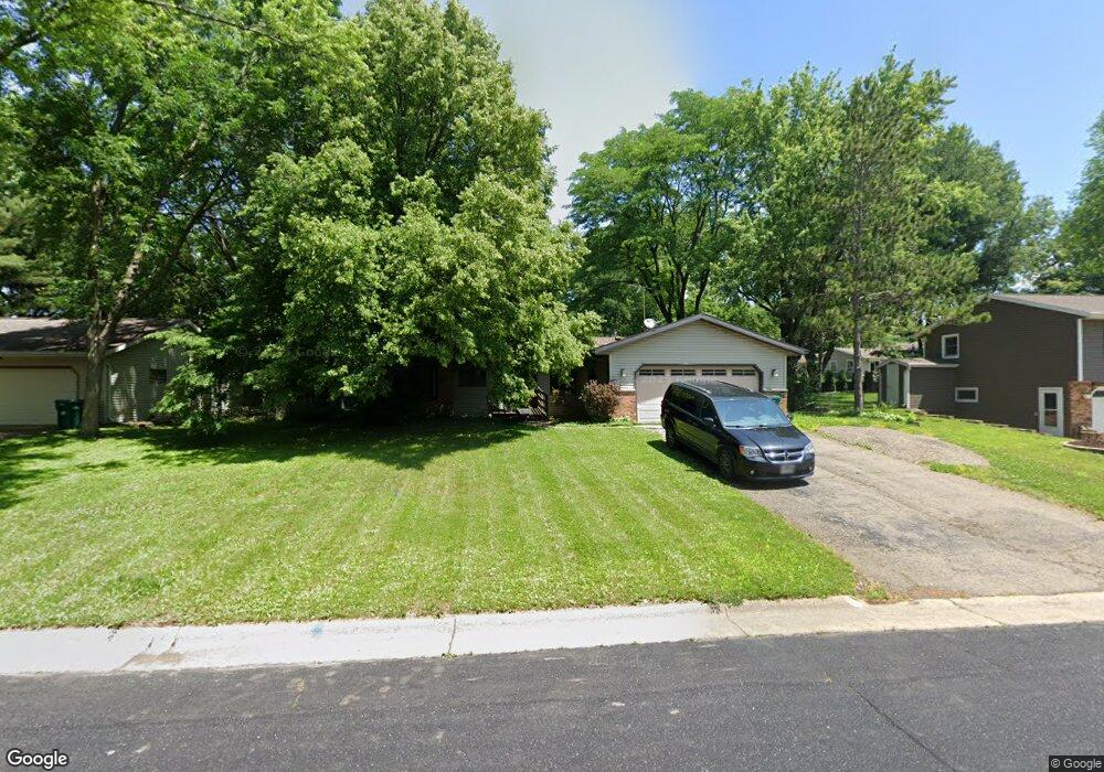
5314 Lani Ln Mc Farland, WI 53558
Estimated Value: $390,000 - $434,000
3
Beds
2
Baths
1,830
Sq Ft
$227/Sq Ft
Est. Value
About This Home
This home is located at 5314 Lani Ln, Mc Farland, WI 53558 and is currently estimated at $415,202, approximately $226 per square foot. 5314 Lani Ln is a home located in Dane County with nearby schools including Conrad Elvehjem Primary School, 4K McFarland, and Waubesa Intermediate School.
Ownership History
Date
Name
Owned For
Owner Type
Purchase Details
Closed on
Jul 26, 2011
Sold by
Schoeller Jeff A
Bought by
Schoeller Kelly C
Current Estimated Value
Purchase Details
Closed on
Feb 26, 2009
Sold by
Johnson Eric W and Johnson Nancy J
Bought by
Schoeller Jeff and Schoeller Kelly
Home Financials for this Owner
Home Financials are based on the most recent Mortgage that was taken out on this home.
Original Mortgage
$176,000
Outstanding Balance
$111,971
Interest Rate
5.14%
Mortgage Type
Purchase Money Mortgage
Estimated Equity
$303,231
Create a Home Valuation Report for This Property
The Home Valuation Report is an in-depth analysis detailing your home's value as well as a comparison with similar homes in the area
Home Values in the Area
Average Home Value in this Area
Purchase History
| Date | Buyer | Sale Price | Title Company |
|---|---|---|---|
| Schoeller Kelly C | -- | None Available | |
| Schoeller Jeff | $220,000 | None Available |
Source: Public Records
Mortgage History
| Date | Status | Borrower | Loan Amount |
|---|---|---|---|
| Open | Schoeller Jeff | $176,000 |
Source: Public Records
Tax History Compared to Growth
Tax History
| Year | Tax Paid | Tax Assessment Tax Assessment Total Assessment is a certain percentage of the fair market value that is determined by local assessors to be the total taxable value of land and additions on the property. | Land | Improvement |
|---|---|---|---|---|
| 2024 | $5,515 | $355,100 | $81,900 | $273,200 |
| 2023 | $5,193 | $331,000 | $63,000 | $268,000 |
| 2021 | $4,880 | $268,000 | $63,000 | $205,000 |
| 2020 | $4,728 | $249,500 | $63,000 | $186,500 |
| 2019 | $4,778 | $246,100 | $63,000 | $183,100 |
| 2018 | $4,571 | $229,100 | $63,000 | $166,100 |
| 2017 | $4,513 | $217,900 | $63,000 | $154,900 |
| 2016 | $4,394 | $209,900 | $63,000 | $146,900 |
| 2015 | $4,148 | $201,200 | $63,000 | $138,200 |
| 2014 | $4,172 | $193,500 | $63,000 | $130,500 |
| 2013 | $4,419 | $208,700 | $75,300 | $133,400 |
Source: Public Records
Map
Nearby Homes
- 5308 Dennis Dr
- 6203 Exchange St
- 5605 Osborn Dr
- 5625 Osborn Dr Unit 5625
- 6002 Running Deer Trail
- 5802 Leanne Ln
- 6207 Indian Mound Dr
- 4719 Burma Rd
- 6402 Brendan Cir
- 5764 Lexington St
- 5802 Sauk Ln
- 4703 Grandview Ct
- 5771 Holscher Rd Unit 2
- 5502 Valley Dr
- 5412 Main St
- 5409 Valley Dr
- 5942 Rosewood Dr
- 6401 Prairie Wood Dr
- 6407 Prairie Wood Dr
- The Beryl Plan at Rosewood Fields