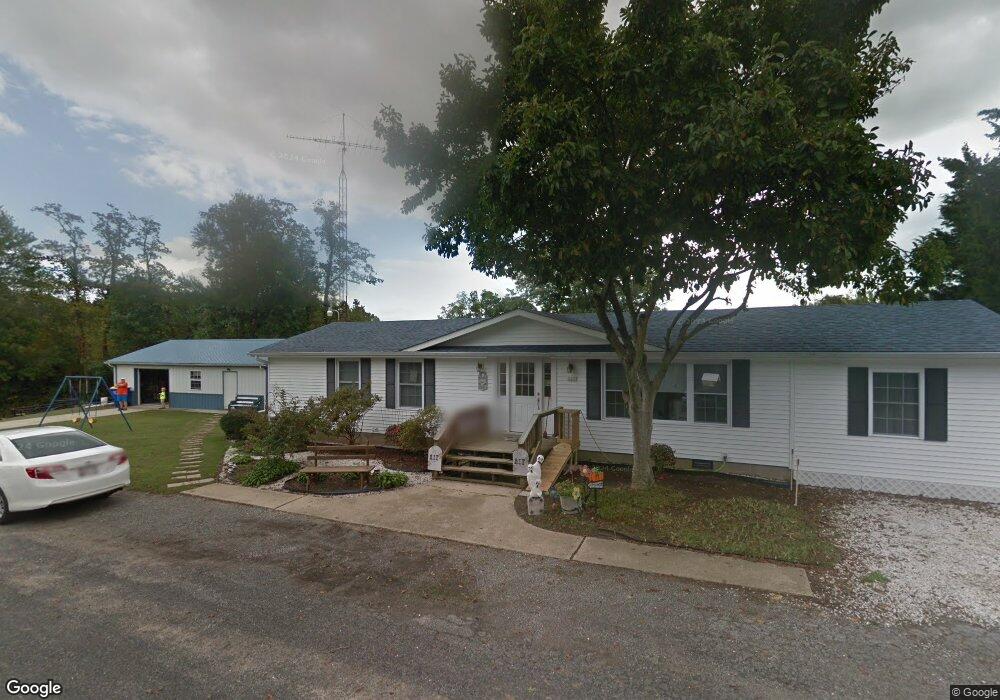
5317 Cedar Dr Cambridge, MD 21613
Estimated Value: $230,647 - $384,000
Studio
2
Baths
1,680
Sq Ft
$183/Sq Ft
Est. Value
About This Home
This home is located at 5317 Cedar Dr, Cambridge, MD 21613 and is currently estimated at $307,412, approximately $182 per square foot. 5317 Cedar Dr is a home located in Dorchester County with nearby schools including Maple Elementary School, Mace's Lane Middle School, and Cambridge-South Dorchester High School.
Ownership History
Date
Name
Owned For
Owner Type
Purchase Details
Closed on
Jan 13, 2022
Sold by
Mitchell Dennis L and Mitchell Michelle C
Bought by
Mitchell Christopher Dennis and Mitchell David Jared
Current Estimated Value
Purchase Details
Closed on
Dec 21, 1989
Sold by
Pliescott Ruth W
Bought by
Mitchell Dennis L and Mitchell Michelle C
Home Financials for this Owner
Home Financials are based on the most recent Mortgage that was taken out on this home.
Original Mortgage
$55,000
Interest Rate
9.75%
Create a Home Valuation Report for This Property
The Home Valuation Report is an in-depth analysis detailing your home's value as well as a comparison with similar homes in the area
Home Values in the Area
Average Home Value in this Area
Purchase History
| Date | Buyer | Sale Price | Title Company |
|---|---|---|---|
| Mitchell Christopher Dennis | -- | None Listed On Document | |
| Mitchell Dennis L | $55,000 | -- |
Source: Public Records
Mortgage History
| Date | Status | Borrower | Loan Amount |
|---|---|---|---|
| Previous Owner | Mitchell Dennis L | $55,000 |
Source: Public Records
Tax History
| Year | Tax Paid | Tax Assessment Tax Assessment Total Assessment is a certain percentage of the fair market value that is determined by local assessors to be the total taxable value of land and additions on the property. | Land | Improvement |
|---|---|---|---|---|
| 2025 | $1,855 | $162,733 | $0 | $0 |
| 2024 | $1,710 | $149,100 | $44,600 | $104,500 |
| 2023 | $1,710 | $148,400 | $0 | $0 |
| 2022 | $3,405 | $147,700 | $0 | $0 |
| 2021 | $1,646 | $147,000 | $44,600 | $102,400 |
| 2020 | $1,646 | $142,633 | $0 | $0 |
| 2019 | $1,598 | $138,267 | $0 | $0 |
| 2018 | $1,549 | $133,900 | $44,600 | $89,300 |
| 2017 | $1,514 | $133,900 | $0 | $0 |
| 2016 | -- | $133,900 | $0 | $0 |
| 2015 | -- | $137,000 | $0 | $0 |
| 2014 | -- | $137,000 | $0 | $0 |
Source: Public Records
Map
Nearby Homes
- 5549 Bonnie Brook Rd
- 5302 River Dr
- 0 Ocean Gateway Unit MDDO2010024
- 3011 - 3017 Beverly Ln
- 0 Cordtown Rd Unit MDDO2009996
- 0 Cordtown Rd Unit MDDO2006048
- 0 Cordtown Rd Unit MDDO2009994
- 2918 Old Route 50
- 3202 Holly Ln
- 5421 N Skipjack Dr
- Homesite 53 Marsh Elder Dr
- 2215 Winterberry Ln
- 2210 Winterberry Ln
- 2203 Winterberry Ln
- 2830 Persimmon Place
- 2197 Winterberry Ln
- 2804 Persimmon Place
- 2187 Winterberry Ln
- 2190 Winterberry Ln
- 2182 Winterberry Ln
- 5319 Cedar Dr
- 5320 Cedar Dr
- 5322 Cedar Dr
- 5324 Cedar Dr
- 5315 Backwoods Dr
- 5314 Backwoods Dr
- 0 Poplar Dr
- 0 Poplar Dr Unit 1000210882
- 5320 Suburban Dr
- 5318 Cedar Dr
- 5326 Suburban Dr
- 5313 Backwoods Dr
- 5314 Suburban Dr
- 5310 Cedar Dr
- 5312 Suburban Dr
- 3031 Center Dr
- 5322 Suburban Dr
- 3027 Center Dr
- 5326 River Dr
- 3104 Ocean Gateway
Your Personal Tour Guide
Ask me questions while you tour the home.