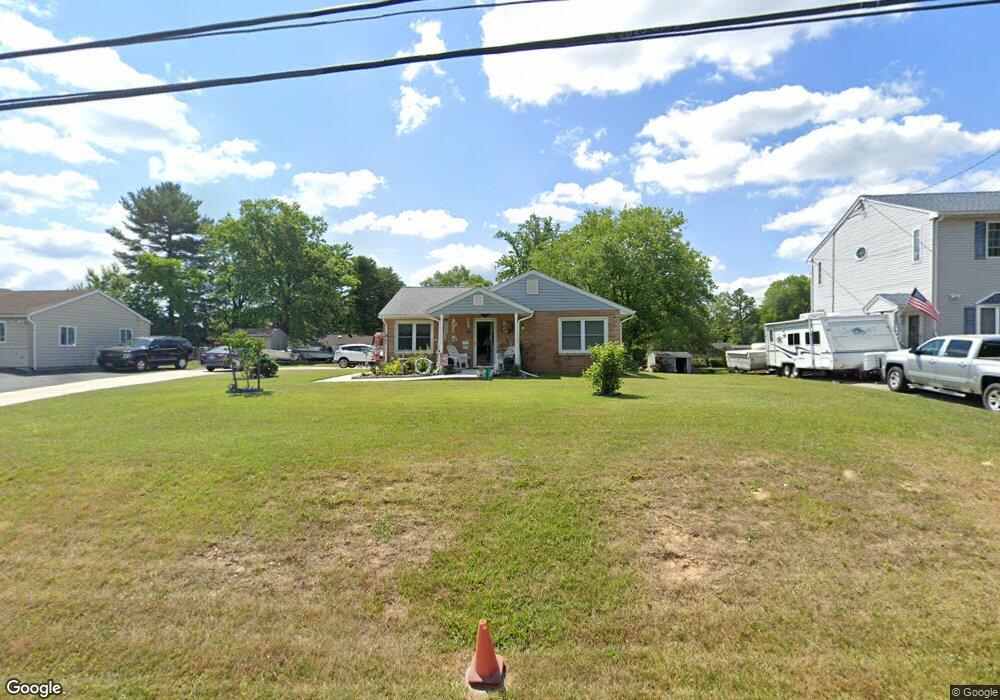
5317 Forge Rd White Marsh, MD 21162
Estimated Value: $385,000 - $434,392
3
Beds
2
Baths
1,980
Sq Ft
$211/Sq Ft
Est. Value
About This Home
This home is located at 5317 Forge Rd, White Marsh, MD 21162 and is currently estimated at $418,098, approximately $211 per square foot. 5317 Forge Rd is a home located in Baltimore County with nearby schools including Honeygo Elementary School, Perry Hall Middle School, and Perry Hall High School.
Ownership History
Date
Name
Owned For
Owner Type
Purchase Details
Closed on
Sep 21, 2018
Sold by
Goulden James E and Goulden Heather M
Bought by
Wingerd Cynthia A
Current Estimated Value
Home Financials for this Owner
Home Financials are based on the most recent Mortgage that was taken out on this home.
Original Mortgage
$128,000
Outstanding Balance
$111,394
Interest Rate
4.5%
Mortgage Type
New Conventional
Estimated Equity
$306,704
Purchase Details
Closed on
May 26, 1976
Sold by
Boschert Anna M
Bought by
Goulden James E and Goulden Heather M
Create a Home Valuation Report for This Property
The Home Valuation Report is an in-depth analysis detailing your home's value as well as a comparison with similar homes in the area
Home Values in the Area
Average Home Value in this Area
Purchase History
| Date | Buyer | Sale Price | Title Company |
|---|---|---|---|
| Wingerd Cynthia A | $160,000 | Universal Title | |
| Goulden James E | $31,000 | -- |
Source: Public Records
Mortgage History
| Date | Status | Borrower | Loan Amount |
|---|---|---|---|
| Open | Wingerd Cynthia A | $128,000 |
Source: Public Records
Tax History Compared to Growth
Tax History
| Year | Tax Paid | Tax Assessment Tax Assessment Total Assessment is a certain percentage of the fair market value that is determined by local assessors to be the total taxable value of land and additions on the property. | Land | Improvement |
|---|---|---|---|---|
| 2025 | $4,621 | $273,300 | -- | -- |
| 2024 | $4,621 | $269,200 | $0 | $0 |
| 2023 | $2,099 | $265,100 | $87,500 | $177,600 |
| 2022 | $4,029 | $254,967 | $0 | $0 |
| 2021 | $4,025 | $244,833 | $0 | $0 |
| 2020 | $3,928 | $234,700 | $87,500 | $147,200 |
| 2019 | $2,772 | $228,733 | $0 | $0 |
| 2018 | $2,700 | $222,767 | $0 | $0 |
| 2017 | $3,589 | $216,800 | $0 | $0 |
| 2016 | $3,059 | $213,400 | $0 | $0 |
| 2015 | $3,059 | $210,000 | $0 | $0 |
| 2014 | $3,059 | $206,600 | $0 | $0 |
Source: Public Records
Map
Nearby Homes
- 0 New Forge Rd Unit MDBC2145794
- 5214 Forge Rd
- 11540 Philadelphia Rd Unit 5
- 7 Bangert Ave
- 9804 Kerries Ct
- 5703 Allender Rd
- 5506 Madge Ct
- 5717 Station Rd
- 5662 Gunpowder Rd
- 11572 Autumn Terrace Dr
- 5733 Allender Rd
- 11604 Jerome Ave
- 5507 Kathryns Ct
- 11503 Jerome Ave
- 5603 Overlook Ct
- 11721 Hamilton Place
- 9307 Georgia Belle Dr
- 5312 Heartland Way
- 5310 Heartland Way
- 5308 Heartland Way
