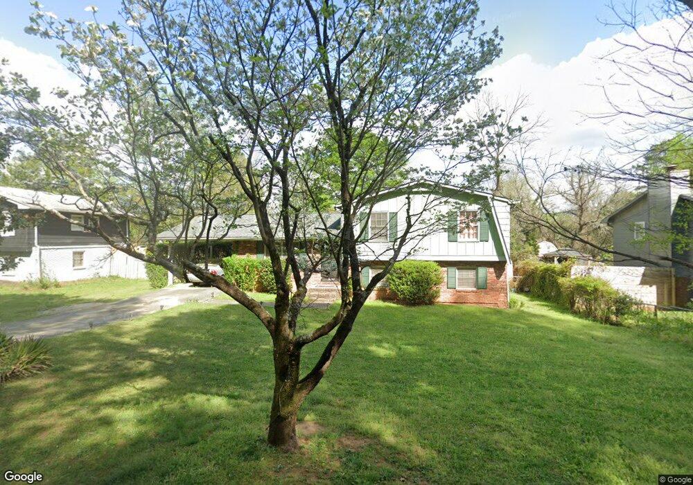
5318 Scofield Rd Atlanta, GA 30349
Estimated Value: $149,000 - $238,000
3
Beds
2
Baths
1,248
Sq Ft
$165/Sq Ft
Est. Value
About This Home
This home is located at 5318 Scofield Rd, Atlanta, GA 30349 and is currently estimated at $205,440, approximately $164 per square foot. 5318 Scofield Rd is a home located in Fulton County with nearby schools including Heritage Elementary School, Woodland Middle School, and Banneker High School.
Ownership History
Date
Name
Owned For
Owner Type
Purchase Details
Closed on
Mar 17, 2008
Sold by
Securitized A Trust 2007 & Br4
Bought by
Eason Rodney L
Current Estimated Value
Purchase Details
Closed on
Sep 16, 2007
Sold by
Washington Ronald
Bought by
Securitized Asset Trust 2007 & B
Purchase Details
Closed on
Sep 14, 2005
Sold by
Hix Alvin E
Bought by
Washington Ronald
Home Financials for this Owner
Home Financials are based on the most recent Mortgage that was taken out on this home.
Original Mortgage
$87,600
Interest Rate
5.77%
Mortgage Type
New Conventional
Create a Home Valuation Report for This Property
The Home Valuation Report is an in-depth analysis detailing your home's value as well as a comparison with similar homes in the area
Home Values in the Area
Average Home Value in this Area
Purchase History
| Date | Buyer | Sale Price | Title Company |
|---|---|---|---|
| Eason Rodney L | $59,000 | -- | |
| Securitized Asset Trust 2007 & B | $83,685 | -- | |
| Washington Ronald | $109,500 | -- |
Source: Public Records
Mortgage History
| Date | Status | Borrower | Loan Amount |
|---|---|---|---|
| Previous Owner | Washington Ronald | $87,600 |
Source: Public Records
Tax History Compared to Growth
Tax History
| Year | Tax Paid | Tax Assessment Tax Assessment Total Assessment is a certain percentage of the fair market value that is determined by local assessors to be the total taxable value of land and additions on the property. | Land | Improvement |
|---|---|---|---|---|
| 2025 | $3,072 | $72,320 | $20,640 | $51,680 |
| 2023 | $2,251 | $79,760 | $25,640 | $54,120 |
| 2022 | $2,164 | $55,200 | $13,800 | $41,400 |
| 2021 | $1,363 | $34,040 | $10,200 | $23,840 |
| 2020 | $1,340 | $32,920 | $7,600 | $25,320 |
| 2019 | $749 | $18,960 | $2,280 | $16,680 |
| 2018 | $739 | $18,560 | $2,240 | $16,320 |
| 2017 | $664 | $16,280 | $2,840 | $13,440 |
| 2016 | $664 | $16,280 | $2,840 | $13,440 |
| 2015 | $666 | $16,280 | $2,840 | $13,440 |
| 2014 | $388 | $9,000 | $2,160 | $6,840 |
Source: Public Records
Map
Nearby Homes
- 5400 Louis XIV Ln
- 5520 Saint lo Ln
- 5316 the Savoy St
- 5411 Louis XIV Ln
- 5243 Joan of Arc Place
- 2270 Britley Terrace Unit 2
- 5150 Scofield Rd
- 5287 Chantilly Terrace
- 5312 Joan of Arc Place
- 5324 Joan of Arc Place
- 5337 Chantilly Terrace
- 5171 Hanover St
- 300 Fox Trail Dr
- 2039 Faith Cove
- 2595 Northfield Ct
- 1882 Godby Rd
- 2670 Alderbrook Ct
- 215 Camelot Dr
- 5326 Scofield Rd
- 5310 Scofield Rd
- 5311 Orly Terrace
- 5302 Scofield Rd
- 5334 Scofield Rd
- 5327 Orly Terrace
- 5303 Orly Terrace
- 5294 Scofield Rd
- 5342 Scofield Rd
- 5295 Orly Terrace
- 0 Scofield Rd Unit 7350534
- 0 Scofield Rd Unit 7029584
- 0 Scofield Rd Unit 7282925
- 0 Scofield Rd Unit 7219077
- 0 Scofield Rd Unit 8796299
- 0 Scofield Rd Unit 8664085
- 0 Scofield Rd Unit 8346602
- 0 Scofield Rd Unit 8337489
- 0 Scofield Rd Unit 8133441
- 0 Scofield Rd Unit 8104776